Gu Yang, Rong Zhenwei, Tong Huzhou, Wang Jia, Si Yulin, Yang Shujie
School of Marine Engineering Equipment, Zhejiang Ocean University, Zhoushan 316022, China.
Institute of Ocean Engineering and Technology, Ocean College, Zhejiang University, Zhoushan 316021, China.
Sensors (Basel). 2022 Aug 3;22(15):5796. doi: 10.3390/s22155796.
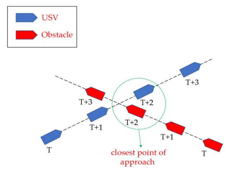
Navigation safety is one of the primary operational requirements for unmanned surface vehicles (USVs) in a complex marine environment, mainly guaranteed by a reliable path planning system for collision avoidance. This work proposes a novel weighted sum multi-objective optimisation strategy for USV collision avoidance path planning in restricted waters. In particular, the coefficients of different objectives could be tuned to emphasise the most critical design consideration under varying navigation scenarios. Moreover, in addition to the Convention on the International Regulations for Preventing Collisions at Sea (COLREGs), the terrain and weather constraints were also considered in the path planning system. The proposed USV collision avoidance path planning framework's effectiveness was demonstrated through numerical simulations and hardware-in-the-loop (HIL) tests. The numerical simulation results indicate that the proposed method could avoid collision with dynamic and static obstacles, and it is also adaptive to different navigation restrictions and preferences. Moreover, a USV navigation platform was established by incorporating true Automatic Identification System (AIS) signals, and HIL tests were performed with real-time AIS data in a water channel in the Zhoushan archipelago. The results demonstrate that the proposed USV path planning strategy is applicable in restricted waters with complex terrains and weather constraints.
在复杂的海洋环境中,航行安全是无人水面舰艇(USV)的主要操作要求之一,主要由可靠的避碰路径规划系统来保证。这项工作提出了一种新颖的加权和多目标优化策略,用于受限水域中无人水面舰艇的避碰路径规划。特别是,可以调整不同目标的系数,以强调不同航行场景下最关键的设计考量。此外,除了《国际海上避碰规则公约》(COLREGs)外,路径规划系统还考虑了地形和天气限制。通过数值模拟和硬件在环(HIL)测试,验证了所提出的无人水面舰艇避碰路径规划框架的有效性。数值模拟结果表明,该方法能够避免与动态和静态障碍物碰撞,并且还能适应不同的航行限制和偏好。此外,通过整合真实的自动识别系统(AIS)信号建立了一个无人水面舰艇导航平台,并在舟山群岛的一条水道中使用实时AIS数据进行了硬件在环测试。结果表明,所提出的无人水面舰艇路径规划策略适用于具有复杂地形和天气限制的受限水域。