Zhang Hai-Li, Guo Lin-Yuan, Nizamani Mir Muhammad, Wang Hua-Feng
Sanya Nanfan Research Institute of Hainan University, Hainan Yazhou Bay Seed Laboratory, Hainan University, Sanya, China.
Collaborative Innovation Center of Nanfan and High-Efficiency Tropical Agriculture, School of Tropical Crops, Hainan University, Haikou, China.
Front Plant Sci. 2023 Aug 21;14:1202115. doi: 10.3389/fpls.2023.1202115. eCollection 2023.
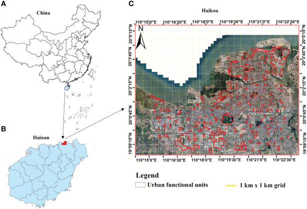
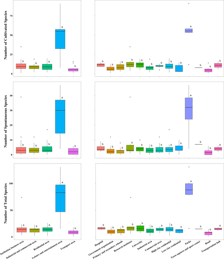
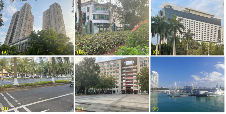
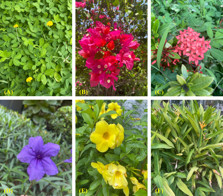
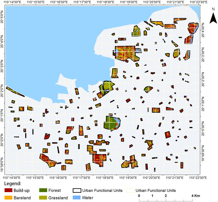
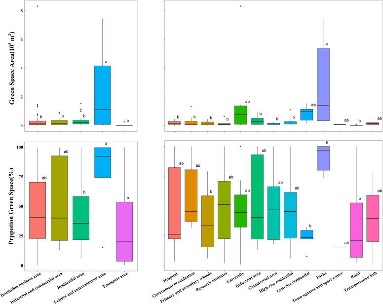
Investigating historical and ongoing changes in urban green space (UGS) and urban plant diversity (UPD) provides critical insights into urban ecology and urban planning development. The present study illuminates some of the transformations which can occur in rapidly developing urban landscapes. In this work, we used 30 m resolution images from the Landsat 5 satellite from 2015 to investigate UGS patterns in Haikou City, China. Metrics of UPD were obtained using field surveys, allowing the proportion of UGS and UPD to be determined in each urban functional unit (UFU) of Haikou. The results revealed that leisure and entertainment areas (such as parks) had the highest diversity, whereas roads and transportation hubs had the lowest. More frequent anthropogenic maintenance had a positive effect on the total number of species, including cultivated, tree, and herb species. Similarly, increased watering frequency had a positive impact on the diversity of cultivated and shrub species. By providing demonstrating a crucial link between UGS and UPD, the results provide valuable information for planning sustainable urban development in Haikou City and other tropical regions. They highlight the important role of UGS in maintaining biodiversity and providing a range of ecosystem services. This research will inform policymakers and urban planners about the need to consider UGS and UPD in urban planning and management process, in order to promote sustainability and conservation of biodiversity.
调查城市绿地空间(UGS)和城市植物多样性(UPD)的历史变化和持续变化,能为城市生态和城市规划发展提供关键见解。本研究阐明了快速发展的城市景观中可能发生的一些转变。在这项工作中,我们使用了2015年陆地卫星5号分辨率为30米的图像来调查中国海口市的城市绿地空间模式。通过实地调查获得城市植物多样性指标,从而确定海口市每个城市功能单元(UFU)中城市绿地空间和城市植物多样性的比例。结果显示,休闲娱乐区域(如公园)的多样性最高,而道路和交通枢纽的多样性最低。更频繁的人为养护对物种总数有积极影响,包括栽培植物、树木和草本植物物种。同样,浇水频率增加对栽培植物和灌木物种的多样性有积极影响。通过证明城市绿地空间和城市植物多样性之间的关键联系,研究结果为海口市和其他热带地区规划可持续城市发展提供了有价值的信息。它们凸显了城市绿地空间在维护生物多样性和提供一系列生态系统服务方面的重要作用。这项研究将告知政策制定者和城市规划者在城市规划和管理过程中考虑城市绿地空间和城市植物多样性的必要性,以促进可持续发展和生物多样性保护。