Yoon Inhye, Jeong Seokhwa, Jeong Jaeheon, Seo Doochun, Paik Joonki
Department of Image, Chung-Ang University, 84 Heukseok-ro, Dongjak-gu, Seoul 156-756, Korea.
Department of Satellite Data Cal/Val Team, Korea Aerospace Research Institute, 115 Gwahangbo,Yusung-Gu, Daejon 305-806, Korea.
Sensors (Basel). 2015 Mar 19;15(3):6633-51. doi: 10.3390/s150306633.
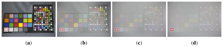
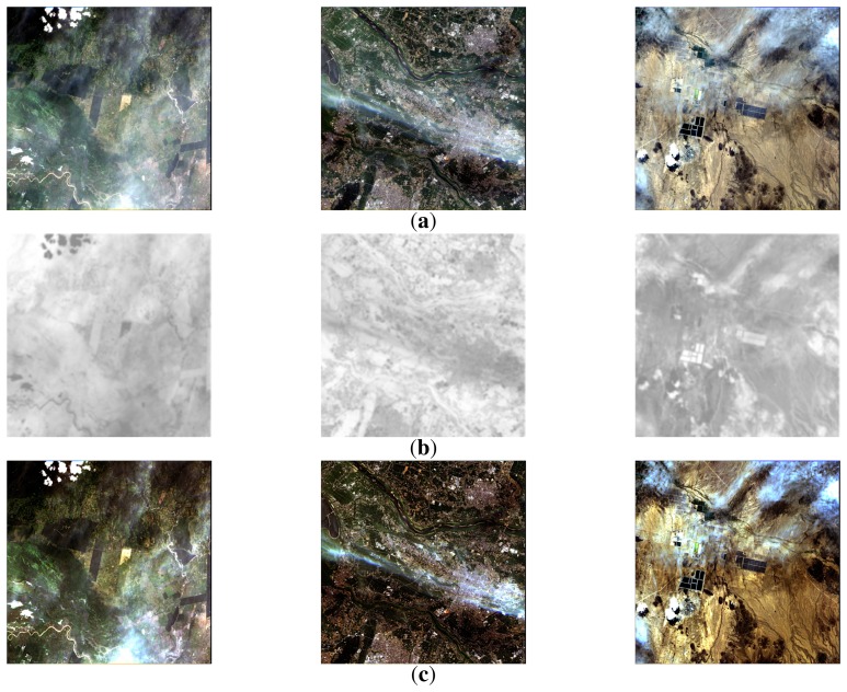
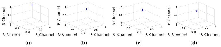
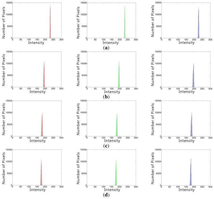
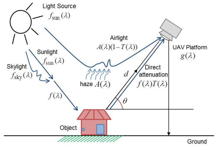
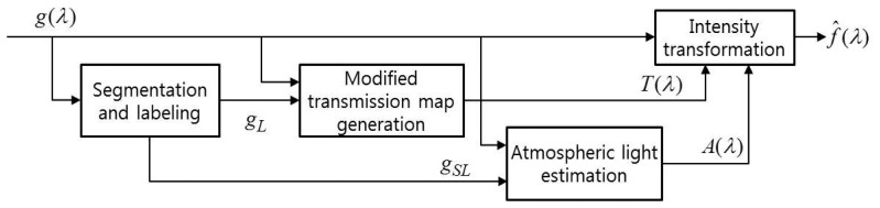
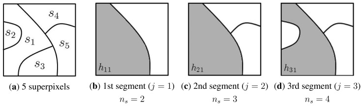
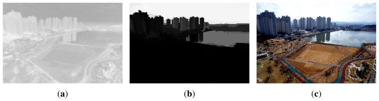
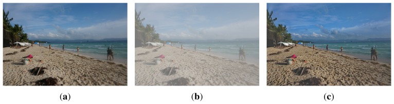
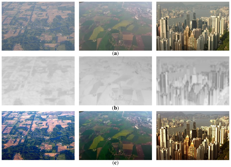
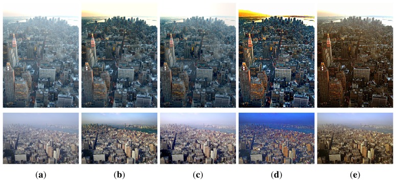
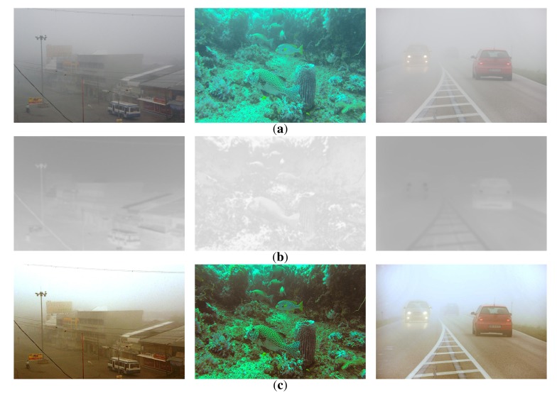
Since incoming light to an unmanned aerial vehicle (UAV) platform can be scattered by haze and dust in the atmosphere, the acquired image loses the original color and brightness of the subject. Enhancement of hazy images is an important task in improving the visibility of various UAV images. This paper presents a spatially-adaptive dehazing algorithm that merges color histograms with consideration of the wavelength-dependent atmospheric turbidity. Based on the wavelength-adaptive hazy image acquisition model, the proposed dehazing algorithm consists of three steps: (i) image segmentation based on geometric classes; (ii) generation of the context-adaptive transmission map; and (iii) intensity transformation for enhancing a hazy UAV image. The major contribution of the research is a novel hazy UAV image degradation model by considering the wavelength of light sources. In addition, the proposed transmission map provides a theoretical basis to differentiate visually important regions from others based on the turbidity and merged classification results.
由于无人机(UAV)平台接收到的光线会被大气中的雾霾和灰尘散射,所获取的图像会失去物体原有的颜色和亮度。模糊图像的增强是提高各类无人机图像可见性的一项重要任务。本文提出了一种空间自适应去雾算法,该算法在考虑波长相关大气浑浊度的情况下合并颜色直方图。基于波长自适应模糊图像采集模型,所提出的去雾算法包括三个步骤:(i)基于几何类别进行图像分割;(ii)生成上下文自适应透射率图;(iii)对模糊的无人机图像进行强度变换以增强图像。该研究的主要贡献是通过考虑光源波长建立了一种新颖的无人机模糊图像退化模型。此外,所提出的透射率图为基于浑浊度和合并分类结果将视觉上重要的区域与其他区域区分开来提供了理论依据。