Boori Mukesh Singh, Ferraro Ralph R, Choudhary Komal, Kupriyanov Alexander
National Research Council (NRC), Washington DC, USA; NOAA/NESDIS/STAR/ Satellite Climate Studies Branch and Cooperative Institute for Climate & Satellites (CICS), ESSIC, University of Maryland, College Park, MD, USA; Scientific Research Laboratory of Automated Systems of Scientific Research (SRL-35), Samara National Research University, Samara, Russia; Department of Geography, Bonn University, Bonn, Germany.
NOAA/NESDIS/STAR/ Satellite Climate Studies Branch and Cooperative Institute for Climate & Satellites (CICS), ESSIC, University of Maryland, College Park, MD, USA.
Data Brief. 2016 Nov 17;9:1077-1089. doi: 10.1016/j.dib.2016.11.006. eCollection 2016 Dec.
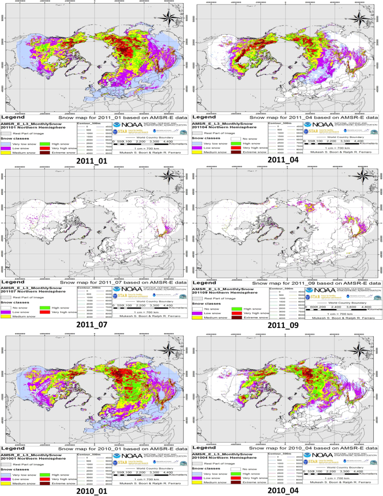
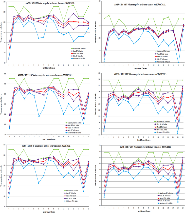
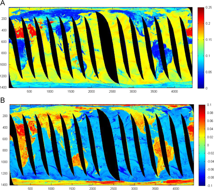
This data article contains data related to the research article entitled "Global land cover classification based on microwave polarization and gradient ratio (MPGR)" [1] and "Microwave polarization and gradient ratio (MPGR) for global land surface phenology" [2]. This data article presents land surface characteristics and snow cover variation information from sensors like EOS Advanced Microwave Scanning Radiometer (AMSR-E). This data article use the HDF Explorer, Matlab, and ArcGIS software to process the pixel latitude, longitude, snow water equivalent (SWE), digital elevation model (DEM) and Brightness Temperature (BT) information from AMSR-E satellite data to provide land surface characteristics and snow cover variation data in all-weather condition at any time. This data information is useful to discriminate different land surface cover types and snow cover variation, which is turn, will help to improve monitoring of weather, climate and natural disasters.
本数据文章包含与题为《基于微波极化和梯度比(MPGR)的全球土地覆盖分类》[1]以及《用于全球陆地表面物候的微波极化和梯度比(MPGR)》[2]的研究文章相关的数据。本数据文章展示了来自诸如EOS先进微波扫描辐射计(AMSR-E)等传感器的陆地表面特征和积雪覆盖变化信息。本数据文章使用HDF Explorer、Matlab和ArcGIS软件来处理来自AMSR-E卫星数据的像素纬度、经度、雪水当量(SWE)、数字高程模型(DEM)和亮温(BT)信息,以便随时提供全天候条件下的陆地表面特征和积雪覆盖变化数据。这些数据信息有助于区分不同的陆地表面覆盖类型和积雪覆盖变化,进而有助于改善对天气、气候和自然灾害的监测。