• 文献检索
  • 文档翻译
  • 深度研究
  • 学术资讯
  • Suppr Zotero 插件Zotero 插件
  • 邀请有礼
  • 套餐&价格
  • 历史记录
应用&插件
Suppr Zotero 插件Zotero 插件浏览器插件Mac 客户端Windows 客户端微信小程序
定价
高级版会员购买积分包购买API积分包
服务
文献检索文档翻译深度研究API 文档MCP 服务
关于我们
关于 Suppr公司介绍联系我们用户协议隐私条款
关注我们

Suppr 超能文献

核心技术专利:CN118964589B侵权必究
粤ICP备2023148730 号-1Suppr @ 2026

文献检索

告别复杂PubMed语法,用中文像聊天一样搜索,搜遍4000万医学文献。AI智能推荐,让科研检索更轻松。

立即免费搜索

文件翻译

保留排版,准确专业,支持PDF/Word/PPT等文件格式,支持 12+语言互译。

免费翻译文档

深度研究

AI帮你快速写综述,25分钟生成高质量综述,智能提取关键信息,辅助科研写作。

立即免费体验

亚喀巴湾更新世珊瑚礁阶地隆升的地震灾害影响

Seismic Hazards Implications of Uplifted Pleistocene Coral Terraces in the Gulf of Aqaba.

作者信息

Bosworth W, Montagna P, Pons-Branchu E, Rasul N, Taviani M

机构信息

Apache Egypt Companies, 11 Street 281, New Maadi, Cairo, Egypt.

Istituto di Scienze Marine (ISMAR), CNR, Via Gobetti 101, 40129, Bologna, Italy.

出版信息

Sci Rep. 2017 Feb 24;7(1):38. doi: 10.1038/s41598-017-00074-2.

DOI:10.1038/s41598-017-00074-2
PMID:28232736
原文链接:https://pmc.ncbi.nlm.nih.gov/articles/PMC5428358/
Abstract

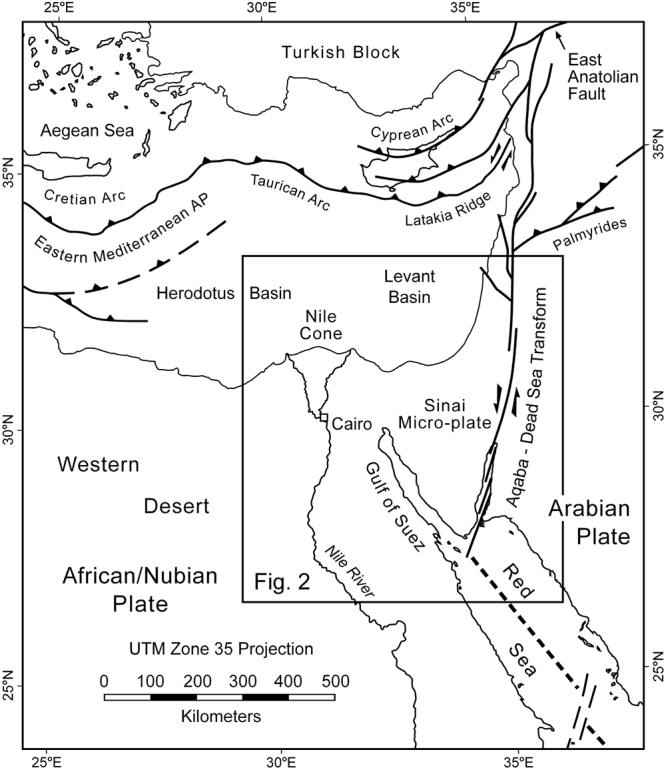
The Gulf of Aqaba transform plate boundary is a source of destructive teleseismic earthquakes. Seismicity is concentrated in the central sub-basin and decreases to both the north and south. Although principally a strike-slip plate boundary, the faulted margins of the Gulf display largely dip-slip extensional movement and accompanying footwall uplift. We have constrained rates of this uplift by measurements of elevated Pleistocene coral terraces. In particular the terrace that formed during the last interglacial (~125 ka) is found discontinuously along the length of the Gulf at elevations of 3 to 26 m. Global sea level was ~7 m higher than today at 125 ka indicating net maximum tectonic uplift of ~19 m with an average rate of ~0.015 cm/yr. Uplift has been greatest adjacent to the central sub-basin and like the seismicity decreases to the north and south. We suggest that the present pattern of a seismically active central region linked to more aseismic areas in the north and south has therefore persisted for at least the past 125 kyr. Consequently the potential for future destructive earthquakes in the central Gulf is greater than in the sub-basins to the north and south.

摘要

亚喀巴湾转换板块边界是破坏性远震的一个震源。地震活动集中在中央子盆地,向北和向南都有所减少。尽管主要是一个走滑板块边界,但海湾的断层边缘主要表现为倾滑伸展运动以及伴随的下盘隆升。我们通过对更新世珊瑚阶地高程的测量来确定这种隆升的速率。特别是在末次间冰期(约12.5万年)形成的阶地,在海湾沿岸断断续续地出露,海拔高度在3至26米之间。在12.5万年前,全球海平面比现在高约7米,这表明构造净最大隆升约为19米,平均速率约为0.015厘米/年。隆升在中央子盆地附近最为显著,并且与地震活动一样,向北和向南都有所减少。我们认为,因此,目前中央地震活跃地区与北部和南部地震活动较少地区相联系的格局至少在过去12.5万年中一直持续存在。因此,未来海湾中部发生破坏性地震的可能性大于北部和南部的子盆地。

https://cdn.ncbi.nlm.nih.gov/pmc/blobs/6fab/5428358/0a50c7c261d6/41598_2017_74_Fig9_HTML.jpg
https://cdn.ncbi.nlm.nih.gov/pmc/blobs/6fab/5428358/745bf82dfa3f/41598_2017_74_Fig1_HTML.jpg
https://cdn.ncbi.nlm.nih.gov/pmc/blobs/6fab/5428358/d2bda0c4c302/41598_2017_74_Fig2_HTML.jpg
https://cdn.ncbi.nlm.nih.gov/pmc/blobs/6fab/5428358/c77316d74100/41598_2017_74_Fig3_HTML.jpg
https://cdn.ncbi.nlm.nih.gov/pmc/blobs/6fab/5428358/62f2e539e0fe/41598_2017_74_Fig4_HTML.jpg
https://cdn.ncbi.nlm.nih.gov/pmc/blobs/6fab/5428358/fbeaa07e3059/41598_2017_74_Fig5_HTML.jpg
https://cdn.ncbi.nlm.nih.gov/pmc/blobs/6fab/5428358/8f52ee7bd468/41598_2017_74_Fig6_HTML.jpg
https://cdn.ncbi.nlm.nih.gov/pmc/blobs/6fab/5428358/2905a9e82908/41598_2017_74_Fig7_HTML.jpg
https://cdn.ncbi.nlm.nih.gov/pmc/blobs/6fab/5428358/272032cf34c3/41598_2017_74_Fig8_HTML.jpg
https://cdn.ncbi.nlm.nih.gov/pmc/blobs/6fab/5428358/0a50c7c261d6/41598_2017_74_Fig9_HTML.jpg

相似文献

1
Seismic Hazards Implications of Uplifted Pleistocene Coral Terraces in the Gulf of Aqaba.亚喀巴湾更新世珊瑚礁阶地隆升的地震灾害影响
Sci Rep. 2017 Feb 24;7(1):38. doi: 10.1038/s41598-017-00074-2.
2
Updating the seismotectonic setting for the Gulf of Aqaba.更新亚喀巴湾的地震构造背景。
Sci Rep. 2023 Jul 19;13(1):11672. doi: 10.1038/s41598-023-38759-6.
3
Monitoring tectonic uplift and paleoenvironmental reconstruction for marine terraces near Maǧaracik and Samandaǧ, Hatay Province, Turkey.土耳其哈塔伊省马贾拉吉克和萨曼达附近海蚀阶地的构造隆升监测与古环境重建
Radiat Prot Dosimetry. 2014 Jun;159(1-4):220-32. doi: 10.1093/rpd/ncu179. Epub 2014 Jun 18.
4
A new probabilistic seismic hazard assessment for greater Tokyo.东京大都市区新的概率地震危险性评估。
Philos Trans A Math Phys Eng Sci. 2006 Aug 15;364(1845):1965-88. doi: 10.1098/rsta.2006.1808.
5
Holocene mean uplift rates across an active plate-collision boundary in taiwan.台湾活动板块碰撞边界全新世平均抬升速率。
Science. 1990 Apr 13;248(4952):204-6. doi: 10.1126/science.248.4952.204.
6
Deformation and seismicity of Taiwan.台湾的变形与地震活动
Proc Natl Acad Sci U S A. 2000 Oct 10;97(21):11176-80. doi: 10.1073/pnas.200370797.
7
Seasonal modulation of deep slow-slip and earthquakes on the Main Himalayan Thrust.季节对主喜马拉雅逆冲断层深部慢滑和地震的调制作用。
Nat Commun. 2018 Oct 8;9(1):4140. doi: 10.1038/s41467-018-06371-2.
8
Seismic reflection imaging of two megathrust shear zones in the northern Cascadia subduction zone.卡斯卡迪亚俯冲带北部两个逆冲型剪切带的地震反射成像
Nature. 2004 Mar 11;428(6979):163-7. doi: 10.1038/nature02372.
9
Tectonic aspects of the guatemala earthquake of 4 february 1976.1976年2月4日危地马拉地震的构造特征
Science. 1976 Sep 24;193(4259):1201-8. doi: 10.1126/science.193.4259.1201.
10
Crustal deformation, active tectonics and seismic potential in the Sicily Channel (Central Mediterranean), along the Nubia-Eurasia plate boundary.沿着努比亚-欧亚板块边界的西西里海峡(地中海中部)的地壳变形、活动构造与地震潜力。
Sci Rep. 2020 Dec 4;10(1):21238. doi: 10.1038/s41598-020-78063-1.

引用本文的文献

1
Hydrocarbon potential in the Northern Egyptian Red Sea: insights from geophysical datasets and analysis of onshore marginal outcrop analogues and subsurface sequences.埃及红海北部的烃类潜力:来自地球物理数据集以及陆上边缘露头类似物和地下层序分析的见解
Sci Rep. 2025 Jan 7;15(1):1198. doi: 10.1038/s41598-024-79605-7.
2
Updating the seismotectonic setting for the Gulf of Aqaba.更新亚喀巴湾的地震构造背景。
Sci Rep. 2023 Jul 19;13(1):11672. doi: 10.1038/s41598-023-38759-6.

本文引用的文献

1
Probabilistic assessment of sea level during the last interglacial stage.末次间冰期海平面的概率评估。
Nature. 2009 Dec 17;462(7275):863-7. doi: 10.1038/nature08686.
2
Chronology of fluctuating sea levels since the triassic.自三叠纪以来的海平面波动的时间顺序。
Science. 1987 Mar 6;235(4793):1156-67. doi: 10.1126/science.235.4793.1156.
3
Continental breakup by a leaky transform: the gulf of elat (aqaba).大陆破裂由渗漏转换带控制:埃拉特湾(亚喀巴湾)。
Science. 1979 Oct 12;206(4415):214-6. doi: 10.1126/science.206.4415.214.
4
The Phanerozoic record of global sea-level change.显生宙全球海平面变化记录。
Science. 2005 Nov 25;310(5752):1293-8. doi: 10.1126/science.1116412.