Gao Qi, Zribi Mehrez, Escorihuela Maria Jose, Baghdadi Nicolas
CESBIO (CNRS/CNES/UPS/IRD), 18 av. Edouard Belin, bpi 2801, 31401 Toulouse CEDEX9, France.
isardSAT, Parc Tecnològic Barcelona Activa, Carrer de Marie Curie, 8, 08042 Barcelona, Spain.
Sensors (Basel). 2017 Aug 26;17(9):1966. doi: 10.3390/s17091966.
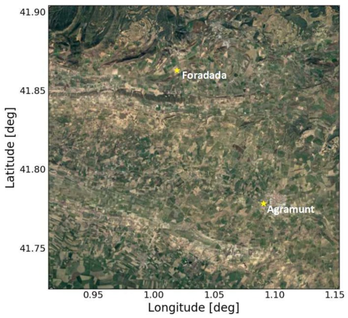
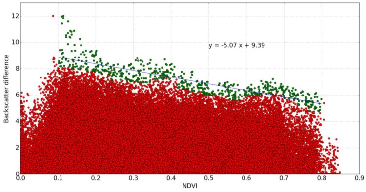
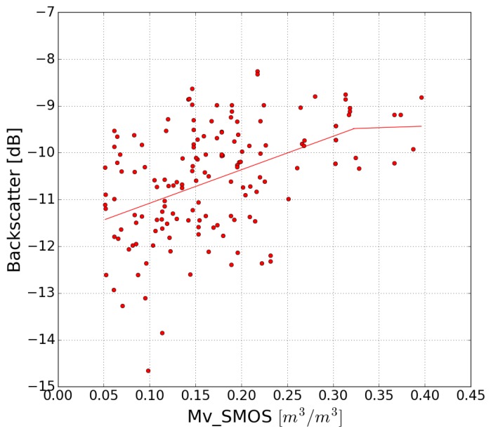
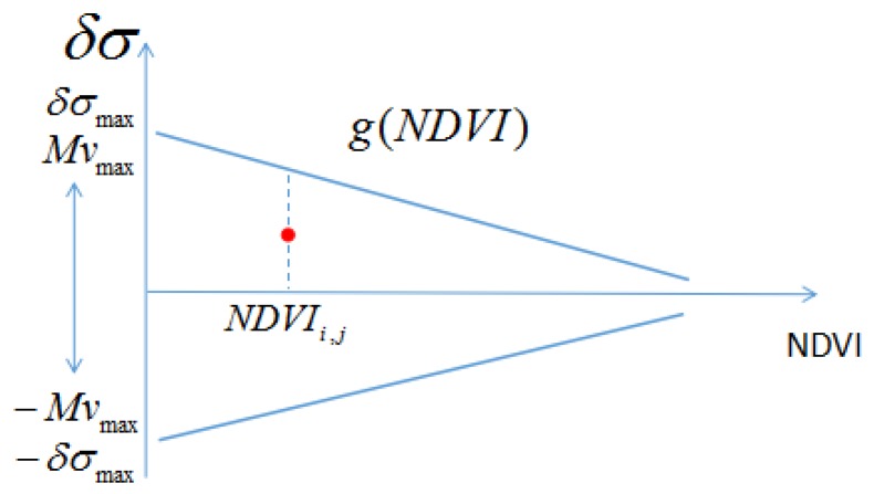
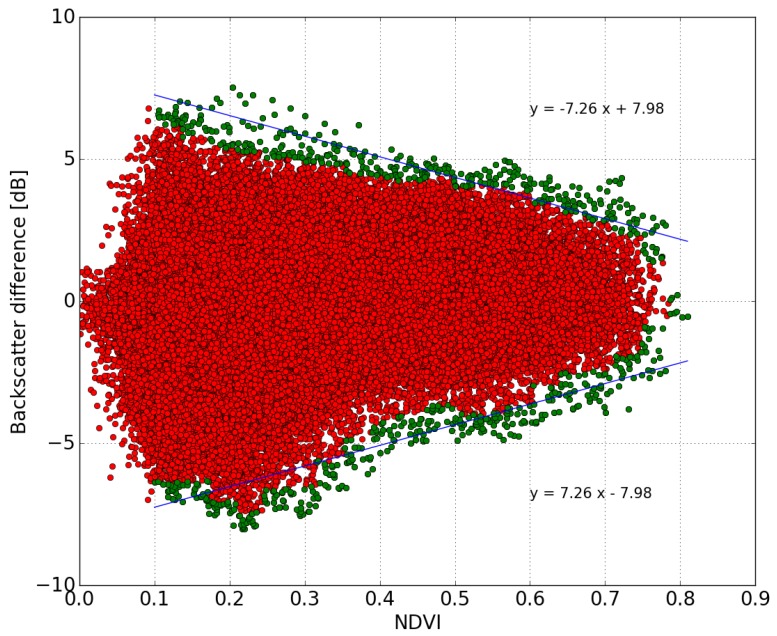
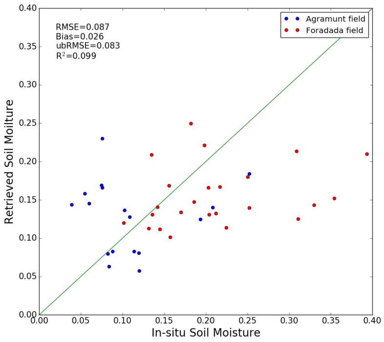
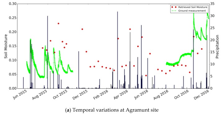
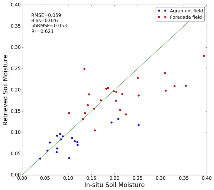
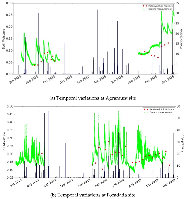
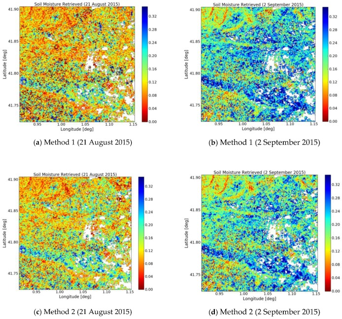
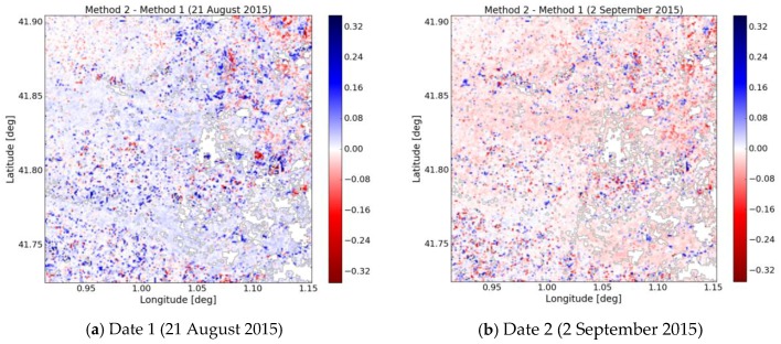
The recent deployment of ESA's Sentinel operational satellites has established a new paradigm for remote sensing applications. In this context, Sentinel-1 radar images have made it possible to retrieve surface soil moisture with a high spatial and temporal resolution. This paper presents two methodologies for the retrieval of soil moisture from remotely-sensed SAR images, with a spatial resolution of 100 m. These algorithms are based on the interpretation of Sentinel-1 data recorded in the VV polarization, which is combined with Sentinel-2 optical data for the analysis of vegetation effects over a site in Urgell (Catalunya, Spain). The first algorithm has already been applied to observations in West Africa by Zribi et al., 2008, using low spatial resolution ERS scatterometer data, and is based on change detection approach. In the present study, this approach is applied to Sentinel-1 data and optimizes the inversion process by taking advantage of the high repeat frequency of the Sentinel observations. The second algorithm relies on a new method, based on the difference between backscattered Sentinel-1 radar signals observed on two consecutive days, expressed as a function of NDVI optical index. Both methods are applied to almost 1.5 years of satellite data (July 2015-November 2016), and are validated using field data acquired at a study site. This leads to an RMS error in volumetric moisture of approximately 0.087 m³/m³ and 0.059 m³/m³ for the first and second methods, respectively. No site calibrations are needed with these techniques, and they can be applied to any vegetation-covered area for which time series of SAR data have been recorded.
欧洲航天局哨兵系列业务卫星的近期部署为遥感应用建立了新的范例。在此背景下,哨兵 -1 雷达图像使得以高空间和时间分辨率获取地表土壤湿度成为可能。本文介绍了两种从空间分辨率为 100 米的遥感合成孔径雷达(SAR)图像中反演土壤湿度的方法。这些算法基于对哨兵 -1 在垂直极化(VV)模式下记录的数据的解读,并结合哨兵 -2 光学数据,用于分析西班牙加泰罗尼亚自治区乌尔盖尔地区一个地点的植被影响。第一种算法已由兹里比等人于 2008 年应用于西非的观测,使用的是低空间分辨率的欧洲遥感卫星(ERS)散射计数据,基于变化检测方法。在本研究中,该方法应用于哨兵 -1 数据,并利用哨兵观测的高重复频率优化反演过程。第二种算法依赖于一种新方法,基于连续两天观测到的哨兵 -1 雷达后向散射信号的差异,以归一化植被指数(NDVI)光学指数表示。两种方法都应用于近 1.5 年的卫星数据(2015 年 7 月至 2016 年 11 月),并使用在一个研究地点获取的实地数据进行验证。这导致第一种和第二种方法的体积含水量均方根误差分别约为 0.087 立方米/立方米和 0.059 立方米/立方米。这些技术无需进行场地校准,可应用于已记录 SAR 数据时间序列的任何植被覆盖区域。