Qi Shanzhong, Cai Yumin
College of Population, Resources and Environment, Shandong Normal University, No. 88 Wenhua East Road, Jinan 250014, Shandong Province, P. R. China.
Sensors (Basel). 2007 Oct 31;7(11):2565-2578. doi: 10.3390/s7112565.
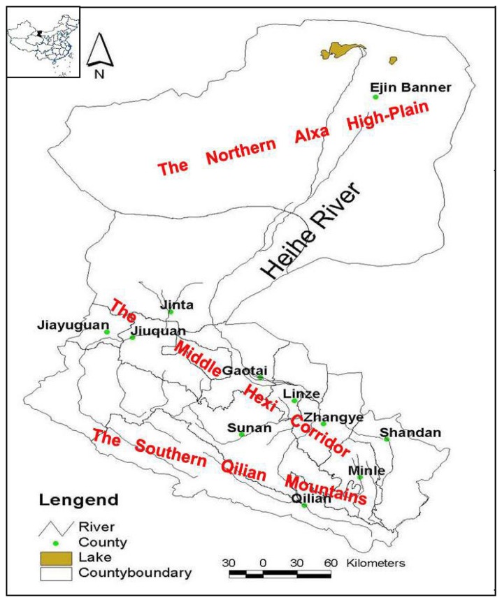
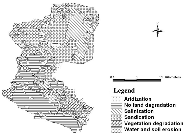
Land degradation is a great threat in the Heihe River Basin, located in the aridinland of northwestern China and land desertification is one of the main aspects ofenvironmental changes in this basin. Previous studies have focused on water resourceutilization and soil erosion, but the status of degraded land in the Heihe River Basin, suchas its distribution, extent and precise characteristics is often inadequately known. Based onfield observations and TM images from the year 2003, this study provides classificationand evaluation information concerning the degraded land in the basin of the Heihe River.There are five types of degraded land types in the Heihe River Basin: water eroded in thesouthern mountains, sandified and vegetation degraded near the oases, aridized in the lowreaches, and salinized in the lowlands. The total degraded area covers 29,355.5 km²,22.58% of the land in the study area. Finally, degraded land in the Heihe River Basin wasevaluated according to changes in the physical structure and chemical components of soils,land productivity, secondary soil salt, and water conditions.
土地退化是位于中国西北干旱内陆的黑河流域面临的重大威胁,土地沙漠化是该流域环境变化的主要方面之一。以往的研究主要集中在水资源利用和土壤侵蚀方面,但黑河流域退化土地的状况,如其分布、范围和精确特征,往往了解不足。基于2003年的实地观测和TM影像,本研究提供了有关黑河流域退化土地的分类和评估信息。黑河流域有五种退化土地类型:南部山区的水蚀地、绿洲附近的沙化和植被退化地、下游的干旱化土地以及低地的盐碱化土地。退化土地总面积为29355.5平方公里,占研究区域土地面积的22.58%。最后,根据土壤物理结构和化学成分的变化、土地生产力、次生土壤盐分和水分状况对黑河流域的退化土地进行了评估。