Manning J P, McGillicuddy D J, Pettigrew N R, Churchill J H, Incze L S
National Oceanic Atmospheric Administration, Northeast Fisheries Science Center, 166 Water St, Woods Hole, Massachusetts, 02543.
Woods Hole Oceanographic Institute, Woods Hole, Ma.02543.
Cont Shelf Res. 2009 Apr 15;29(7):835-845. doi: 10.1016/j.csr.2008.12.008. Epub 2008 Dec 15.
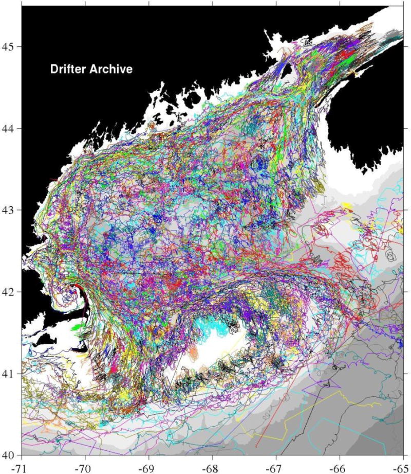
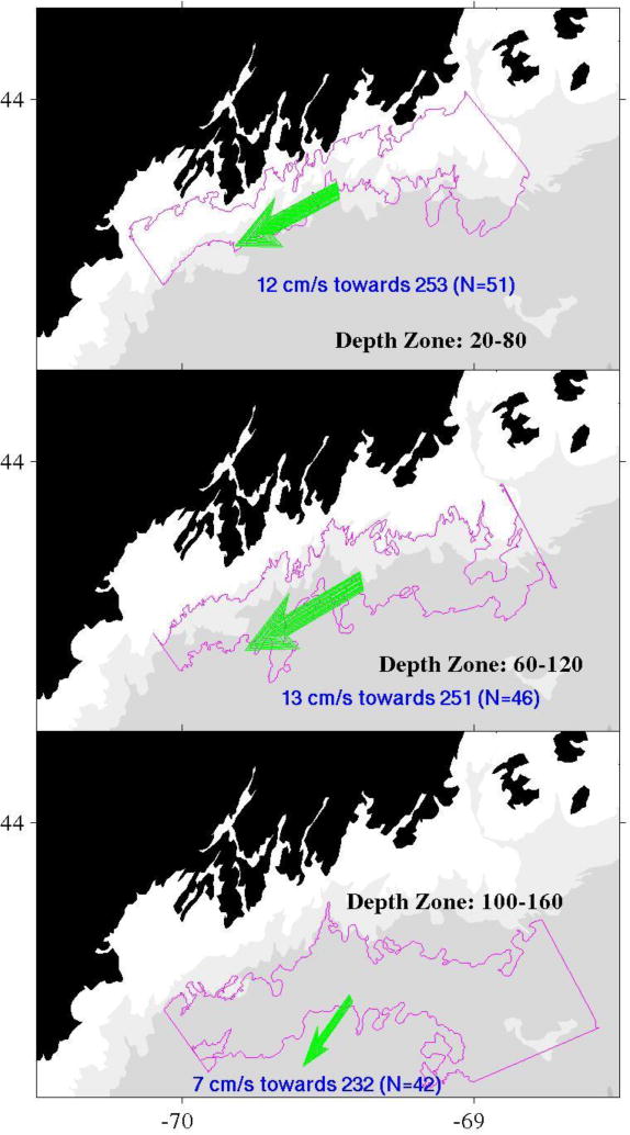
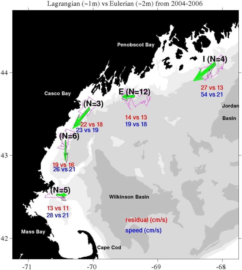
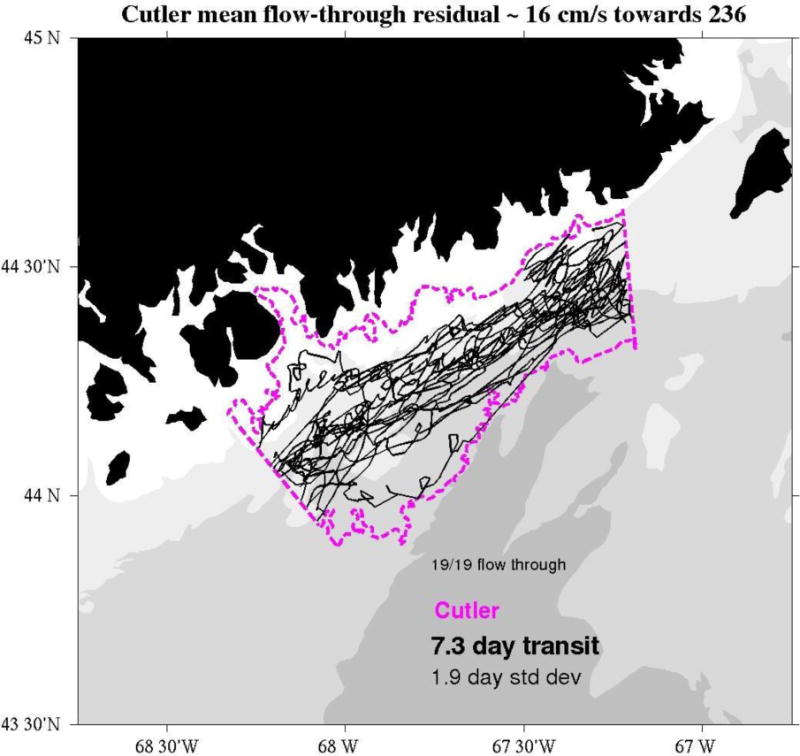
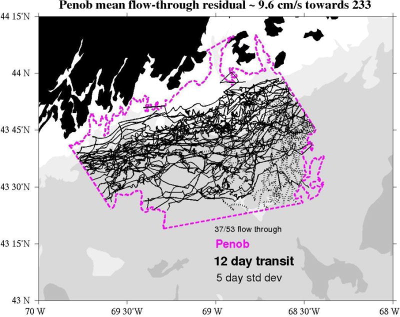
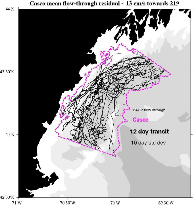
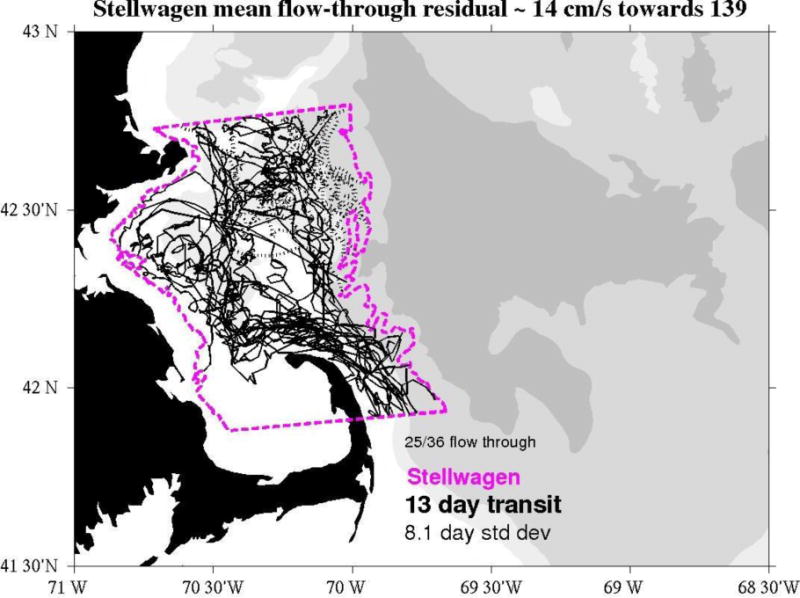
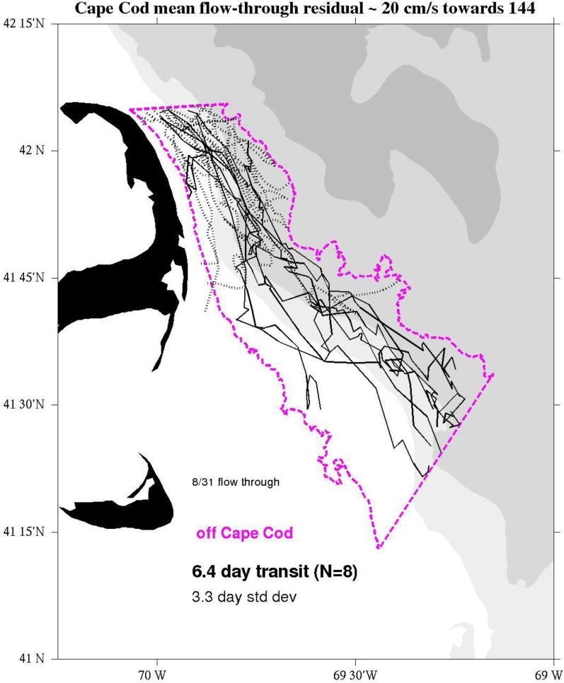
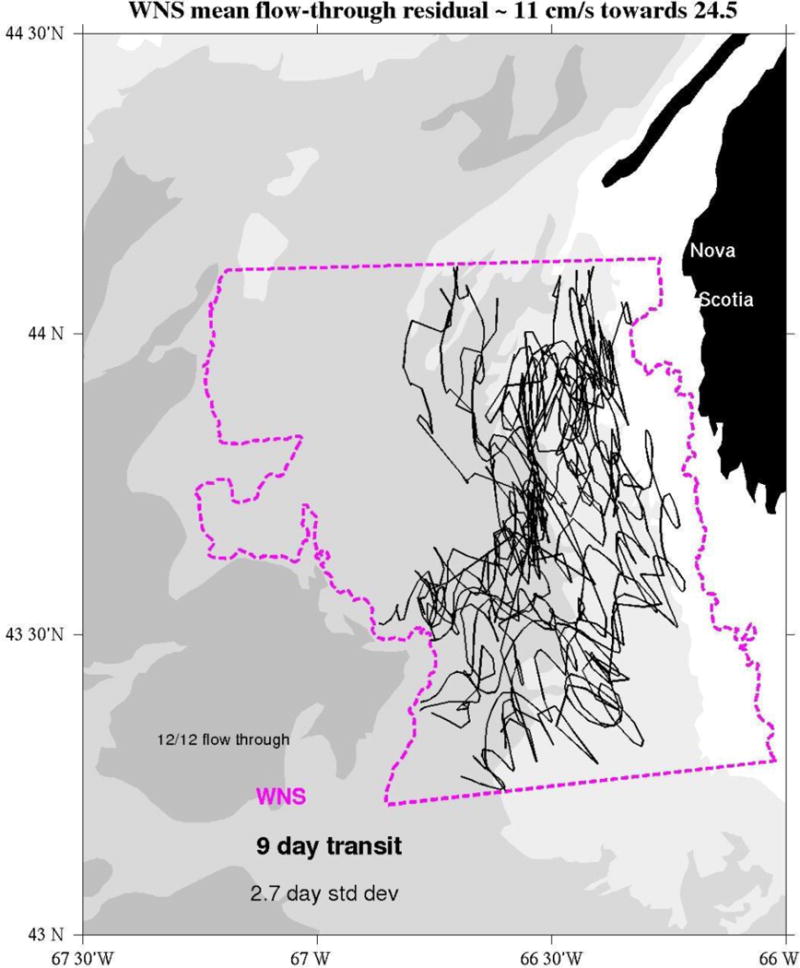
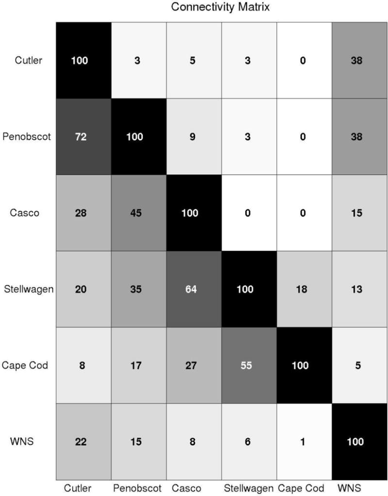
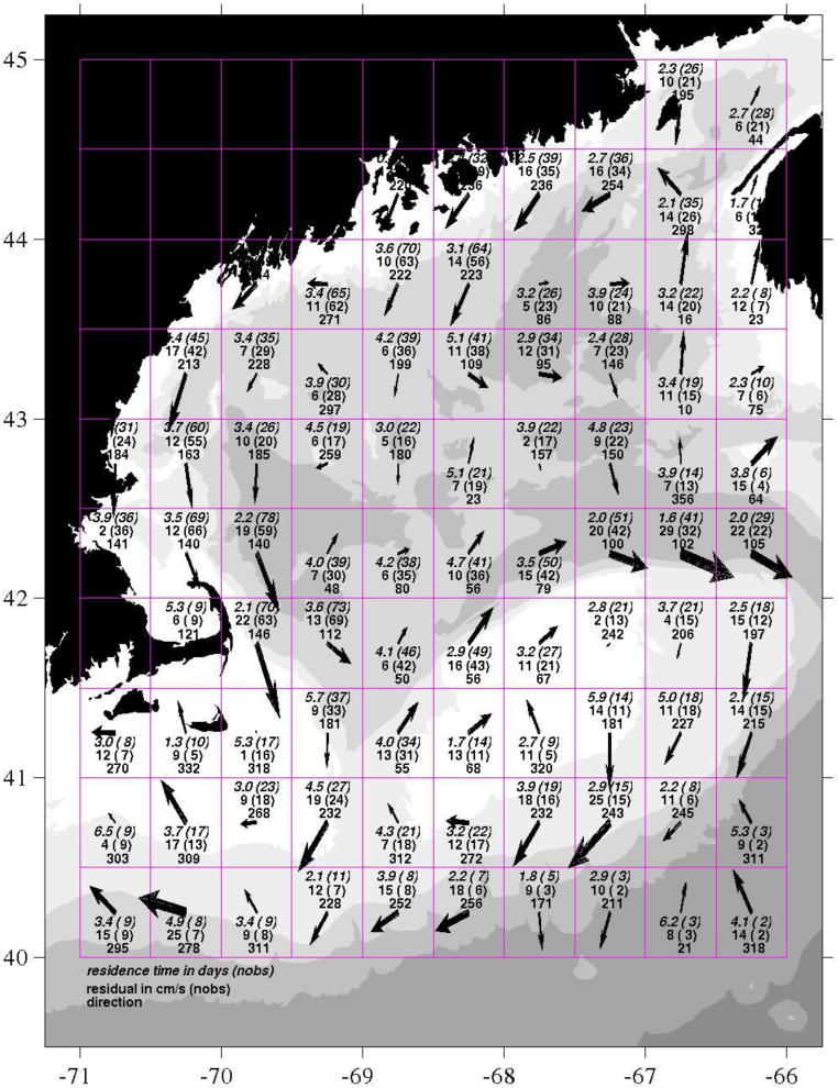
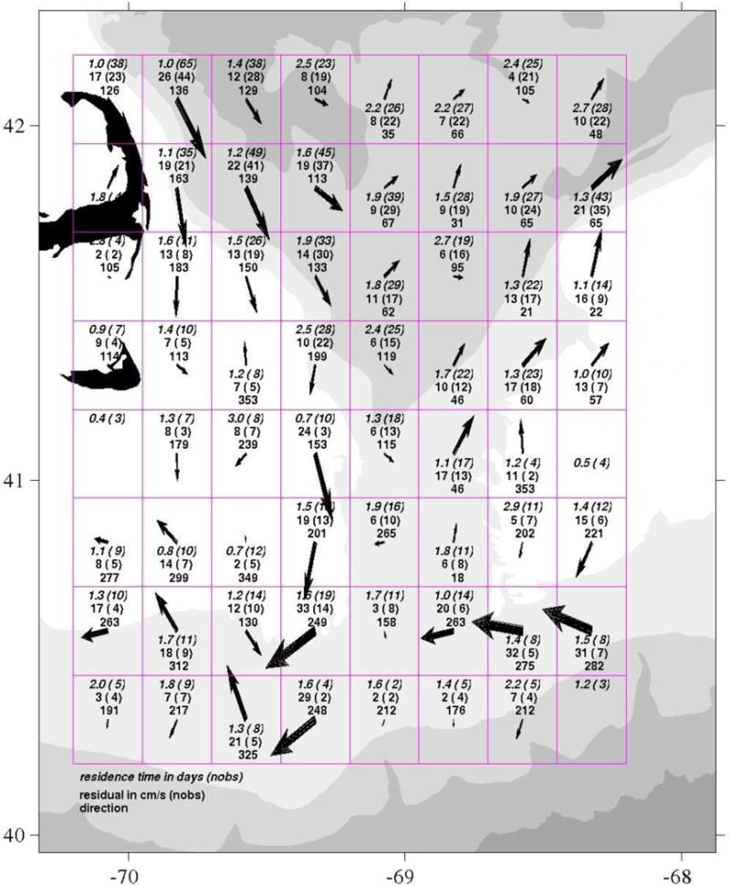
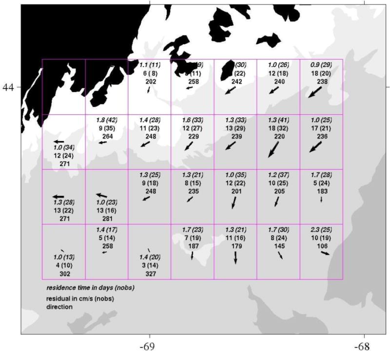
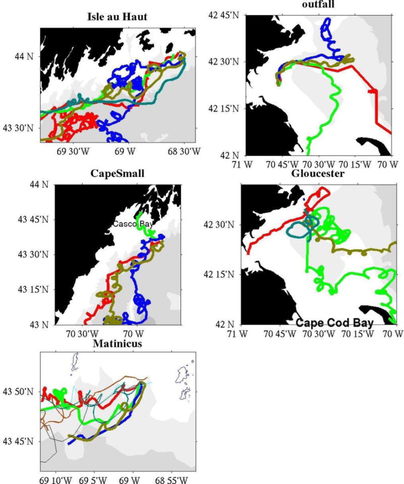
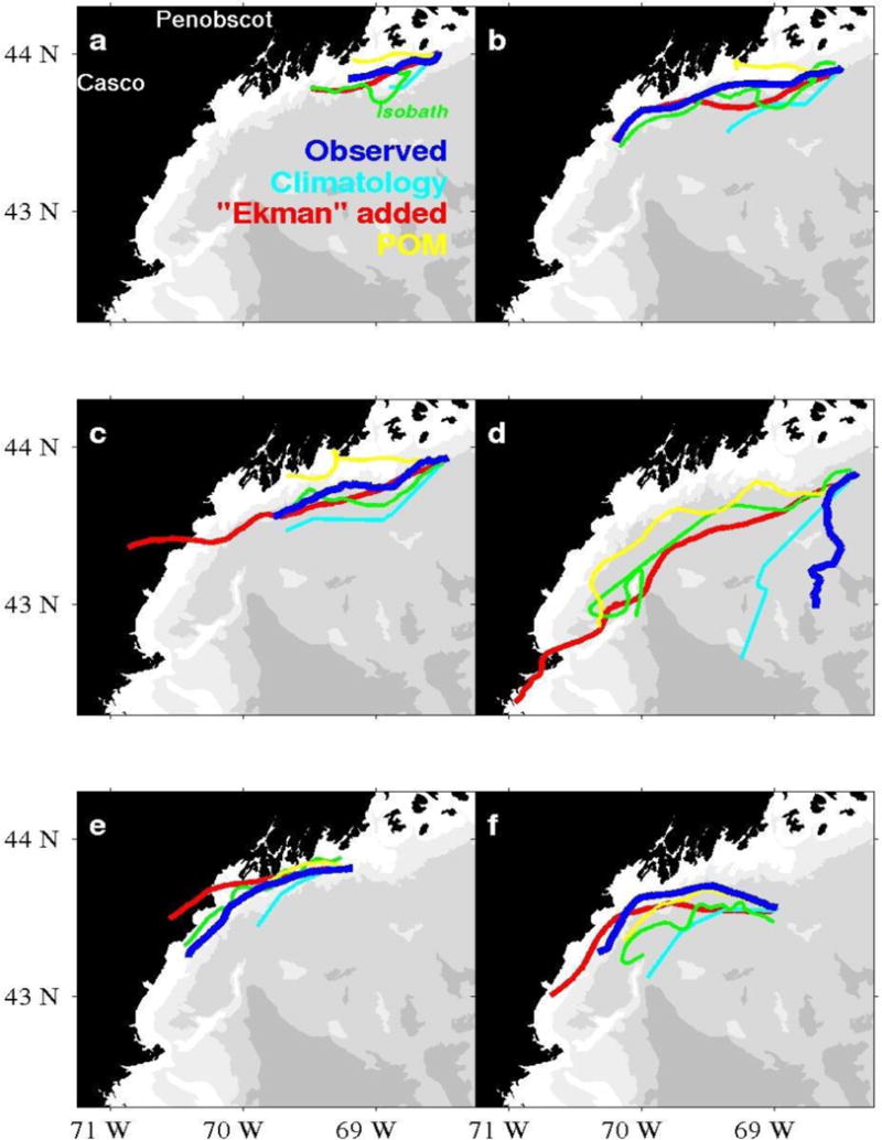
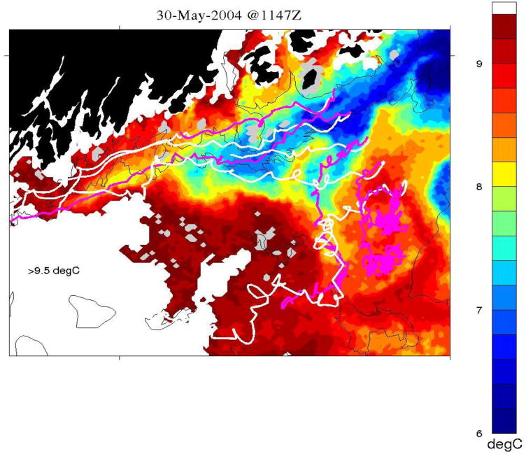
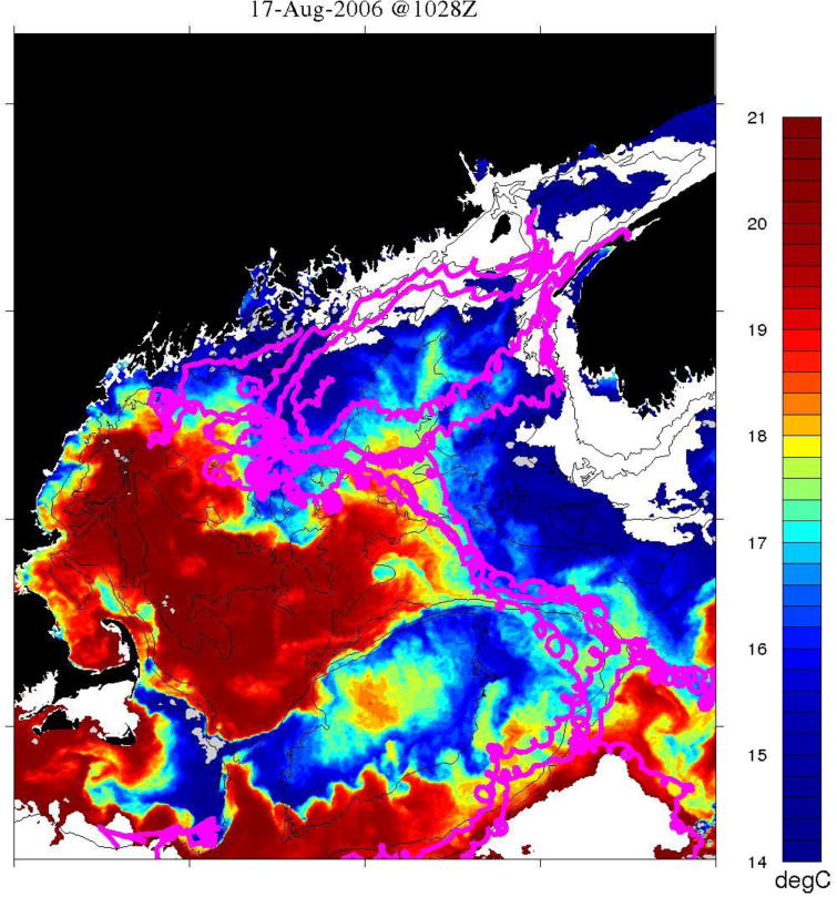
Two-hundred and twenty seven satellite-tracked drifters were deployed in the Gulf of Maine (GoM) from 1988 to 2007, primarily during spring and summer. The archive of tracks includes over 100,000 kilometers logged thus far. Statistics such as transit times, mean velocities, response to wind events, and preferred pathways are compiled for various areas of the coastal GoM. We compare Lagrangian flow with Eulerian estimates from near-by moorings and evaluate drifter trajectories using Ekman theory and 3-D ocean circulation models. Results indicate that the Gulf of Maine Coastal Current is a strong and persistent feature centered on the 94 ± 23 meter isobath, but that particles: a) deviate from the seasonal-mean core fairly regularly, and are often re-entrained; b) follow a slower (9 cm/s), less-constrained path in the western portion off the coast of Maine relative to the eastern (16 cm/s) section; and c) can be affected by wind events and small scale baroclinic structures. Residence times calculated for each ½ degree grid cell throughout the GoM depict some regions (Eastern Maine and Western Nova Scotia) as being relatively steady, flow-through systems, while others (Penobscot, Great South Channel) have more variable, branching pathways. Travel times for drifters that are retained within the coastal current along the entire western side of the Gulf of Maine are typically less than two months (55 days).
1988年至2007年期间,主要在春季和夏季,共在缅因湾(GoM)部署了227个卫星跟踪漂流器。到目前为止,轨迹档案记录的行程已超过100,000公里。针对缅因湾沿海不同区域,汇编了诸如过境时间、平均速度、对风事件的响应以及偏好路径等统计数据。我们将拉格朗日流与附近系泊处的欧拉估计值进行比较,并使用埃克曼理论和三维海洋环流模型评估漂流器轨迹。结果表明,缅因湾沿岸流是一个强大且持久的特征,以94±23米等深线为中心,但粒子:a)相当有规律地偏离季节平均核心,并且经常被重新卷入;b)相对于东部区域(16厘米/秒),在缅因州海岸以西部分沿着较慢(9厘米/秒)、限制较少的路径移动;c)可能受到风事件和小尺度斜压结构的影响。对整个缅因湾每个半度网格单元计算的停留时间表明,一些区域(缅因州东部和新斯科舍省西部)是相对稳定的、贯穿型系统,而其他区域(佩诺布斯科特、大南通道)具有更多可变的分支路径。沿着缅因湾整个西侧被沿岸流留住的漂流器的行进时间通常少于两个月(55天)。