Millan R, Rignot E, Mouginot J, Wood M, Bjørk A A, Morlighem M
Department Earth System Science University of California Irvine Irvine CA USA.
Jet Propulsion Laboratory Caltech Pasadena CA USA.
Geophys Res Lett. 2018 Mar 28;45(6):2688-2696. doi: 10.1002/2017GL076561. Epub 2018 Mar 25.
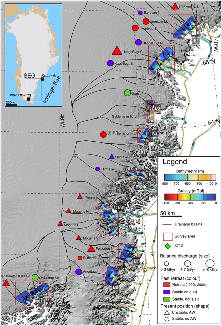
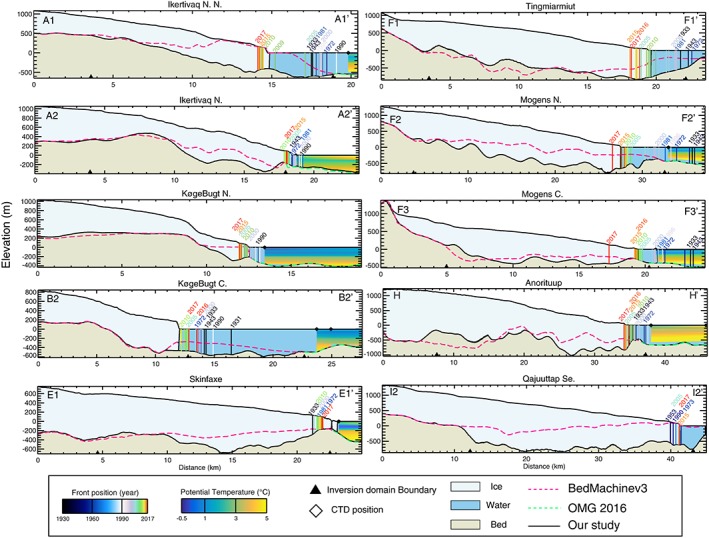
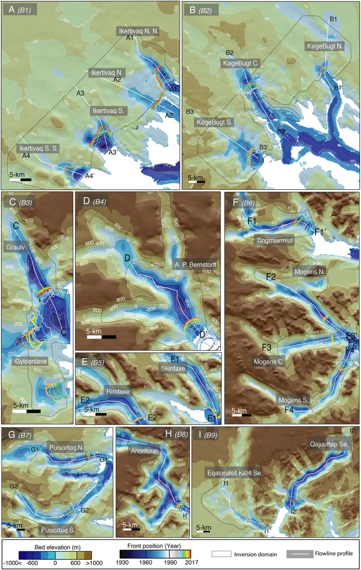
We employ National Aeronautics and Space Administration (NASA)'s Operation IceBridge high-resolution airborne gravity from 2016, NASA's Ocean Melting Greenland bathymetry from 2015, ice thickness from Operation IceBridge from 2010 to 2015, and BedMachine v3 to analyze 20 major southeast Greenland glaciers. The results reveal glacial fjords several hundreds of meters deeper than previously thought; the full extent of the marine-based portions of the glaciers; deep troughs enabling warm, salty Atlantic Water (AW) to reach the glacier fronts and melt them from below; and few shallow sills that limit the access of AW. The new oceanographic and topographic data help to fully resolve the complex pattern of historical ice front positions from the 1930s to 2017: glaciers exposed to AW and resting on retrograde beds have retreated rapidly, while glaciers perched on shallow sills or standing in colder waters or with major sills in the fjords have remained stable.
我们采用了美国国家航空航天局(NASA)2016年的冰桥行动高分辨率机载重力数据、2015年NASA的格陵兰海洋融化测深数据、2010年至2015年冰桥行动的冰厚度数据以及BedMachine v3来分析格陵兰岛东南部的20条主要冰川。结果显示,冰川峡湾比之前认为的深数百米;冰川海洋部分的全貌;能够使温暖、咸的大西洋水(AW)到达冰川前沿并从下方融化它们的深槽;以及限制大西洋水进入的浅海槛。新的海洋学和地形数据有助于全面解析20世纪30年代至2017年历史冰前沿位置的复杂模式:暴露于大西洋水且位于逆行床面上的冰川迅速后退,而栖息在浅海槛上、处于较冷水域或峡湾中有主要海槛的冰川则保持稳定。