Ebbing Jörg, Haas Peter, Ferraccioli Fausto, Pappa Folker, Szwillus Wolfgang, Bouman Johannes
Institut für Geowissenschaften, Kiel University, Kiel, Germany.
British Antarctic Survey, Cambridge, UK.
Sci Rep. 2018 Nov 5;8(1):16356. doi: 10.1038/s41598-018-34733-9.
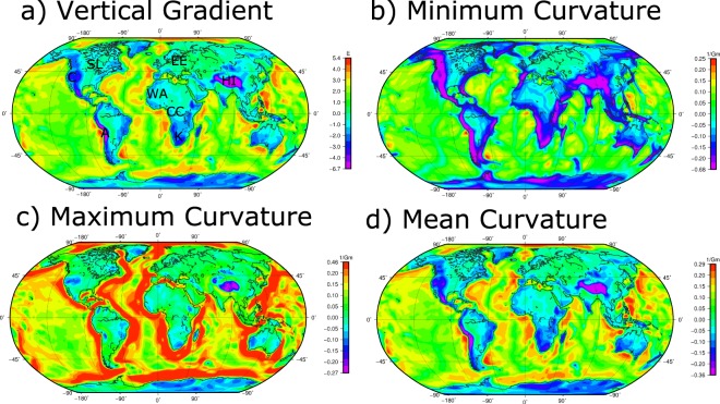
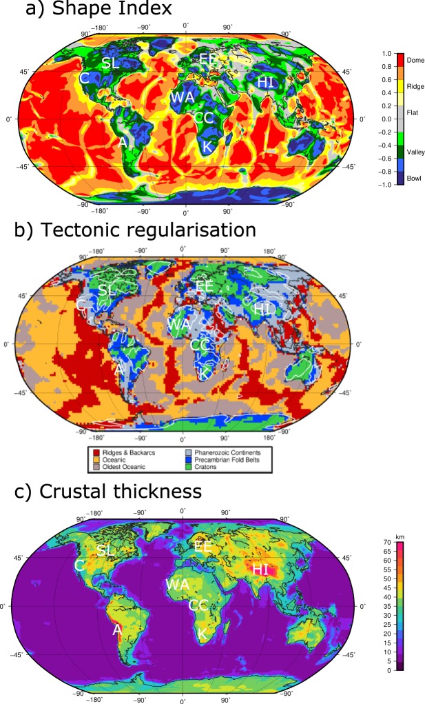
Curvature components derived from satellite gravity gradients provide new global views of Earth's structure. The satellite gravity gradients are based on the GOCE satellite mission and we illustrate by curvature images how the Earth is seen differently compared to seismic imaging. Tectonic domains with similar seismic characteristic can exhibit distinct differences in satellite gravity gradients maps, which points to differences in the lithospheric build-up. This is particularly apparent for the cratonic regions of the Earth. The comparisons demonstrate that the combination of seismological, and satellite gravity gradient imaging has significant potential to enhance our knowledge of Earth's structure. In remote frontiers like the Antarctic continent, where even basic knowledge of lithospheric scale features remains incomplete, the curvature images help unveil the heterogeneity in lithospheric structure, e.g. between the composite East Antarctic Craton and the West Antarctic Rift System.
由卫星重力梯度得出的曲率分量提供了地球结构的全新全球视角。卫星重力梯度基于GOCE卫星任务,我们通过曲率图像展示了与地震成像相比,地球的呈现方式有何不同。具有相似地震特征的构造域在卫星重力梯度图中可能表现出明显差异,这表明岩石圈构造存在差异。这在地球的克拉通地区尤为明显。比较结果表明,地震学和卫星重力梯度成像相结合有巨大潜力增进我们对地球结构的了解。在像南极大陆这样的偏远地区,即使是岩石圈尺度特征的基础知识仍不完整,曲率图像有助于揭示岩石圈结构的异质性,例如在复合的东南极克拉通和西南极裂谷系统之间。