Pollard James A, Brooks Susan M, Spencer Tom
Coastal Research Unit, Department of Geography, University of Cambridge, Downing Place, Cambridge, CB2 3EN, UK.
Department of Geography, Birkbeck, University of London, Malet Street, London, WC1E 7HX, UK.
Sci Data. 2019 Apr 26;6(1):42. doi: 10.1038/s41597-019-0044-3.
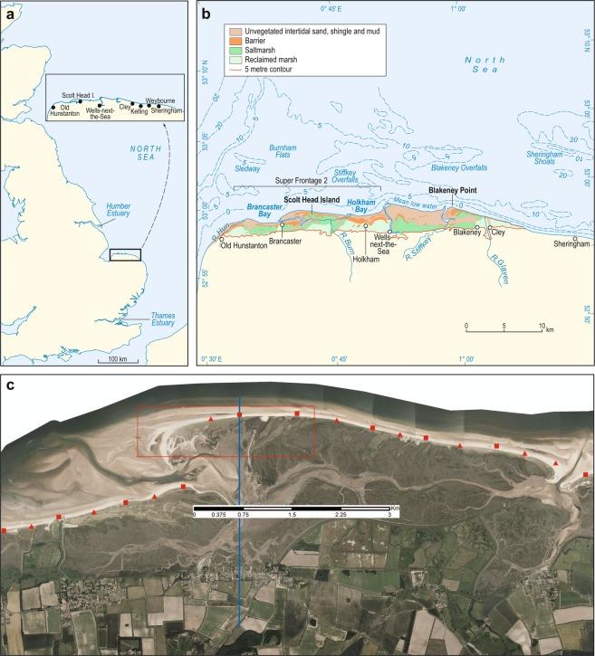
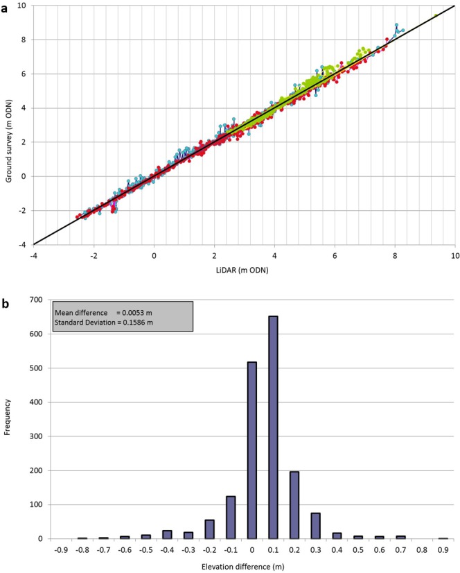
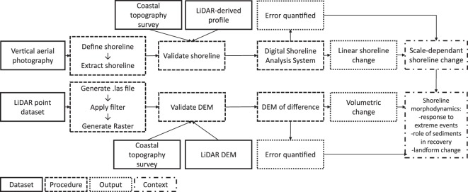
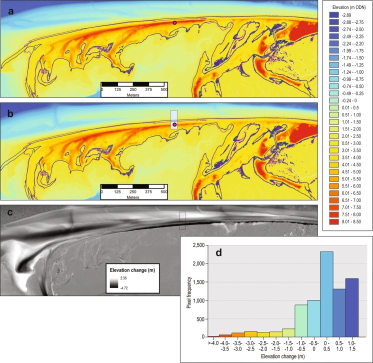
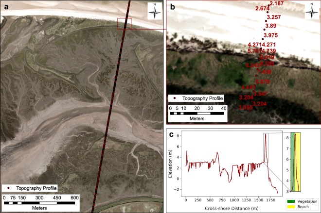
This paper presents a novel reference dataset for North Norfolk, UK, that demonstrates the value of harmonising coastal field-based topographic and remotely sensed datasets at local scales. It is hoped that this reference dataset and the associated methodologies will facilitate the use of topographic and remotely sensed coastal datasets, as demonstrated here using open-access UK Environment Agency datasets. Two core methodologies, used to generate the novel reference dataset, are presented. Firstly, we establish a robust approach to extracting shorelines from vertical aerial photography, validated against LiDAR (Light Detection and Ranging) and coastal topography surveys. Secondly, we present a standard methodology for quantifying sediment volume change from spatially continuous LiDAR elevation datasets. As coastal systems are monitored at greater spatial resolution and temporal frequency there is an unprecedented opportunity to determine how and why coastal systems have changed in the past with a view to informing future forecasting. With revelation of trends that suggest increasing coastal risk, coastal change research is needed to inform the management and protection of coasts.
本文展示了一个针对英国北诺福克郡的全新参考数据集,该数据集证明了在地方尺度上协调基于实地的海岸地形数据集和遥感数据集的价值。希望这个参考数据集及相关方法将促进地形和遥感海岸数据集的使用,正如在此使用英国环境署的开放获取数据集所展示的那样。本文介绍了用于生成这个全新参考数据集的两种核心方法。首先,我们建立了一种从垂直航空摄影中提取海岸线的稳健方法,并通过激光雷达(光探测和测距)及海岸地形测量进行了验证。其次,我们提出了一种从空间连续的激光雷达高程数据集中量化沉积物体积变化的标准方法。随着对海岸系统的监测在空间分辨率和时间频率上的提高,现在有前所未有的机会来确定海岸系统在过去如何以及为何发生了变化,以便为未来的预测提供信息。鉴于显示出海岸风险增加的趋势,需要开展海岸变化研究,为海岸的管理和保护提供信息。