Office of Research and Development, National Health and Environmental Effects Laboratory, Western Ecology Division, US Environmental Protection Agency, 200 SW 35th Street, Corvallis, OR, 97333, USA.
Environ Monit Assess. 2019 Jun 20;191(Suppl 1):325. doi: 10.1007/s10661-019-7316-4.
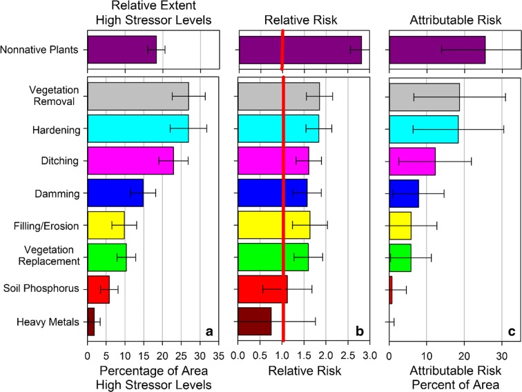
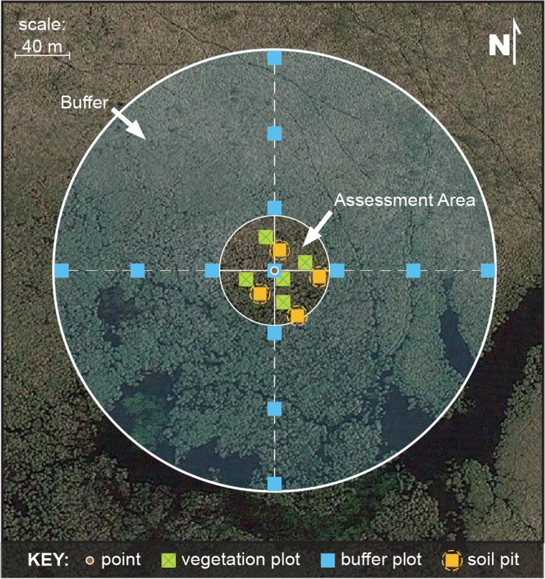
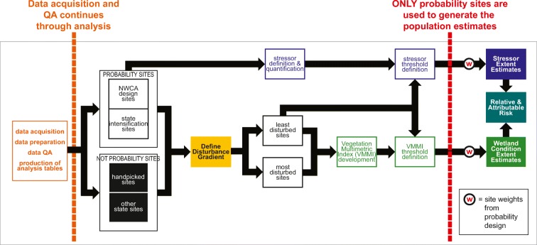
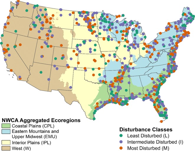
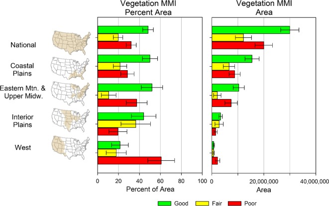
The first National Wetland Condition Assessment (NWCA) was conducted in 2011 by the US Environmental Protection Agency (USEPA) and its federal and state partners, using a survey design that allowed inference of results to national and regional scales. Vegetation, algae, soil, water chemistry, and hydrologic data were collected at each of 1138 locations across the conterminous United States (US). Ecological condition was assessed in relation to a disturbance gradient anchored by least disturbed (reference) and most disturbed sites identified using chemical, physical, and biological disturbance indices based on site-level data. A vegetation multimetric index (VMMI) was developed as an indicator of condition, and included four metrics: a floristic quality assessment index, relative importance of native plants, number of disturbance-tolerant plant species, and relative cover of native monocots. Potential stressors to wetland condition were identified and incorporated into two indicators of vegetation alteration, four indicators of hydrologic alteration, a soil heavy metal index, and a nonnative plant indicator and were used to quantify national and regional stressor extent, and the associated relative and attributable risk. Approximately 48 ± 6% of the national wetland area was found to be in good condition and 32 ± 6% in poor condition as defined by the VMMI. Across the conterminous US, approximately 20% of wetland area had high or very high stressor levels related to nonnative plants. Vegetation removal, hardening, and ditching stressors had the greatest extent of wetland area with high stressor levels, affecting 23-27% of the wetland area in the NWCA sampled population. The results from the 2016 NWCA will build on those from the 2011 assessment and initiate the ability to report on trends in addition to status. The data and tools produced by the NWCA can be used by others to further our knowledge of wetlands in the conterminous US.
第一次全国湿地状况评估(NWCA)于 2011 年由美国环境保护署(USEPA)及其联邦和州合作伙伴进行,采用调查设计,允许从全国和区域尺度推断结果。在美国本土的 1138 个地点收集了植被、藻类、土壤、水质和水文学数据。生态状况是根据基于站点数据的化学、物理和生物干扰指数确定的最不受干扰(参考)和最受干扰的站点的干扰梯度来评估的。开发了一种植被多指标指数(VMMI)作为状况指标,包括四个指标:一个植物区系质量评估指数、本地植物的相对重要性、耐受干扰的植物物种数量以及本地单子叶植物的相对覆盖度。确定了湿地状况的潜在胁迫因素,并将其纳入两个植被变化指标、四个水文变化指标、一个土壤重金属指数、一个外来植物指标中,用于量化全国和区域胁迫因素的程度,以及相关的相对和归因风险。根据 VMMI 的定义,大约 48±6%的全国湿地面积被认为处于良好状况,32±6%处于较差状况。在美国本土,大约 20%的湿地面积与外来植物有关,存在高或极高的胁迫水平。植被清除、硬化和沟渠化胁迫因素对具有高胁迫水平的湿地面积的影响最大,占 NWCA 抽样人口中 23-27%的湿地面积。2016 年 NWCA 的结果将建立在 2011 年评估的基础上,并启动除了现状之外还能报告趋势的能力。NWCA 产生的数据和工具可被他人用于进一步了解美国本土的湿地。