Faculty of Advanced Science and Technology, Kumamoto University, 2-39-1 Kurokami, Kumamoto, 860-8555, Japan.
International Research Organization for Advanced Science and Technology, Kumamoto University, 2-39-1 Kurokami, Kumamoto, 860-8555, Japan.
Nat Commun. 2020 Jun 2;11(1):2776. doi: 10.1038/s41467-020-16604-y.
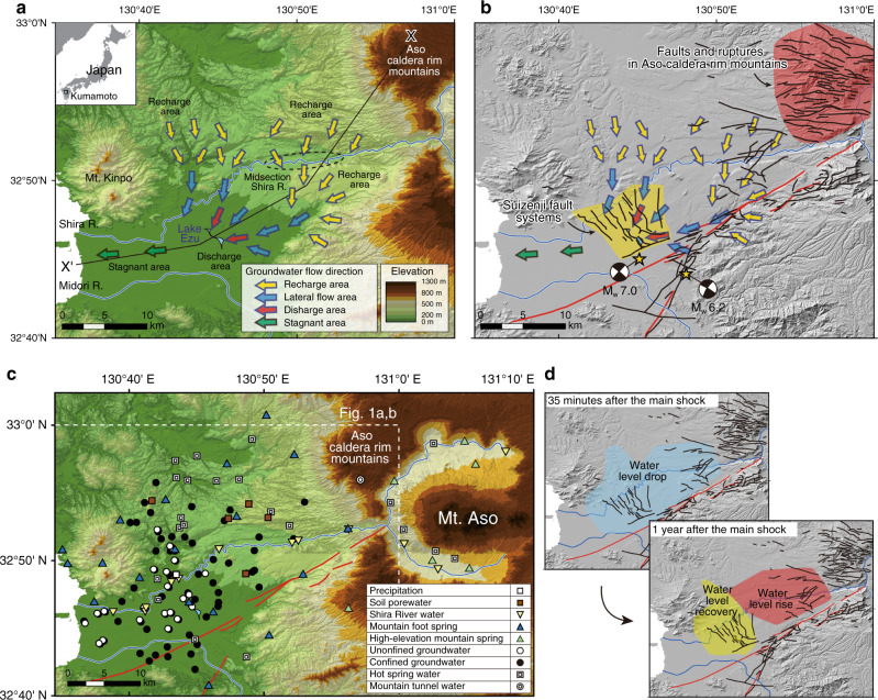
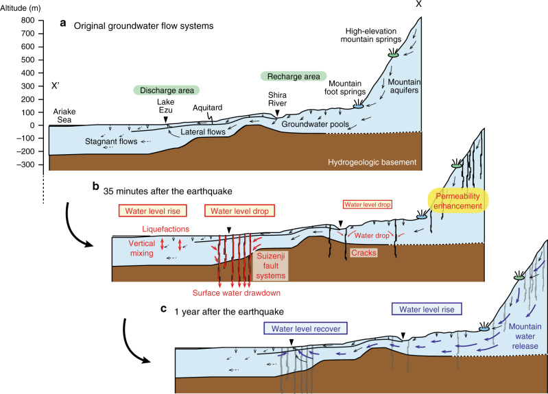
Hydrogeological properties can change in response to large crustal earthquakes. In particular, permeability can increase leading to coseismic changes in groundwater level and flow. These processes, however, have not been well-characterized at regional scales because of the lack of datasets to describe water provenances before and after earthquakes. Here we use a large data set of water stable isotope ratios (n = 1150) to show that newly formed rupture systems crosscut surrounding mountain aquifers, leading to water release that causes groundwater levels to rise (~11 m) in down-gradient aquifers after the 2016 M 7.0 Kumamoto earthquake. Neither vertical infiltration of soil water nor the upwelling of deep fluids was the major cause of the observed water level rise. As the Kumamoto setting is representative of volcanic aquifer systems at convergent margins where seismotectonic activity is common, our observations and proposed model should apply more broadly.
水文地质性质会因大型地壳运动而发生变化。特别是,渗透率会增加,从而导致地震时地下水位和水流发生变化。然而,由于缺乏描述地震前后水源的数据集,这些过程在区域尺度上还没有得到很好的描述。在这里,我们使用大量的水稳定同位素比值数据集(n=1150)来表明,新形成的断裂系统贯穿周围的山地含水层,导致地下水释放,从而在 2016 年熊本地震后,下游含水层的地下水位上升(~11m)。观测到的水位上升不是土壤水垂直入渗或深部流体上涌的主要原因。由于熊本地区是地震构造活动常见的汇聚边缘火山含水层系统的代表,因此我们的观测结果和提出的模型应该更具有普遍性。