Departamento de Geodinámica, Universidad de Granada, 18071 Granada, Spain.
Instituto Andaluz de Ciencias de la Tierra (CSIC-UGR), 18071 Granada, Spain.
Sensors (Basel). 2022 Mar 9;22(6):2128. doi: 10.3390/s22062128.
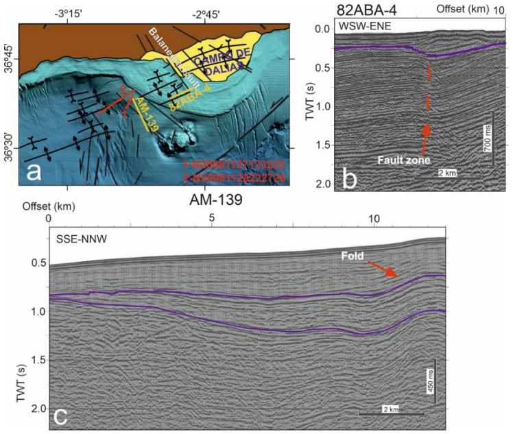
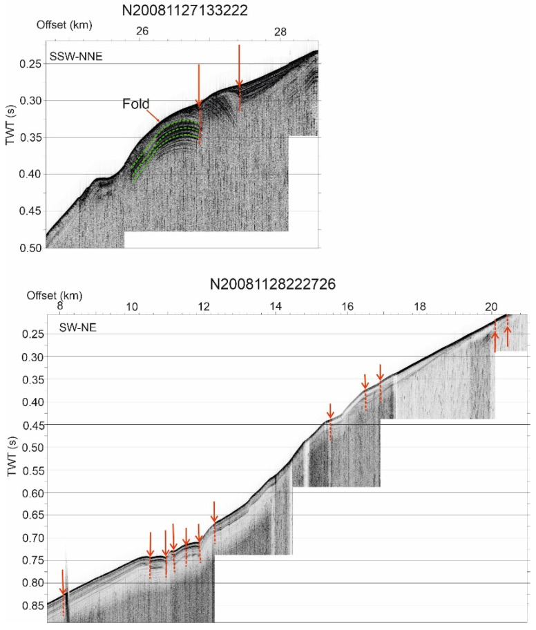
The Gibraltar Arc includes the Betic and Rif Cordilleras surrounding the Alboran Sea; it is formed at the northwest-southeast Eurasia-Nubia convergent plate boundary in the westernmost Mediterranean. Since 2006, the Campo de Dalias GNSS network has monitored active tectonic deformation of the most seismically active area on the north coast of the Alboran Sea. Our results show that the residual deformation rates with respect to Eurasia range from 1.7 to 3.0 mm/year; roughly homogenous west-southwestward displacements of the northern sites occur, while the southern sites evidence irregular displacements towards the west and northwest. This deformation pattern supports simultaneous east-northeast-west-southwest extension, accommodated by normal and oblique faults, and north-northwest-south-southeast shortening that develops east-northeast-west-southwest folds. Moreover, the GNSS results point to dextral creep of the main northwest-southeast Balanegra Fault. These GNNS results thus reveal, for the first time, present-day interaction of the roll-back tectonics of the Rif-Gibraltar-Betic slab in the western part of the Gibraltar Arc with the indentation tectonics affecting the eastern and southern areas, providing new insights for improving tectonic models of arcuate orogens.
直布罗陀弧形构造包括围绕阿尔沃兰海的贝提克山脉和里夫山脉;它形成于欧亚大陆与努比亚汇聚板块边界的西北-东南方向,位于最西端的地中海。自 2006 年以来,达利阿斯 GNSS 网络一直在监测阿尔沃兰海北海岸地震活动最活跃地区的活动构造变形。我们的研究结果表明,相对于欧亚大陆的残余变形速率在 1.7 至 3.0 毫米/年之间;北部站点发生大致均匀的西南向西向位移,而南部站点的位移则不规则,向西和西北方向发生。这种变形模式支持由正断层和斜断层协调的同时进行的东北-西南-东西向伸展,并伴有北西北-南东南向缩短,从而形成东北-西南-东西向褶皱。此外,GNSS 结果表明,主要的西北-东南方向的巴兰内格拉断层存在右旋蠕动。因此,这些 GNSS 结果首次揭示了直布罗陀弧形构造西部里夫-直布罗陀-贝提克板块后退构造与影响东部和南部地区的俯冲构造之间的相互作用,为改进弧形造山带的构造模型提供了新的见解。