Instituto de Geociencias (CSIC, UCM). Calle del Doctor Severo Ochoa, nº 7, Ciudad Universitaria, 28040, Madrid, Spain.
Istituto Nazionale di Geofisica e Vulcanologia, Osservatorio Etneo - Sezione di Catania, Piazza Roma 2, 95125, Catania, Italy.
Sci Rep. 2022 Dec 12;12(1):20257. doi: 10.1038/s41598-022-23998-w.
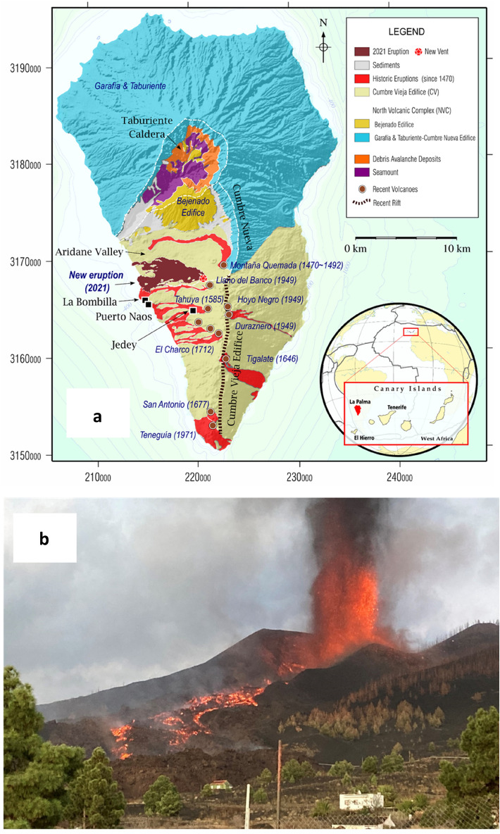
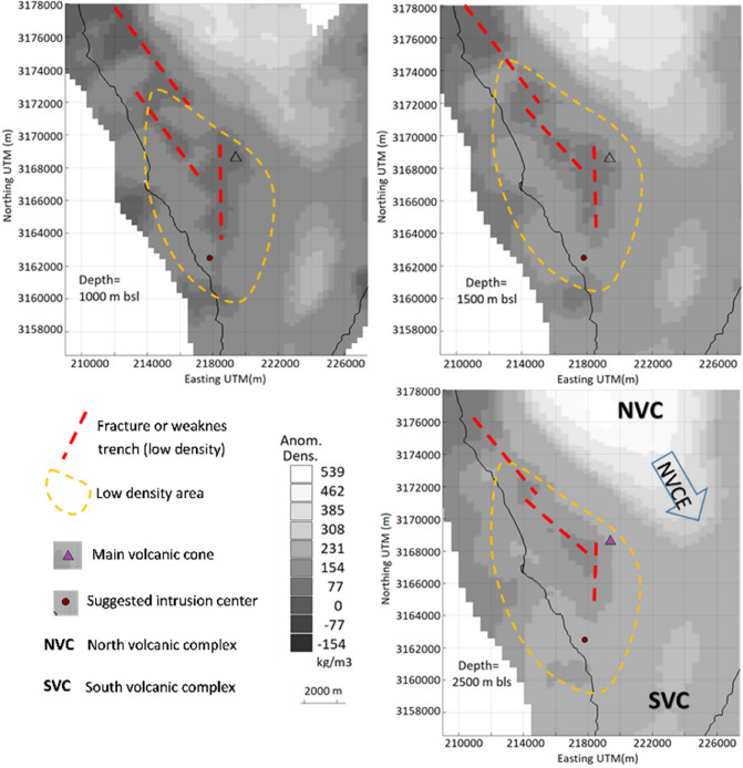
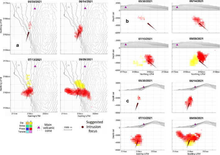
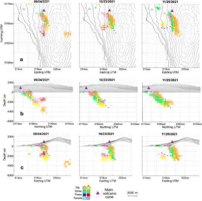
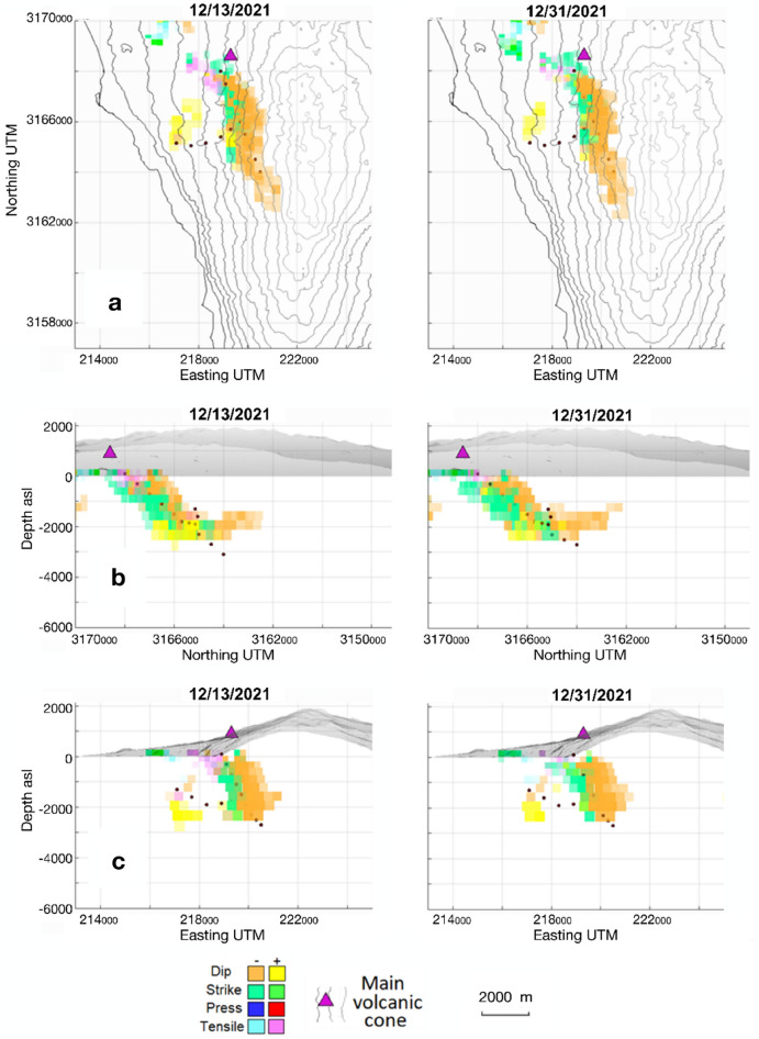
La Palma, Canary Islands, underwent volcanic unrest which culminated in its largest historical eruption. We study this unrest along 2021 using Interferometric Synthetic Aperture Radar (InSAR) and a new improved interpretation methodology, comparing achieved results with the crustal structure. We reproduce the final phase of La Palma volcanic unrest, highligthing a shallow magma accumulation which begins about 3.5 months before the eruption in a crustal volume charactherized by low density and fractured rocks. Our modeling, together with our improved pictures of the crustal structure, allows us to explain the location and characteristics of the eruption and to detect failed eruption paths. These can be used to explain post-eruptive phenomena and hazards to the local population, such as detected gases anomalies in La Bombilla and Puerto Naos. Our results have implications for understanding volcanic activity in the Canaries and volcano monitoring elsewhere, helping to support decision-making and providing significant insights into urban and infrastructure planning in volcanic areas.
拉帕尔马岛,加那利群岛,经历了火山活动,最终引发了其历史上最大规模的喷发。我们使用干涉合成孔径雷达(InSAR)和一种新的改进解释方法,研究了 2021 年的火山活动,将获得的结果与地壳结构进行了比较。我们再现了拉帕尔马火山活动的最后阶段,突出了一个浅层岩浆积累,该积累始于喷发前约 3.5 个月,在一个以低密度和破碎岩石为特征的地壳体积中。我们的模型,以及我们对地壳结构的改进图片,使我们能够解释喷发的位置和特征,并探测到失败的喷发路径。这些可以用来解释喷发后的现象和对当地居民的危害,例如在拉邦比拉和波多诺沃检测到的气体异常。我们的研究结果对理解加那利群岛的火山活动和其他地方的火山监测具有重要意义,有助于支持决策,并为火山地区的城市和基础设施规划提供重要的见解。