Ngo Dung Trung, Nguyen Hoi Dang, Nguyen Huan Cao
Institute of Tropical Ecology, Joint Vietnam-Russia Tropical Science and Technology Research Center, No. 63, Nguyen Van Huyen Str., Cau Giay District, Hanoi, Viet Nam.
University of Science, Vietnam National University, No. 334, Nguyen Trai Str., Thanh Xuan District, Hanoi, Viet Nam.
Heliyon. 2023 Jun 3;9(6):e16984. doi: 10.1016/j.heliyon.2023.e16984. eCollection 2023 Jun.
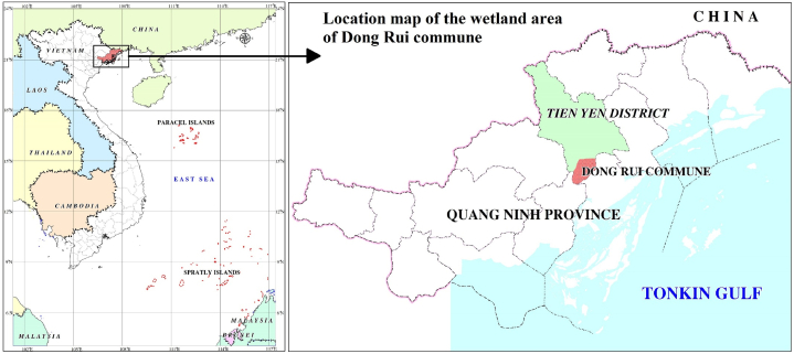
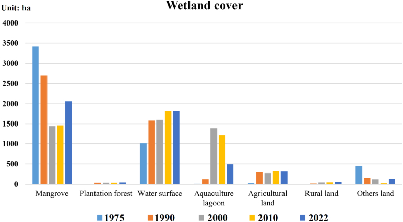
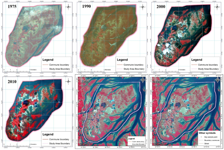
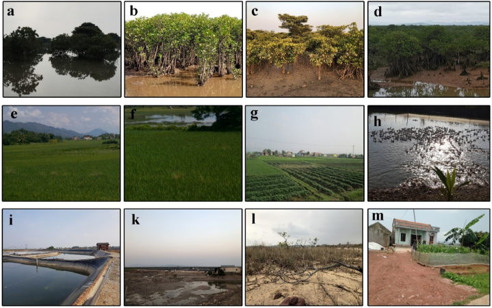
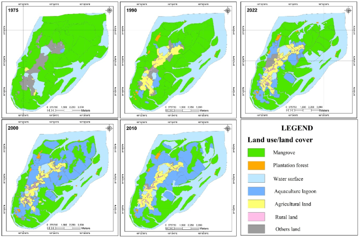
Wetlands are one of the most important ecosystems as habitats for many animal and plant species and are crucial for disaster mitigation, improving environmental quality, storing carbon, and responding to climate change. However, these sensitive ecosystems have been heavily affected by anthropogenic activities, including aquaculture. In this study, we used multitemporal satellite imagery integrated with a verified field survey method to map the coverage of the wetland ecosystem in the Dong Rui commune, Tien Yen district, Quang Ninh Province, Vietnam, five times for four periods from 1975 to 2022, with high accuracy (overall accuracy = 92.3%, Kappa = 0.91). The results showed that from 1975 to 2000, the area of mangrove forests declined sharply (by nearly 2,000 ha), mainly due to policies of development and conversion of land use. From 2000 to 2022, the mangrove forest area was gradually restored, while the area under aquaculture shrank. Anthropogenic impacts, especially the effects of local economic development, and conservation and developmental policies, are the main causes of continuous change in each short period. Our study demonstrates satellite imagery as an effective tool for assessing wetland ecosystem area fluctuations and assessing the extent of human impacts on this natural ecosystem. Our findings can serve as a basis for planning, conservation strategies, and sustainable development of wetland ecosystems and for improving the associated livelihoods of the communities.
湿地是最重要的生态系统之一,是许多动植物物种的栖息地,对于减灾、改善环境质量、储存碳以及应对气候变化至关重要。然而,这些敏感的生态系统受到了包括水产养殖在内的人为活动的严重影响。在本研究中,我们使用多时相卫星图像并结合经过验证的实地调查方法,对越南广宁省先安县东瑞公社湿地生态系统的覆盖范围进行了测绘,在1975年至2022年的四个时期内进行了五次测绘,精度很高(总体精度 = 92.3%,卡帕系数 = 0.91)。结果表明,从1975年到2000年,红树林面积急剧下降(减少了近2000公顷),主要是由于土地开发和用途转换政策。从2000年到2022年,红树林面积逐渐恢复,而水产养殖面积则缩小。人为影响,特别是当地经济发展的影响以及保护和发展政策,是每个短时期内持续变化的主要原因。我们的研究表明,卫星图像是评估湿地生态系统面积波动以及评估人类对这个自然生态系统影响程度的有效工具。我们的研究结果可为湿地生态系统的规划、保护策略和可持续发展以及改善相关社区的生计提供依据。