Salhi Adil, El Hasnaoui Yassin, Pérez Cutillas Pedro, Heggy Essam
Geography and Development Group, Abdelmalek Essaadi University, FLSH, Martil, Morocco.
Department of Geography, University of Murcia, C. Santo Cristo, 1, 30001, Murcia, Spain.
Sci Rep. 2023 Aug 12;13(1):13158. doi: 10.1038/s41598-023-40135-3.
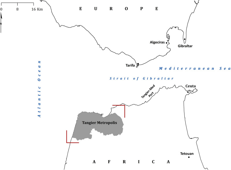
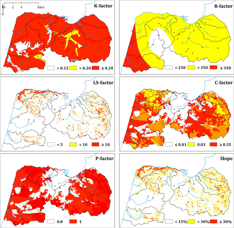
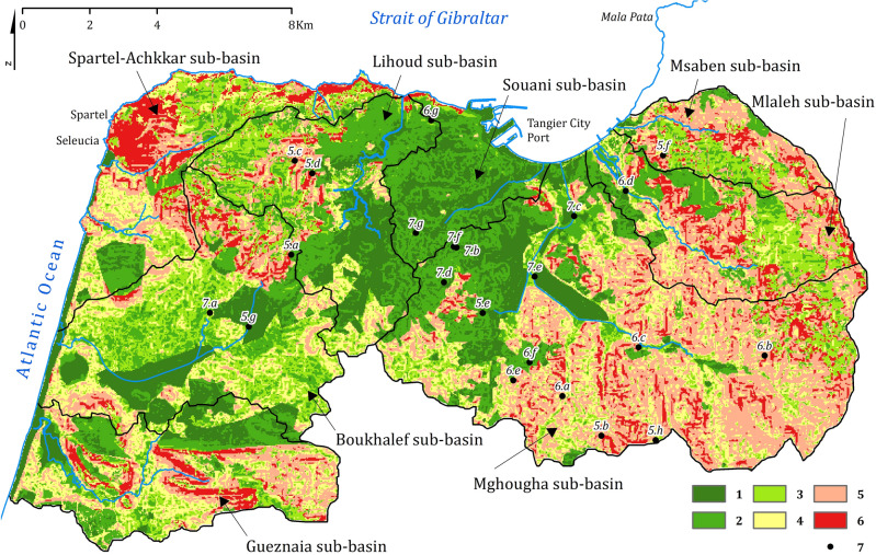
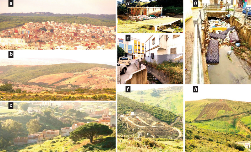
Land degradation and soil erosion are becoming increasingly problematic in Africa's rapidly developing urban areas, particularly in Major Port Cities. Uncontrolled expansion and human pressures are hindering planning, adaptation, and conservation efforts. To understand the extent of these issues, this study combined morphometric analysis, soil loss calculation, field monitoring, and remote sensing and GIS tools to assess soil erosion in the Metropolis of Tangier (Morocco) located at the confluence of the Mediterranean Sea and the Atlantic Ocean at the Strait of Gibraltar. The study relied on data from 13 rain gauge stations, official reports, and remote sensing acquisitions, as well as field observations. Results showed an average soil erosion rate of 24.2 t/ha/year, equivalent to an annual soil loss of 588,051 t/year. This high rate was largely due to areas with a high erosion risk (99.8%), covering only 8.3% of the territory, which were characterized by recently burned topsoil, fallow land, and steep slopes. These areas included both uncontrolled neighbourhoods and areas for planned urban and industrial expansion, posing a threat to the landscape's sustainability and socio-economic prospects. The morphometric analysis revealed its high vulnerability to erosion and degradation, with the highest soil loss rates observed in the eastern and western regions. The study also found that flash floods caused by hydroclimatic hazards can lead to significant damage to infrastructure and equipment, particularly in western sub-basins and mountainous regions. In conclusion, the use of remote sensing and GIS technologies provided valuable insights into the physical characteristics and vulnerability of the Tangier Metropolis to land degradation and soil erosion. These findings emphasize the need for effective land management practices and conservation measures to mitigate the impacts of land degradation and soil erosion in the face of climate change. This information is crucial for decision-makers and stakeholders to develop strategies to address these pressing issues.
在非洲快速发展的城市地区,尤其是主要港口城市,土地退化和土壤侵蚀问题日益严重。无节制的扩张和人类压力阻碍了规划、适应和保护工作。为了解这些问题的严重程度,本研究结合形态测量分析、土壤流失计算、实地监测以及遥感和地理信息系统工具,对位于直布罗陀海峡地中海与大西洋交汇处的摩洛哥丹吉尔市的土壤侵蚀情况进行评估。该研究依赖于13个雨量站的数据、官方报告、遥感采集数据以及实地观测。结果显示,土壤侵蚀平均速率为每年24.2吨/公顷,相当于每年土壤流失588,051吨。如此高的侵蚀速率主要归因于侵蚀风险高的区域(占99.8%),这些区域仅占总面积的8.3%,其特征为近期表层土被烧毁、休耕地和陡坡。这些区域既包括无规划的社区,也包括规划中的城市和工业扩张区域,对景观的可持续性和社会经济前景构成威胁。形态测量分析表明该地区极易遭受侵蚀和退化,东部和西部地区的土壤流失率最高。研究还发现,水文气候灾害引发的山洪会对基础设施和设备造成重大破坏,尤其是在西部次流域和山区。总之,遥感和地理信息系统技术的应用为了解丹吉尔市的物理特征以及其对土地退化和土壤侵蚀的脆弱性提供了宝贵见解。这些发现强调,面对气候变化,需要采取有效的土地管理措施和保护措施来减轻土地退化和土壤侵蚀的影响。这些信息对于决策者和利益相关者制定应对这些紧迫问题的策略至关重要。