Mohamed Waheed H, Elyaseer Mahmoud H, Sabra Mohamed Elsadek M
Geology Department, Faculty of Science, Al-Azhar University, Cairo, Egypt.
Egyptian Mineral Resources Authority, PO. Box 11517, Abbassiya, Cairo, Egypt.
Sci Rep. 2023 Dec 7;13(1):21569. doi: 10.1038/s41598-023-48660-x.
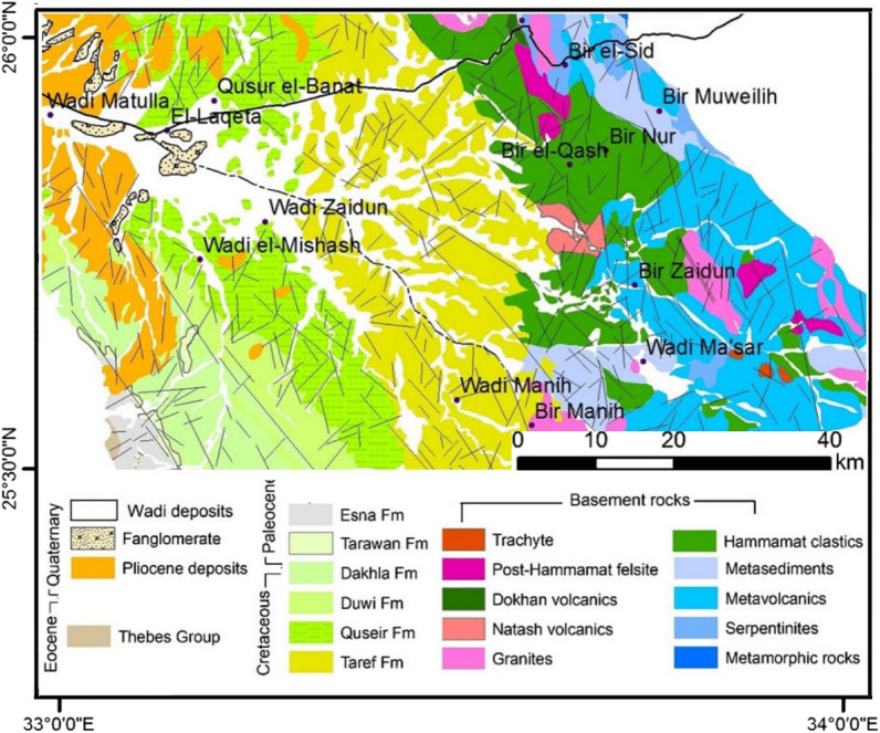
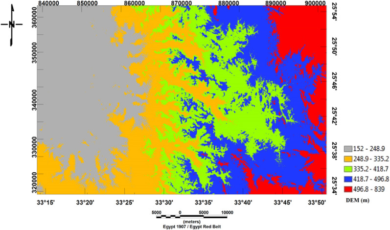
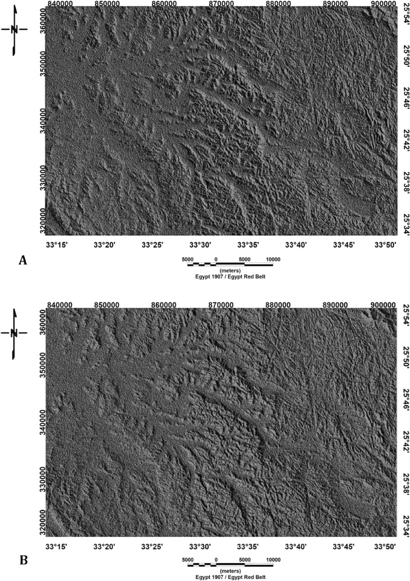
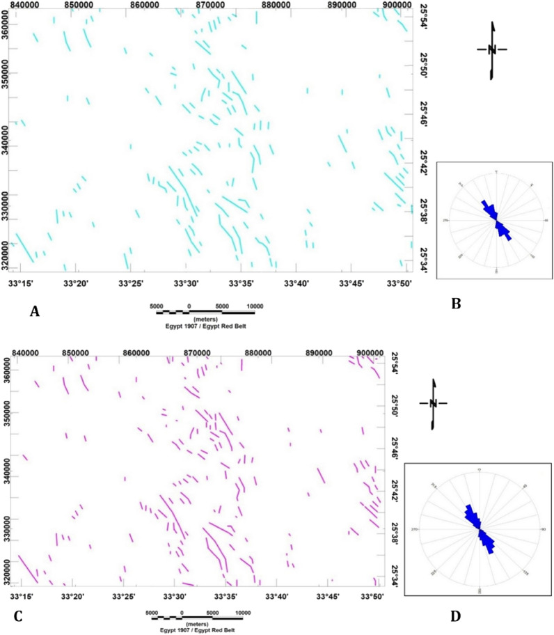
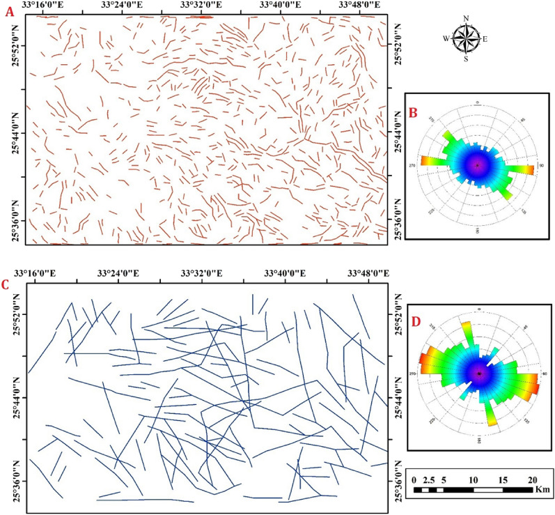
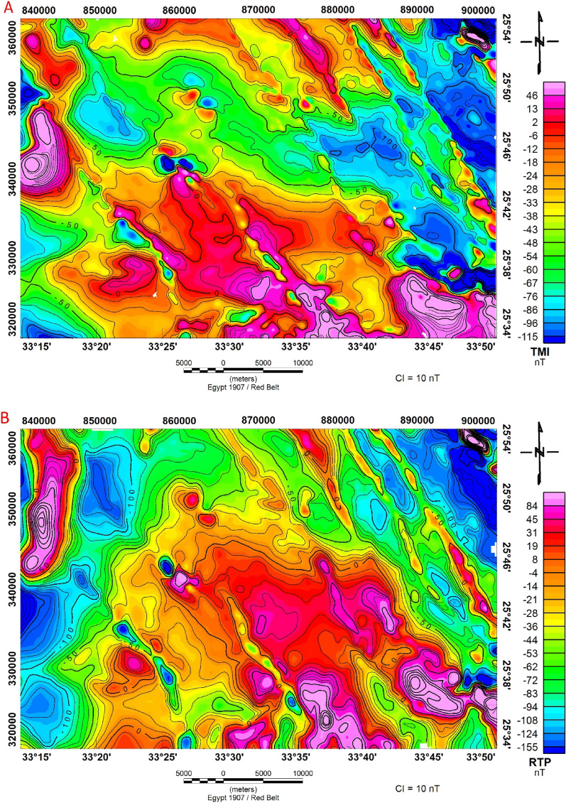
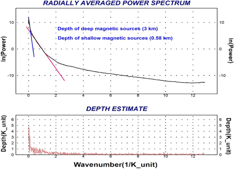
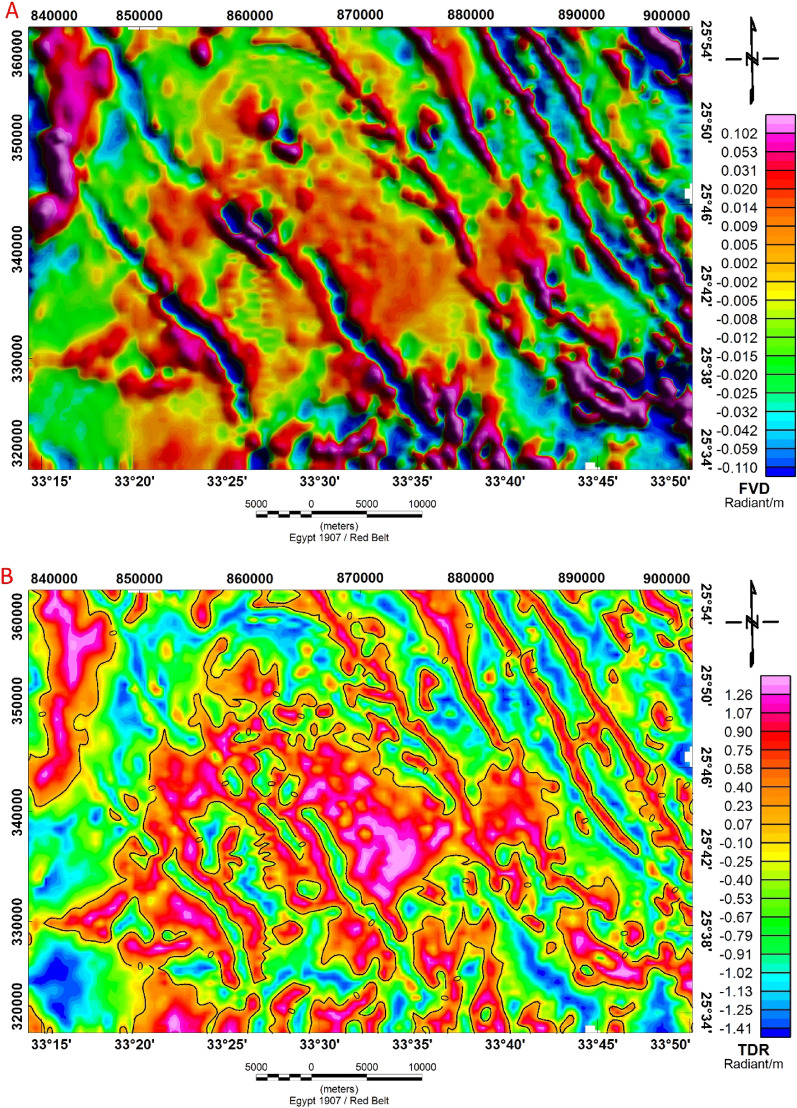
The Bir El-Qash area, located in the Central Eastern Desert of Egypt, is characterized by a diverse range of igneous, metamorphic, and sedimentary rocks with ages spanning from the Late Proterozoic to Quaternary. Integration of remote sensing with aeromagnetic data was conducted to generate surface and subsurface structural lineaments. Shaded relief from digital elevation models, principal component analysis of Landsat-8 data, and ALOS/PALSAR images were utilized to create lineament maps. Airborne magnetic data were employed to reveal subsurface characterizations. The study area has undergone various tectonic activities, resulting in complex structures. Multiple fault trends and fractures were identified, including the NW-SE (Red Sea-Gulf of Suez) trend, the NE-SW trending Syrian arc trend, the N-S trending East African trend and the WNW-ESE trend. By analyzing the tectonic features of the Bir El-Qash area, this study provides insights into the geological history and evolution of the Eastern Desert of Egypt.
比尔卡什地区位于埃及东部沙漠中部,其特征是有各种各样的火成岩、变质岩和沉积岩,年龄跨度从元古代晚期到第四纪。开展了遥感与航磁数据的整合,以生成地表和地下构造线理。利用数字高程模型的阴影浮雕、Landsat-8数据的主成分分析以及ALOS/PALSAR图像来创建线理图。利用航空磁测数据揭示地下特征。研究区域经历了各种构造活动,形成了复杂的构造。识别出了多个断层走向和裂缝,包括西北-东南(红海-苏伊士湾)走向、东北-西南走向的叙利亚弧形走向、南北走向的东非走向以及西北西-东南东走向。通过分析比尔卡什地区的构造特征,本研究为埃及东部沙漠的地质历史和演化提供了见解。