Liu Yang, Qi Xuyao, Luo Dayong, Zhang Yongqing, Qin Jiangtao
School of Resources and Security, Chongqing Vocational Institute of Engineering, Chongqing, 402260, China.
School of Safety Engineering, China University of Mining and Technology, Xuzhou, 221000, China.
Sci Rep. 2024 Feb 26;14(1):4609. doi: 10.1038/s41598-024-55304-1.
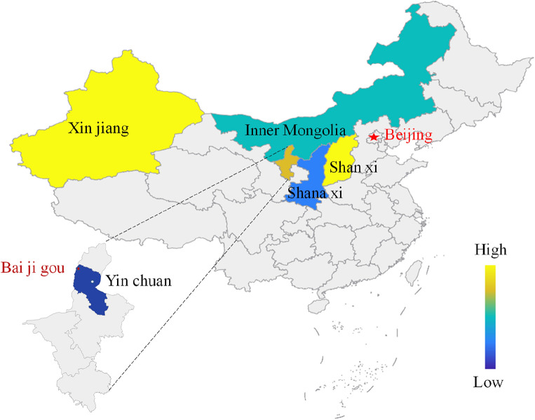
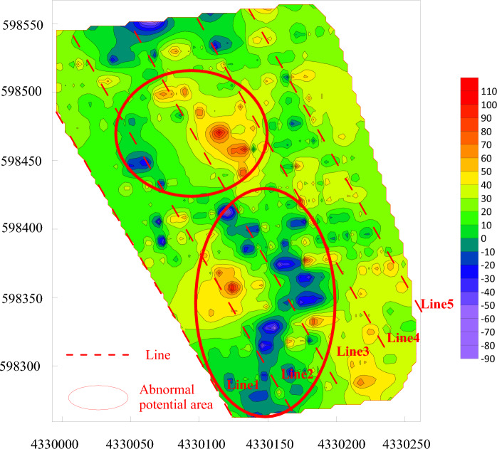
The outcrop fire area in Rujigou Coal Mine in Ningxia, China has been burning continuously for over 100 years. This not only results in wastage of resources but also poses significant damage to the ecological environment. Previous research on open fire detection has mainly focused on coalfield fire areas, using single method such as infrared remote sensing or surface temperature measurement, magnetic method, electrical method, radon measurement and mercurimetry. However, the outcrop fire area has migrated to deeper parts over the years, conventional single fire zone detection methods are not capable of accurately detecting the extent of the fire zone, inversion interpretation is faced with the problem of many solutions. In fire management, current research focuses on the development of new materials, such as fly ash gel, sodium silicate gel, etc., However, it is often difficult to quickly extinguish outcrop fire areas with a single technique. Considering this status quo, unmanned aerial vehicle (UAV) infrared thermal imaging was employed to initially detect the scope of the outcrop fire area, and then both the spontaneous potential and directional drilling methods were adopted for further scope detection in pursuit of more accurate results. In addition, an applicable fire prevention and extinguishing system was constructed, in which three-phase foam was injected for the purpose of absorbing heat and cooling. Furthermore, the composite colloid was used to plug air leakage channels, and loess was backfilled to avoid re-combustion. The comprehensive detection and control technologies proposed in this study can be applied to eliminating the outcrop fire area and protecting the environment. This study can provide guidance and reference for the treatment of other outcrop fire areas.
中国宁夏汝箕沟煤矿的露头火区已持续燃烧100多年。这不仅造成资源浪费,还对生态环境造成严重破坏。以往对明火探测的研究主要集中在煤田火区,采用红外遥感或地表温度测量、磁法、电法、测氡法和测汞法等单一方法。然而,多年来露头火区已向深部迁移,传统的单一火区探测方法无法准确探测火区范围,反演解释面临多解问题。在火灾治理方面,目前的研究集中在新型材料的开发上,如粉煤灰凝胶、硅酸钠凝胶等,但往往难以用单一技术快速扑灭露头火区。考虑到这一现状,采用无人机红外热成像初步探测露头火区范围,然后采用自然电位法和定向钻孔法进行进一步的范围探测,以追求更准确的结果。此外,构建了适用的防灭火系统,注入三相泡沫以吸热降温。此外,使用复合胶体封堵漏风通道,并回填黄土以避免复燃。本研究提出的综合探测与治理技术可应用于消除露头火区、保护环境。本研究可为其他露头火区的治理提供指导和参考。