Fone David L, Christie Stephen, Lester Nathan
Department of Epidemiology, Statistics and Public Health, Centre for Health Sciences Research, School of Medicine, Cardiff University, Heath Park, Cardiff, CF14 4YS, UK.
Int J Health Geogr. 2006 Apr 13;5:16. doi: 10.1186/1476-072X-5-16.
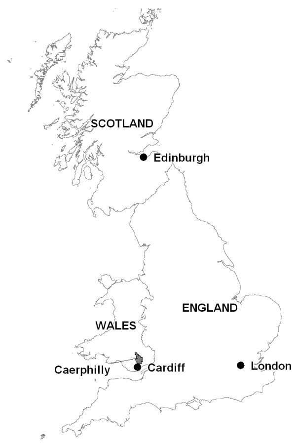
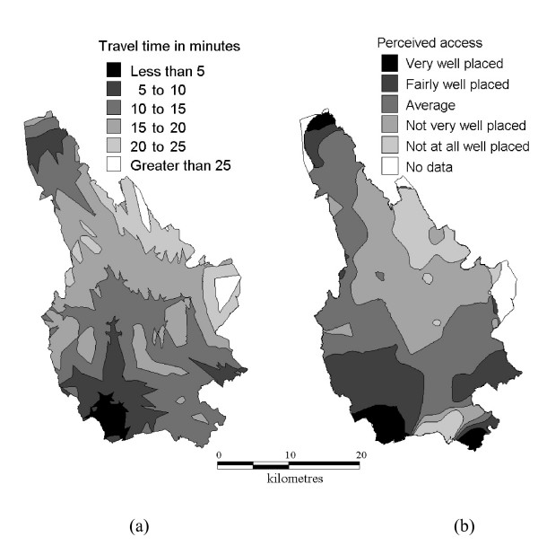
Assessment of the spatial accessibility of hospital accident and emergency departments as perceived by local residents has not previously been investigated. Perceived accessibility may affect where, when, and whether potential patients attend for treatment. Using data on 11,853 respondents to a population survey in Caerphilly county borough, Wales, UK, we present an analysis comparing the accessibility of accident and emergency departments as reported by local residents and drive-time to the nearest accident and emergency department modelled using a geographical information system (GIS).
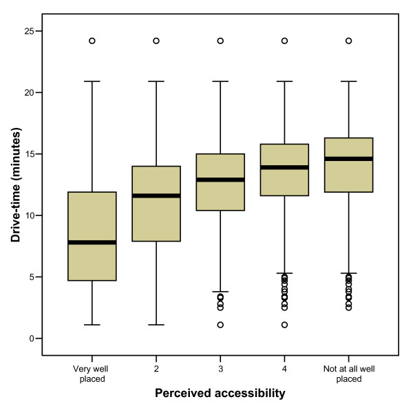
Median drive-times were significantly shorter in the lowest perceived access category and longer in the best perceived access category (p < 0.001). The perceived access and GIS modelled drive-time variables were positively correlated (Spearman's rank correlation coefficient, r = 0.38, p < 0.01). The strongest correlation was found for respondents living in areas in which nearly all households had a car or van (r = 0.47, p < 0.01). Correlations were stronger among respondents reporting good access to public transport and among those reporting a recent accident and emergency attendance for injury treatment compared to other respondents. Correlation coefficients did not vary substantially by levels of household income. Drive-time, road distance and straight-line distance were highly inter-correlated and substituting road distance or straight-line distance as the GIS modelled spatial accessibility measure only marginally decreased the magnitude of the correlations between perceived and GIS modelled access.
This study provides evidence that the accessibility of hospital-based health care services as perceived by local residents is related to measures of spatial accessibility modelled using GIS. For studies that aim to model geographical separation in a way that correlates well with the perception of local residents, there may be minimal advantage in using sophisticated measures. Straight-line distance, which can be calculated without GIS, may be as good as GIS-modelled drive-time or distance for this purpose. These findings will be of importance to health policy makers and local planners who seek to obtain local information on access to services through focussed assessments of residents' concerns over accessibility and GIS modelling.
此前尚未对当地居民所感知的医院急诊科空间可达性进行评估。感知可达性可能会影响潜在患者前往何处、何时以及是否就诊。利用英国威尔士卡菲利县行政区一项人口调查中11853名受访者的数据,我们进行了一项分析,比较了当地居民报告的急诊科可达性与使用地理信息系统(GIS)建模得出的到最近急诊科的驾车时间。
在感知可达性最低的类别中,驾车时间中位数显著更短,而在感知可达性最佳的类别中则更长(p < 0.001)。感知可达性与GIS建模的驾车时间变量呈正相关(斯皮尔曼等级相关系数,r = 0.38,p < 0.01)。对于几乎所有家庭都拥有汽车或货车的地区的受访者,相关性最强(r = 0.47,p < 0.01)。与其他受访者相比,报告公共交通便利性良好的受访者以及报告近期因受伤前往急诊科就诊的受访者之间的相关性更强。相关系数并未因家庭收入水平而有显著差异。驾车时间、道路距离和直线距离高度相关,用道路距离或直线距离替代GIS建模的空间可达性度量,只会略微降低感知可达性与GIS建模可达性之间的相关程度。
本研究提供了证据,表明当地居民所感知的基于医院的医疗保健服务可达性与使用GIS建模的空间可达性度量相关。对于旨在以与当地居民感知良好相关的方式对地理分隔进行建模的研究,使用复杂度量可能优势不大。无需GIS即可计算的直线距离,在此目的上可能与GIS建模的驾车时间或距离一样好。这些发现对于寻求通过集中评估居民对可达性的担忧以及GIS建模来获取有关服务可达性的当地信息的卫生政策制定者和地方规划者具有重要意义。