Twumasi Yaw A, Merem Edmund C
Center for Hydrology, Soil Climatology and Remote Sensing, Department of Plant and Soil Science, Alabama A&M University, Normal, AL 35762, USA.
Int J Environ Res Public Health. 2007 Jun;4(2):173-84. doi: 10.3390/ijerph2007040013.
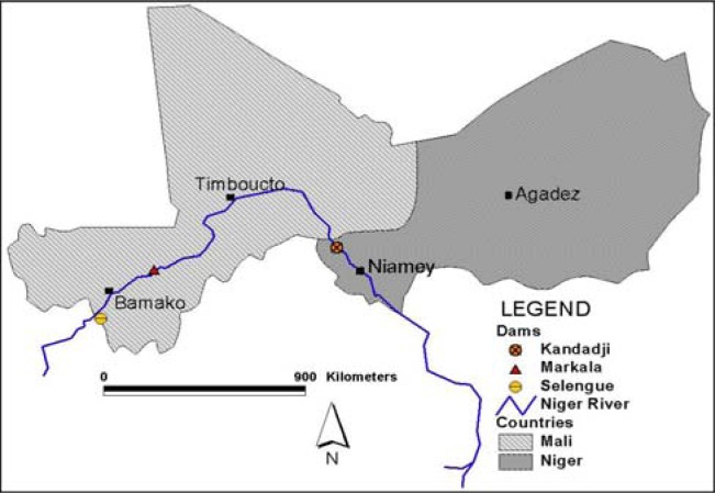
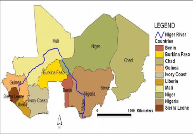
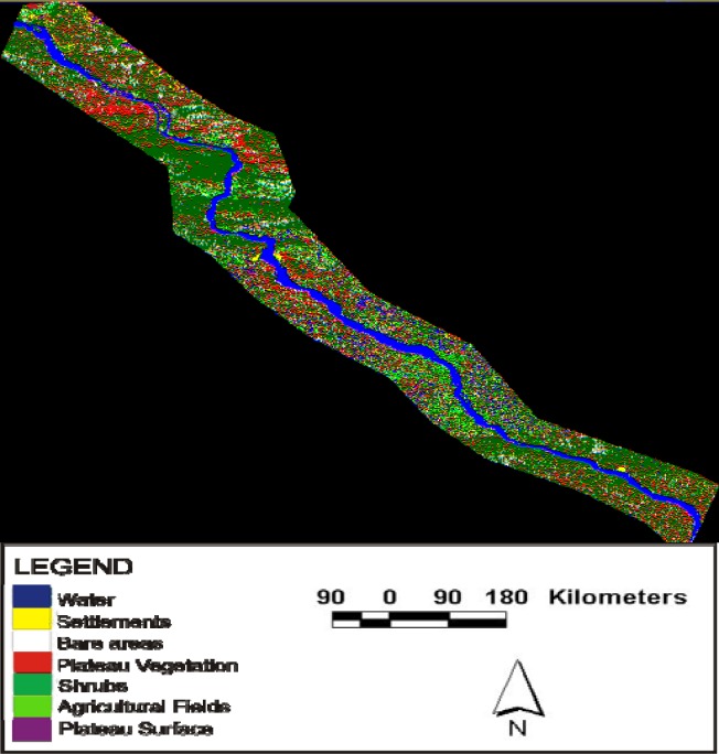
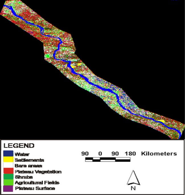
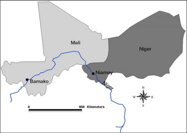
In the Sub-Saharan African region of the River Niger Basin, where none of the major rivers is fully contained within the borders of a single nation, riverine ecosystem health monitoring is essential for survival. Even the globally proclaimed goals of sustainability and environmental security in the region are unattainable without using geospatial technologies of remote sensing and Geographic Information Systems (GIS) as conduits for environmental health within shared waters. Yet the systematic study of the nature of cooperation between states over shared water resources in troubled areas of the Middle East continues to dominate the literature with minimal coverage of the Sub- Saharan Africa experience and the role of GIS and remote sensing in monitoring the problem. Considering the intense ecosystem stress inflicted on River Niger by human activities and natural forces emanating from upstream and downstream nations. Researching the growing potential for acute riverine ecosystem decline among the nations of Niger and Mali along the River Niger Basin with the latest advances in spatial information technology as a decision support tool not only helps in ecosystem recovery and the avoidance of conflicts, but it has the potentials to bring countries much closer through information exchange. While the nature of the problem remains compounded due to the depletion of available water resources and environmental resources within shared waters, the lack of information exchange extracts ecological costs from all players. This is essential as the Niger Basin nations move towards a multinational watershed management as a conduit for sustainability. To confront these problems, some research questions with relevance to the paper have been posed. The questions include, Have there been any declines in the riverine ecosystem of the study area? What are the effects and what factors trigger the changes? What mitigation measures are in place for dealing with the problems? The first objective of the paper is to develop a new framework for analyzing the health of riverine ecosystems while the second objective seeks a contribution to the literature. The third objective is to design a geo-spatial tool for riverine ecosystem management and impact analysis. The fourth objective is to measure the nature of change in riverine environments with the latest advances in geo-spatial information technologies and methods. In terms of methodology, the paper relies on primary data sources analyzed with descriptive statistics, GIS techniques and remote sensing. The sections in the paper consist of a review of the major environmental effects and factors associated with the problem as well as mitigation measures in Mali and Niger. The paper concludes with some recommendations. The results point to growing modification along the riverine environments of the Mali and Niger portions of the River Niger Basin due to a host of factors.
在撒哈拉以南非洲地区的尼日尔河流域,该地区主要河流没有一条完全处于单一国家境内,因此对河流生态系统健康状况进行监测对生存至关重要。若不利用遥感和地理信息系统(GIS)等地理空间技术作为共享水域环境健康状况的信息渠道,即便该地区在全球所宣称的可持续发展和环境安全目标也无法实现。然而,关于中东动荡地区各国在共享水资源方面合作性质的系统性研究仍在文献中占据主导地位,而对撒哈拉以南非洲地区的经验以及GIS和遥感在监测该问题中的作用却极少涉及。考虑到上游和下游国家的人类活动及自然力量给尼日尔河带来的巨大生态系统压力。随着空间信息技术的最新进展作为决策支持工具,研究尼日尔河流域的尼日利亚和马里两国河流生态系统急剧衰退的可能性不断增加,这不仅有助于生态系统恢复和避免冲突,还可能通过信息交流使各国关系更加紧密。尽管由于共享水域内可用水资源和环境资源的枯竭,问题的性质依然复杂,但信息交流的匮乏使所有相关方都付出了生态代价。这对于尼日尔河流域各国朝着跨国流域管理以实现可持续发展的方向发展至关重要。为应对这些问题,本文提出了一些相关的研究问题。这些问题包括:研究区域内的河流生态系统是否出现衰退?有哪些影响以及哪些因素引发了这些变化?针对这些问题采取了哪些缓解措施?本文的首要目标是构建一个分析河流生态系统健康状况的新框架,第二个目标是为相关文献做出贡献。第三个目标是设计一个用于河流生态系统管理和影响分析的地理空间工具。第四个目标是利用地理空间信息技术和方法的最新进展来衡量河流环境变化的性质。在方法论方面,本文依赖于通过描述性统计、GIS技术和遥感分析的原始数据来源。本文各部分包括对与该问题相关的主要环境影响、因素以及马里和尼日尔的缓解措施的综述。本文最后给出了一些建议。结果表明,由于多种因素,尼日尔河流域马里和尼日尔部分的河流环境变化日益明显。