Bodart Catherine, Brink Andreas B, Donnay François, Lupi Andrea, Mayaux Philippe, Achard Frédéric
Joint Research Centre of the European Commission, Institute for Environment and Sustainability Ispra, Italy.
J Biogeogr. 2013 Jun;40(6):1036-1047. doi: 10.1111/jbi.12084.
This study provides regional estimates of forest cover in dry African ecoregions and the changes in forest cover that occurred there between 1990 and 2000, using a systematic sample of medium-resolution satellite imagery which was processed consistently across the continent.
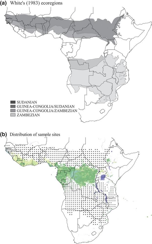
The study area corresponds to the dry forests and woodlands of Africa between the humid forests and the semi-arid regions. This area covers the Sudanian and Zambezian ecoregions.
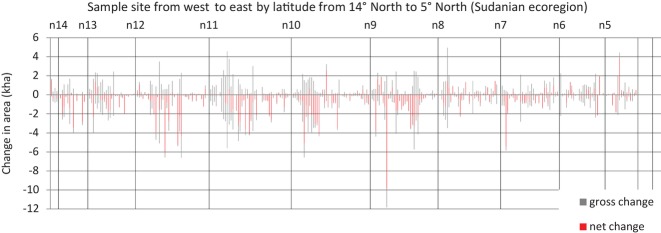
A systematic sample of 1600 Landsat satellite imagery subsets, each 20 km × 20 km in size, were analysed for two reference years: 1990 and 2000. At each sample site and for both years, dense tree cover, open tree cover, other wooded land and other vegetation cover were identified from the analysis of satellite imagery, which comprised multidate segmentation and automatic classification steps followed by visual control by national forestry experts.
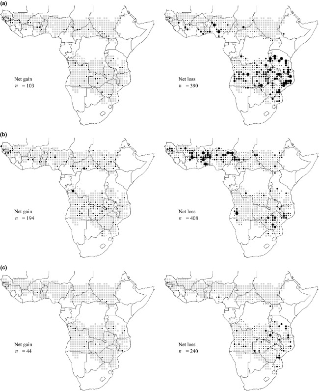
Land cover and land-cover changes were estimated at continental and ecoregion scales and compared with existing pan-continental, regional and local studies. The overall accuracy of our land-cover maps was estimated at 87%. Between 1990 and 2000, 3.3 million hectares (Mha) of dense tree cover, 5.8 Mha of open tree cover and 8.9 Mha of other wooded land were lost, with a further 3.9 Mha degraded from dense to open tree cover. These results are substantially lower than the 34 Mha of forest loss reported in the FAO's 2010 Global Forest Resources Assessment for the same period and area.
Our method generates the first consistent and robust estimates of forest cover and change in dry Africa with known statistical precision at continental and ecoregion scales. These results reduce the uncertainty regarding vegetation cover and its dynamics in these previously poorly studied ecosystems and provide crucial information for both science and environmental policies.
本研究利用在整个非洲大陆统一处理的中等分辨率卫星图像系统样本,对非洲干旱生态区的森林覆盖情况以及1990年至2000年间该地区森林覆盖的变化进行区域估计。
研究区域对应于非洲湿润森林和半干旱地区之间的干旱森林和林地。该区域涵盖苏丹和赞比西生态区。
对1600个陆地卫星图像子集(每个大小为20千米×20千米)进行系统抽样,分析了两个参考年份:1990年和2000年。在每个样本点以及这两个年份,通过对卫星图像的分析来识别茂密树木覆盖、开阔树木覆盖、其他林地和其他植被覆盖,分析包括多日期分割和自动分类步骤,随后由国家林业专家进行目视检查。
在大陆和生态区尺度上估计了土地覆盖和土地覆盖变化,并与现有的泛大陆、区域和地方研究进行了比较。我们土地覆盖图的总体精度估计为87%。1990年至2000年间,330万公顷的茂密树木覆盖、580万公顷的开阔树木覆盖和890万公顷的其他林地消失,另有390万公顷从茂密树木覆盖退化到开阔树木覆盖。这些结果大大低于粮农组织《2010年全球森林资源评估》报告的同期和同一地区3400万公顷的森林损失。
我们的方法在大陆和生态区尺度上首次以已知的统计精度对非洲干旱地区的森林覆盖和变化进行了一致且可靠的估计。这些结果减少了这些此前研究不足的生态系统中植被覆盖及其动态的不确定性,并为科学和环境政策提供了关键信息。