Wang Yan, Song Baoyan, Wang Junlu, Zhang Li, Wang Ling
School of Information, Liaoning University, Shenyang 110036, China.
School of Information Science and Engineering, Northeastern University, Shenyang 110819, China.
Sensors (Basel). 2016 Mar 29;16(4):454. doi: 10.3390/s16040454.
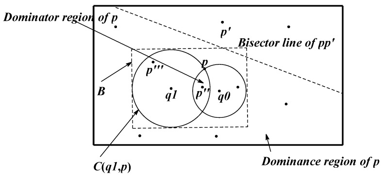
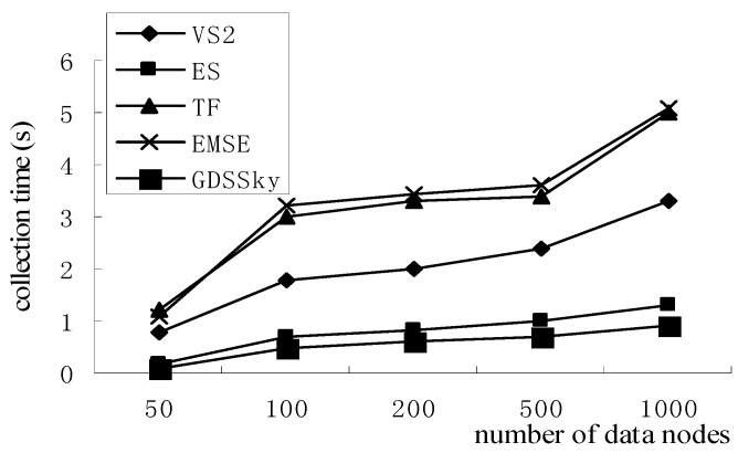
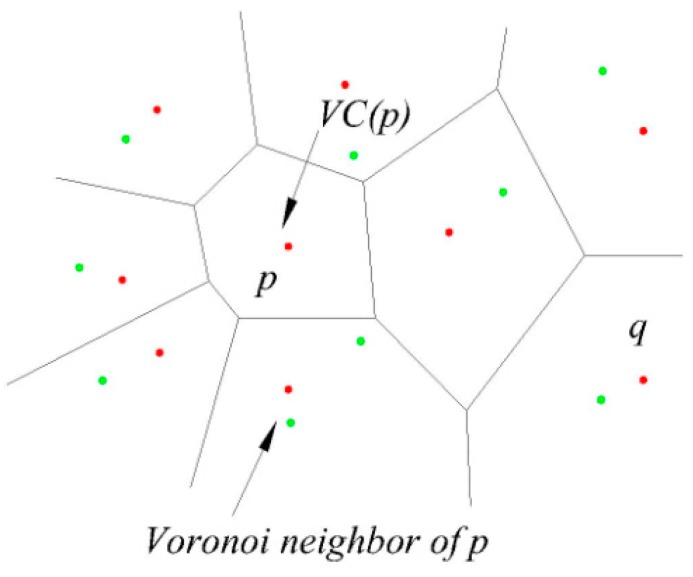
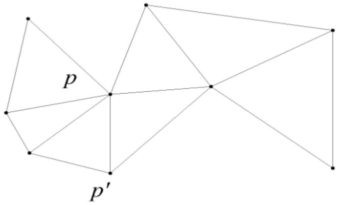
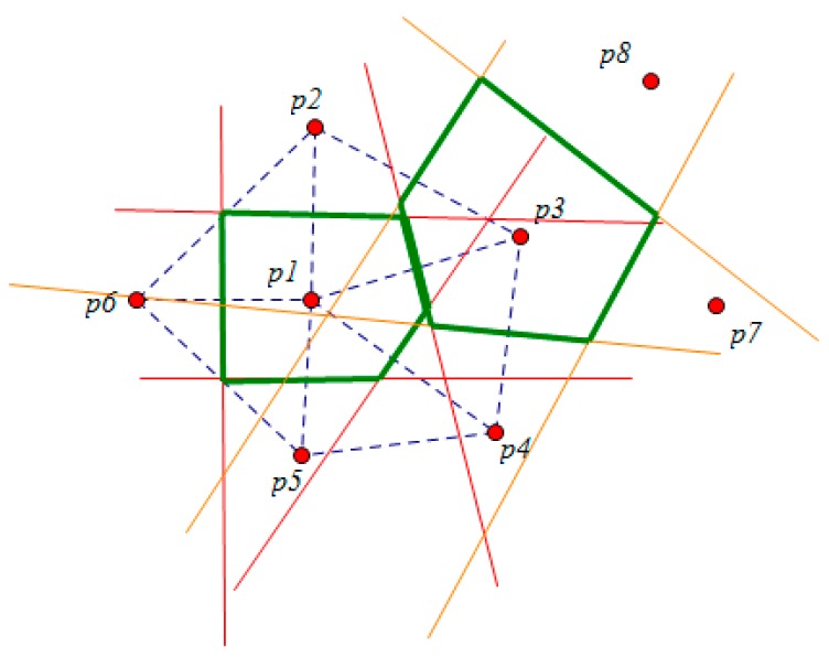
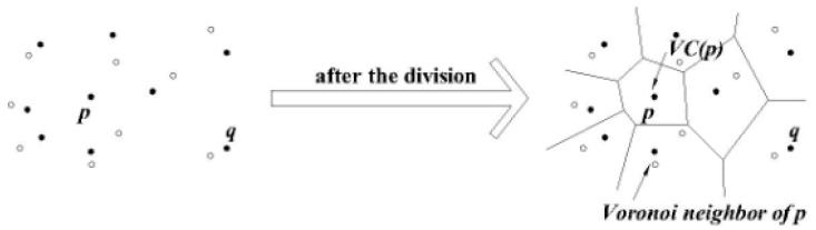
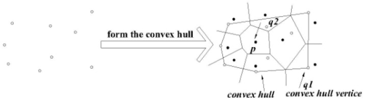
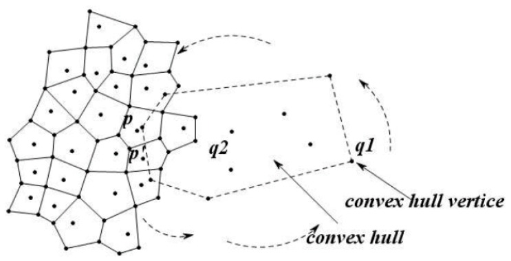
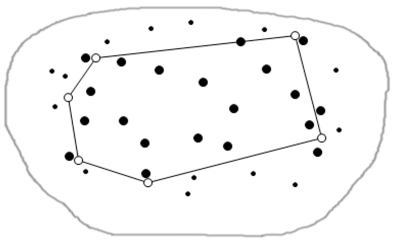
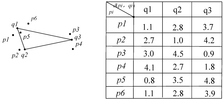
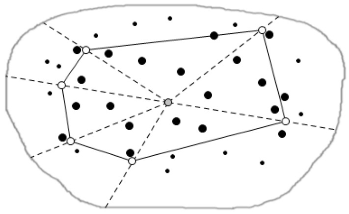
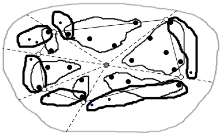
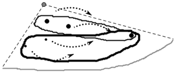
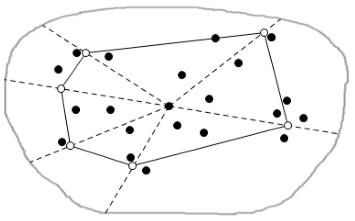
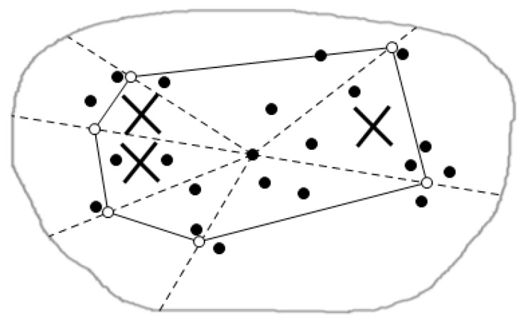
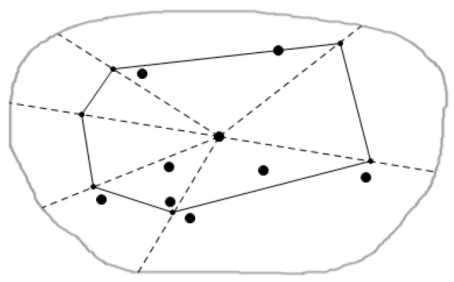
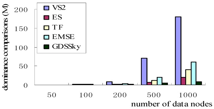
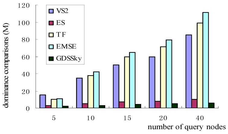
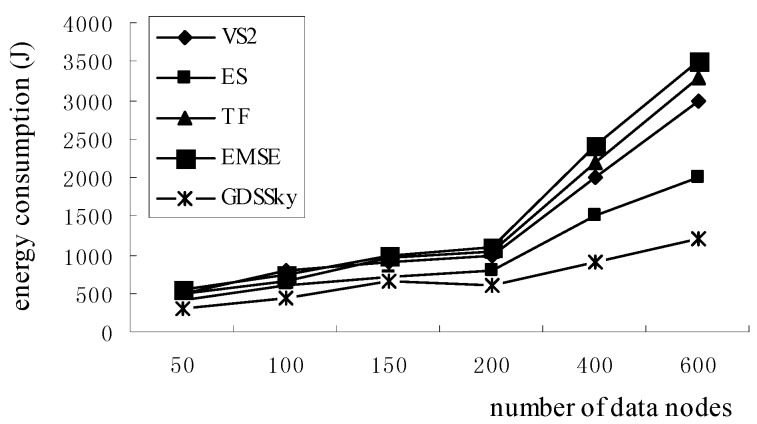
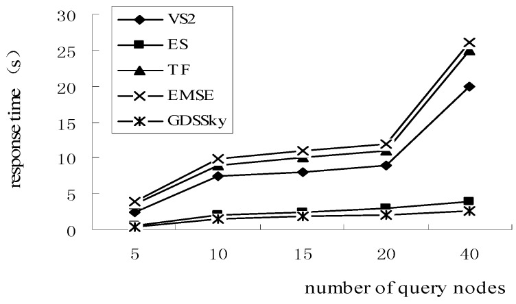
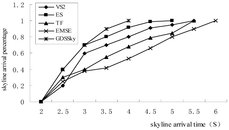
Algorithms for skyline querying based on wireless sensor networks (WSNs) have been widely used in the field of environmental monitoring. Because of the multi-dimensional nature of the problem of monitoring spatial position, traditional skyline query strategies cause enormous computational costs and energy consumption. To ensure the efficient use of sensor energy, a geometry-based distributed spatial query strategy (GDSSky) is proposed in this paper. Firstly, the paper presents a geometry-based region partition strategy. It uses the skyline area reduction method based on the convex hull vertices, to quickly query the spatial skyline data related to a specific query area, and proposes a regional partition strategy based on the triangulation method, to implement distributed queries in each sub-region and reduce the comparison times between nodes. Secondly, a sub-region clustering strategy is designed to group the data inside into clusters for parallel queries that can save time. Finally, the paper presents a distributed query strategy based on the data node tree to traverse all adjacent sensors' monitoring locations. It conducts spatial skyline queries for spatial skyline data that have been obtained and not found respectively, so as to realize the parallel queries. A large number of simulation results shows that GDSSky can quickly return the places which are nearer to query locations and have larger pollution capacity, and significantly reduce the WSN energy consumption.
基于无线传感器网络(WSN)的天际线查询算法已在环境监测领域得到广泛应用。由于监测空间位置问题具有多维度性质,传统的天际线查询策略会导致巨大的计算成本和能量消耗。为确保传感器能量的高效利用,本文提出了一种基于几何的分布式空间查询策略(GDSSky)。首先,本文提出了一种基于几何的区域划分策略。它使用基于凸包顶点的天际线区域缩减方法,快速查询与特定查询区域相关的空间天际线数据,并提出了一种基于三角剖分法的区域划分策略,以在每个子区域中实现分布式查询并减少节点间的比较次数。其次,设计了一种子区域聚类策略,将内部数据分组进行并行查询,从而节省时间。最后,本文提出了一种基于数据节点树的分布式查询策略,遍历所有相邻传感器的监测位置。它对已获取和未找到的空间天际线数据分别进行空间天际线查询,以实现并行查询。大量仿真结果表明,GDSSky能够快速返回离查询位置更近且污染容量更大的地点,并显著降低无线传感器网络的能量消耗。