Daryabor Farshid, Ooi See Hai, Samah Azizan Abu, Akbari Abolghasem
National Antarctic Research Center, Institute of Postgraduate Studies, University of Malaya, 50603, Kuala Lumpur, Malaysia.
Institute of Ocean and Earth Sciences, Institute of Postgraduate Studies, University of Malaya, 50603, Kuala Lumpur, Malaysia.
PLoS One. 2016 Jul 13;11(7):e0158415. doi: 10.1371/journal.pone.0158415. eCollection 2016.
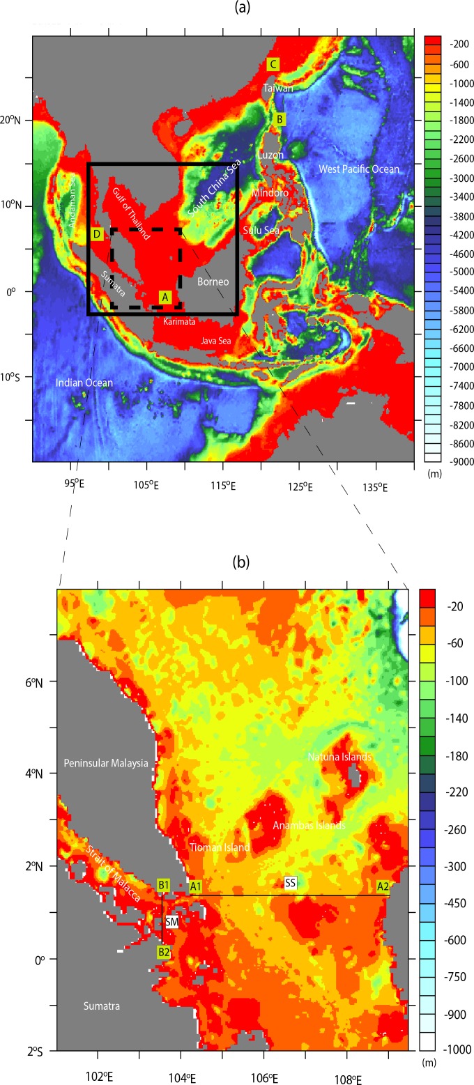
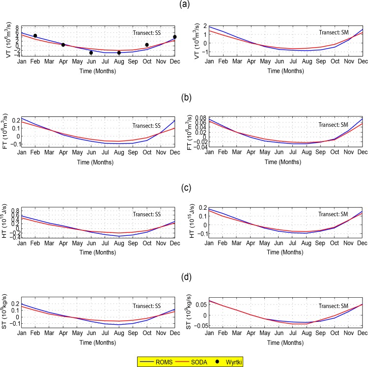
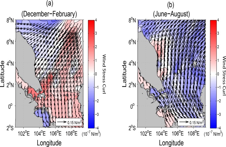
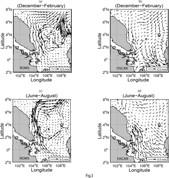
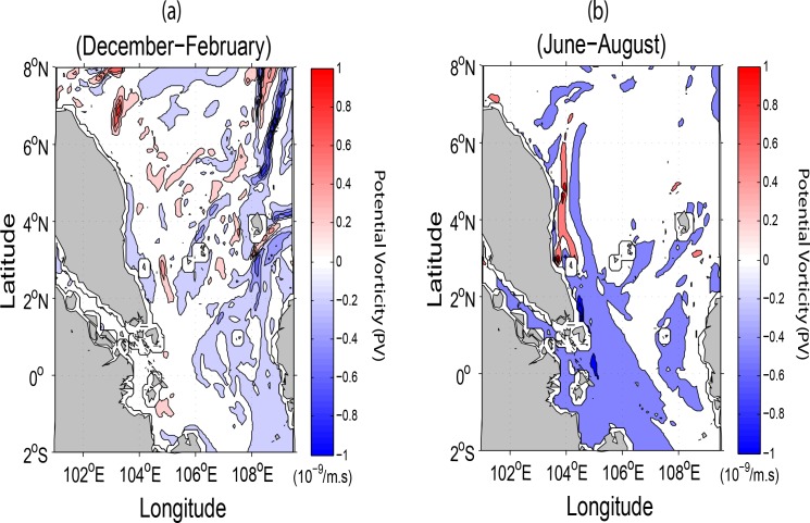
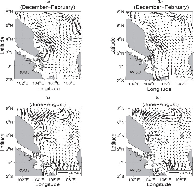
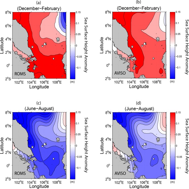
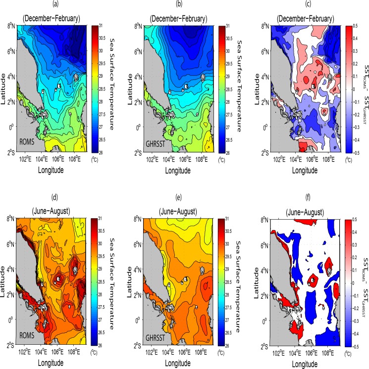
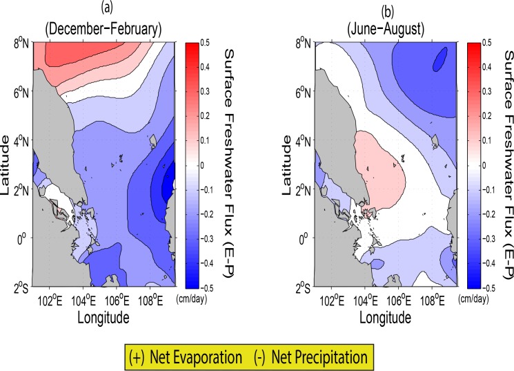
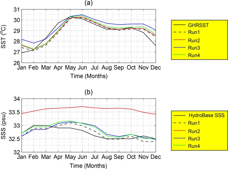
A three-dimensional Regional Ocean Modeling System is used to study the seasonal water circulations and transports of the Southern South China Sea. The simulated seasonal water circulations and estimated transports show consistency with observations, e.g., satellite altimeter data set and re-analysis data of the Simple Ocean Data Assimilation. It is found that the seasonal water circulations are mainly driven by the monsoonal wind stress and influenced by the water outflow/inflow and associated currents of the entire South China Sea. The intrusion of the strong current along the East Coast of Peninsular Malaysia and the eddies at different depths in all seasons are due to the conservation of the potential vorticity as the depth increases. Results show that the water circulation patterns in the northern part of the East Coast of Peninsular Malaysia are generally dominated by the geostrophic currents while those in the southern areas are due solely to the wind stress because of negligible Coriolis force there. This study clearly shows that individual surface freshwater flux (evaporation minus precipitation) controls the sea salinity balance in the Southern South China Sea thermohaline circulations. Analysis of climatological data from a high resolution Regional Ocean Modeling System reveals that the complex bathymetry is important not only for water exchange through the Southern South China Sea but also in regulating various transports across the main passages in the Southern South China Sea, namely the Sunda Shelf and the Strait of Malacca. Apart from the above, in comparision with the dynamics of the Sunda Shelf, the Strait of Malacca reflects an equally significant role in the annual transports into the Andaman Sea.
利用三维区域海洋模型系统研究南海南部的季节性水体环流和输运。模拟的季节性水体环流和估算的输运与观测结果一致,例如卫星高度计数据集和简单海洋数据同化的再分析数据。研究发现,季节性水体环流主要由季风风应力驱动,并受整个南海的水体流出/流入及相关海流影响。沿马来西亚半岛东海岸的强流入侵以及各季节不同深度的涡旋是由于深度增加时位涡守恒所致。结果表明,马来西亚半岛东海岸北部的水体环流模式一般受地转流主导,而南部地区则仅受风应力影响,因为那里的科里奥利力可忽略不计。这项研究清楚地表明,单个表面淡水通量(蒸发减去降水)控制着南海南部热比容环流中的海表盐度平衡。对高分辨率区域海洋模型系统的气候数据进行分析后发现,复杂的地形不仅对南海南部的水体交换很重要,而且在调节南海南部主要通道(即巽他陆架和马六甲海峡)的各种输运方面也很重要。除此之外,与巽他陆架的动力学相比马六甲海峡在每年流入安达曼海的输运中也发挥着同样重要的作用。