British Antarctic Survey, Natural Environment Research Council, High Cross, Madingley Road, Cambridge, CB3 OET, U.K.
National Oceanography Centre, University of Southampton Waterfront Campus, European Way, Southampton SO14 3ZH, Southampton, U.K.
Sci Rep. 2016 Oct 3;6:33163. doi: 10.1038/srep33163.
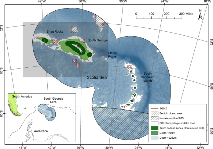
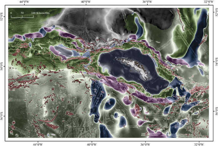
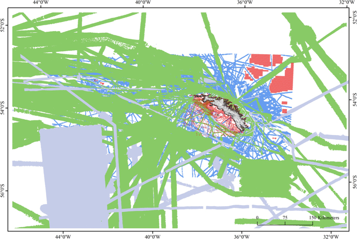
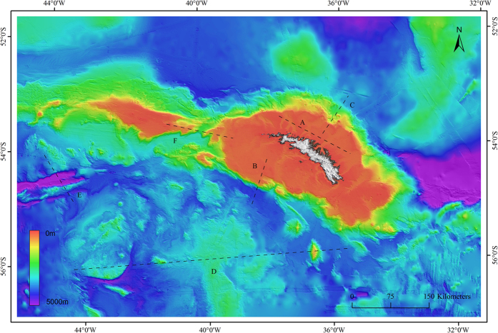
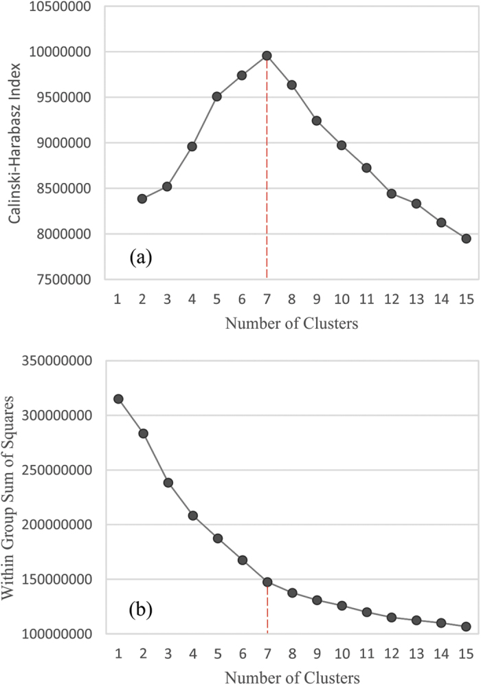
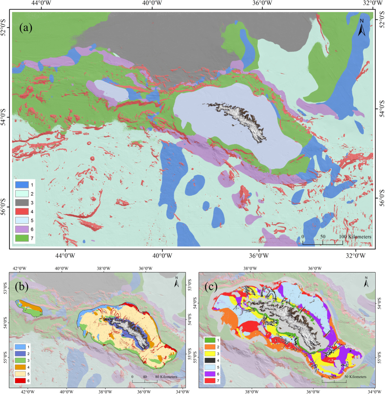
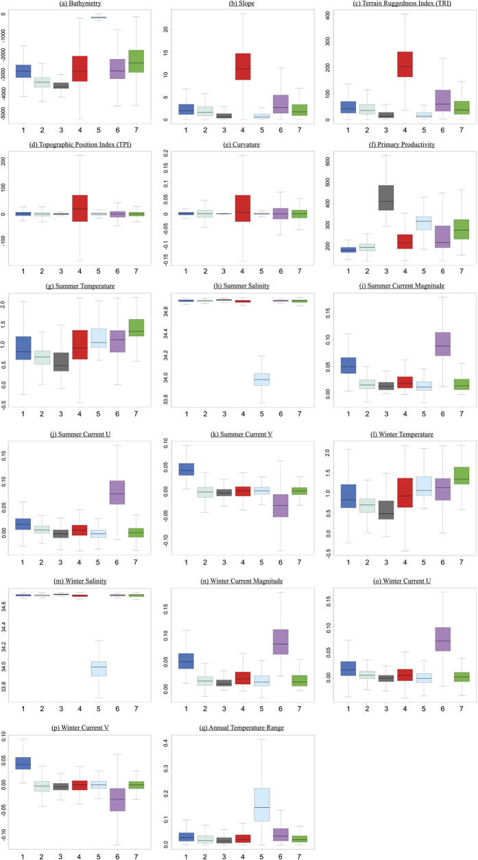
Global biodiversity is in decline, with the marine environment experiencing significant and increasing anthropogenic pressures. In response marine protected areas (MPAs) have increasingly been adopted as the flagship approach to marine conservation, many covering enormous areas. At present, however, the lack of biological sampling makes prioritising which regions of the ocean to protect, especially over large spatial scales, particularly problematic. Here we present an interdisciplinary approach to marine landscape mapping at the sub-Antarctic island of South Georgia as an effective protocol for underpinning large-scale (10-10 km) MPA designations. We have developed a new high-resolution (100 m) digital elevation model (DEM) of the region and integrated this DEM with bathymetry-derived parameters, modelled oceanographic data, and satellite primary productivity data. These interdisciplinary datasets were used to apply an objective statistical approach to hierarchically partition and map the benthic environment into physical habitats types. We assess the potential application of physical habitat classifications as proxies for biological structuring and the application of the landscape mapping for informing on marine spatial planning.
全球生物多样性正在减少,海洋环境承受着越来越大的人为压力。作为海洋保护的旗舰方法,海洋保护区(MPA)越来越多地被采用,其中许多保护区的面积非常大。然而,目前缺乏生物采样,使得确定保护海洋区域的优先级变得特别困难,特别是在大的空间尺度上。在这里,我们以南乔治亚岛的亚南极岛屿为例,提出了一种跨学科的海洋景观制图方法,作为支持大规模(10-10 公里)MPA 设计的有效协议。我们已经开发了该地区的新的高分辨率(100 米)数字高程模型(DEM),并将该 DEM 与地形衍生参数、建模海洋学数据和卫星初级生产力数据集成在一起。这些跨学科数据集被用于应用客观的统计方法,将海底环境分层并映射成物理生境类型。我们评估了物理生境分类作为生物结构代理的潜在应用,以及景观制图在海洋空间规划中的应用。