British Antarctic Survey, Natural Environmental Research Council, Cambridge, United Kingdom.
PLoS One. 2011;6(5):e19795. doi: 10.1371/journal.pone.0019795. Epub 2011 May 25.
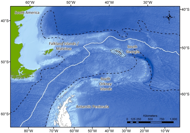
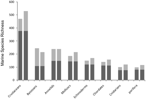
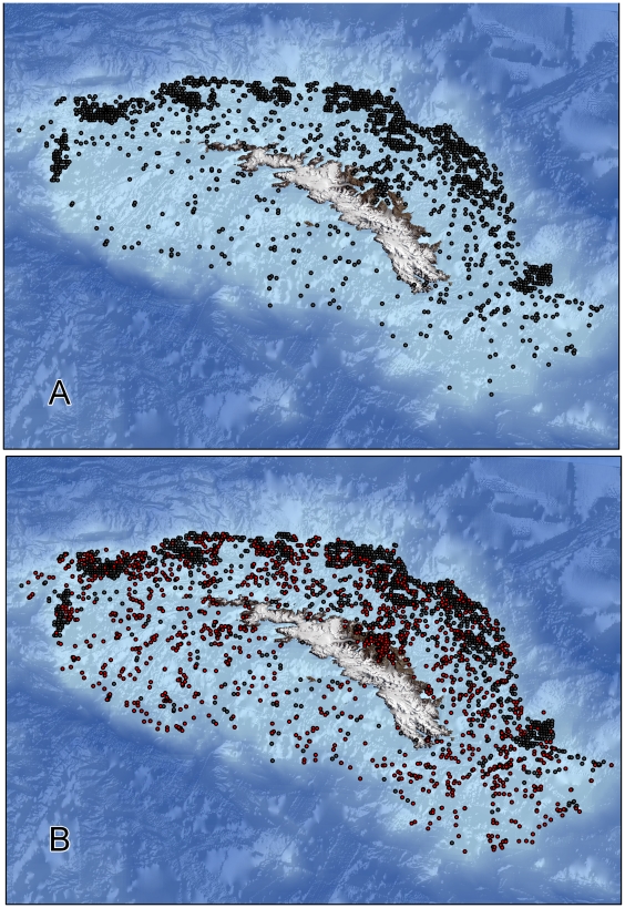
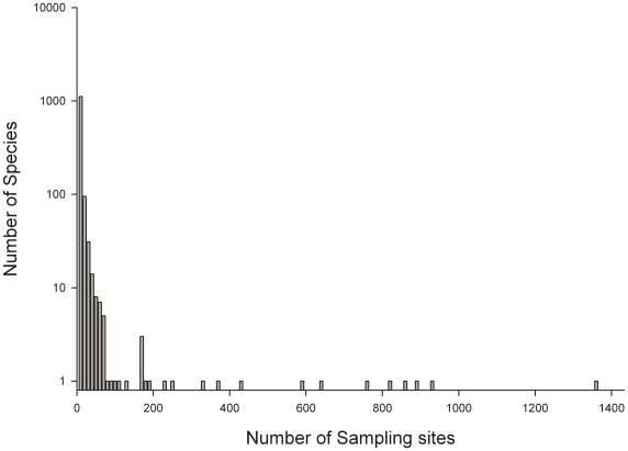
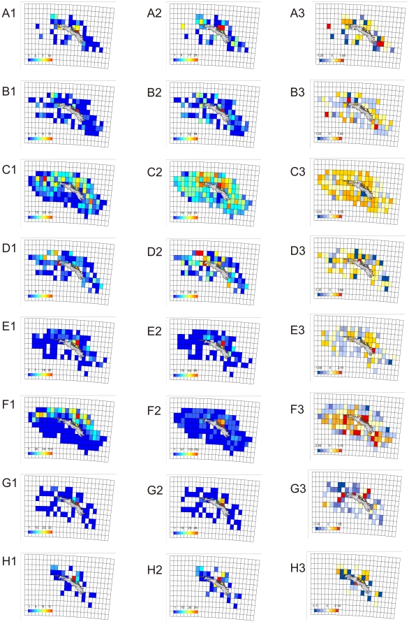
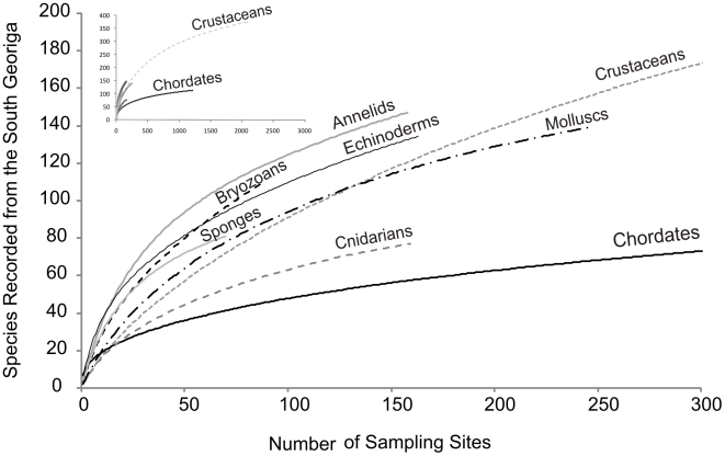
We attempt to quantify how significant the polar archipelago of South Georgia is as a source of regional and global marine biodiversity. We evaluate numbers of rare, endemic and range-edge species and how the faunal structure of South Georgia may respond to some of the fastest warming waters on the planet. Biodiversity data was collated from a comprehensive review of reports, papers and databases, collectively representing over 125 years of polar exploration. Classification of each specimen was recorded to species level and fully geo-referenced by depth, latitude and longitude. This information was integrated with physical data layers (e.g. temperature, salinity and flow) providing a visualisation of South Georgia's biogeography across spatial, temporal and taxonomic scales, placing it in the wider context of the Southern Hemisphere. This study marks the first attempt to map the biogeography of an archipelago south of the Polar Front. Through it we identify the South Georgian shelf as the most speciose region of the Southern Ocean recorded to date. Marine biodiversity was recorded as rich across taxonomic levels with 17,732 records yielding 1,445 species from 436 families, 51 classes and 22 phyla. Most species recorded were rare, with 35% recorded only once and 86% recorded <10 times. Its marine fauna is marked by the cumulative dominance of endemic and range-edge species, potentially at their thermal tolerance limits. Consequently, our data suggests the ecological implications of environmental change to the South Georgian marine ecosystem could be severe. If sea temperatures continue to rise, we suggest that changes will include depth profile shifts of some fauna towards cooler Antarctic Winter Water (90-150 m), the loss of some range-edge species from regional waters, and the wholesale extinction at a global scale of some of South Georgia's endemic species.
我们试图量化南乔治亚的极地群岛作为区域和全球海洋生物多样性的来源有多重要。我们评估了稀有、特有和边缘分布物种的数量,以及南乔治亚的动物群结构可能如何应对地球上变暖最快的一些水域。通过对报告、论文和数据库的全面回顾,收集了生物多样性数据,这些数据总计代表了 125 多年的极地探索。对每个标本的分类记录到种的水平,并通过深度、纬度和经度进行了全面的地理参考。这些信息与物理数据层(例如温度、盐度和流量)相结合,提供了南乔治亚生物地理学在空间、时间和分类学尺度上的可视化,将其置于南半球的更广泛背景下。这项研究标志着首次尝试绘制南极锋以南群岛的生物地理学。通过它,我们确定南乔治亚大陆架是迄今为止记录到的南大洋生物多样性最丰富的区域。海洋生物多样性在分类水平上非常丰富,有 17732 条记录,记录了来自 436 个科、51 个纲和 22 个门的 1445 种物种。记录的大多数物种都是稀有物种,其中 35%的物种仅记录过一次,86%的物种记录不到 10 次。其海洋动物群的特点是特有种和边缘分布种的累积优势,可能达到它们的热耐受极限。因此,我们的数据表明,环境变化对南乔治亚海洋生态系统的生态影响可能是严重的。如果海水温度继续上升,我们建议,一些动物群的深度分布变化将包括向更冷的南极冬季水(90-150 米)移动,一些边缘分布物种将从区域水域消失,以及南乔治亚一些特有物种在全球范围内的整体灭绝。