Snyder Keirith A, Wehan Bryce L, Filippa Gianluca, Huntington Justin L, Stringham Tamzen K, Snyder Devon K
USDA-ARS, Great Basin Rangelands Research Unit, Reno, NV 89512, USA.
Environmental Protection Agency of Aosta Valley, ARPA Valle d'Aosta, Climate Change Unit, Saint-christophe 11020, Italy.
Sensors (Basel). 2016 Nov 18;16(11):1948. doi: 10.3390/s16111948.
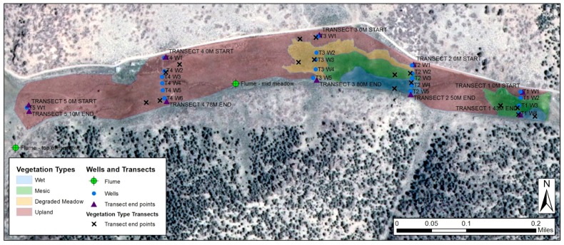
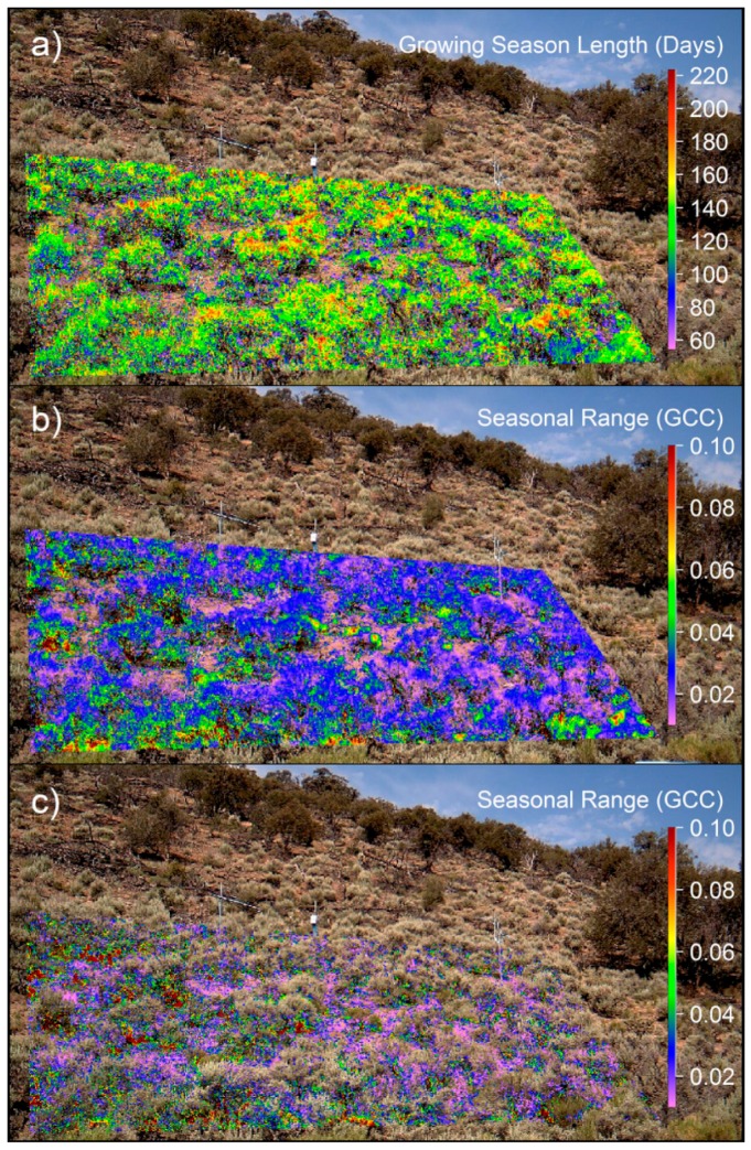
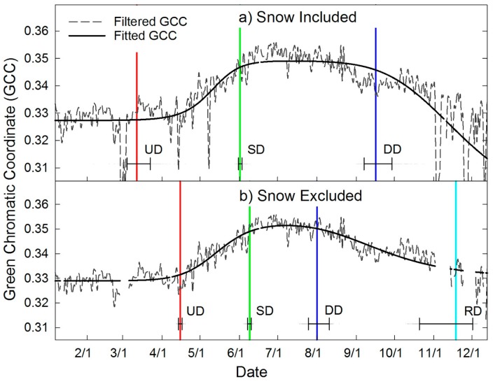
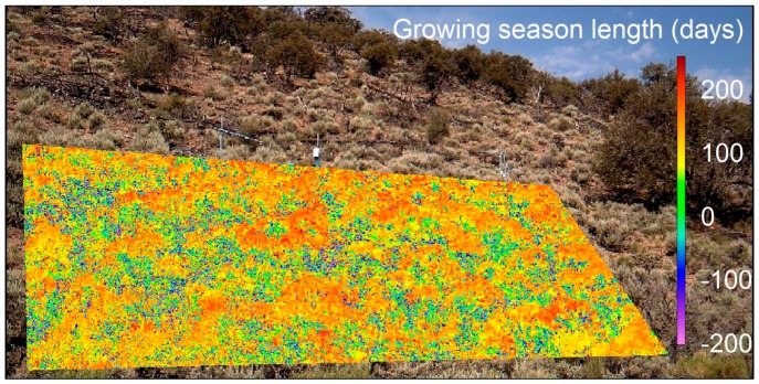
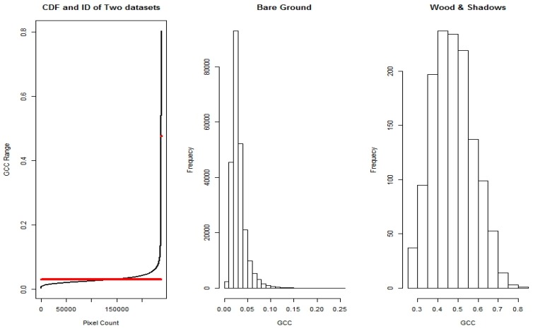
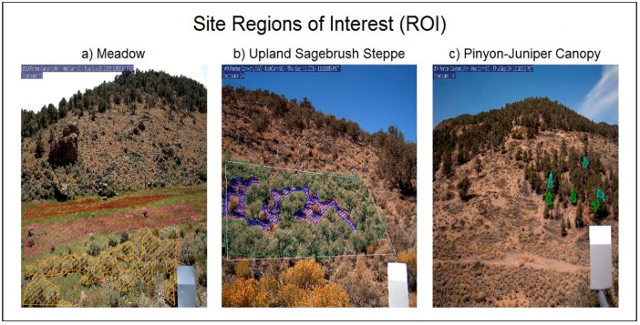
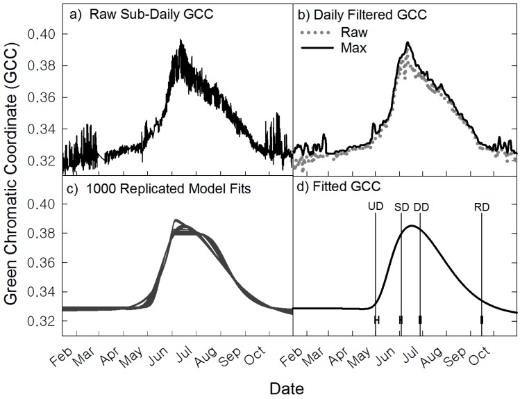
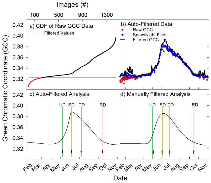
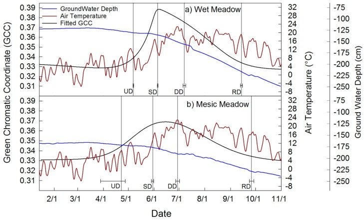
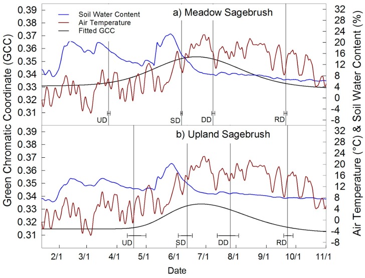
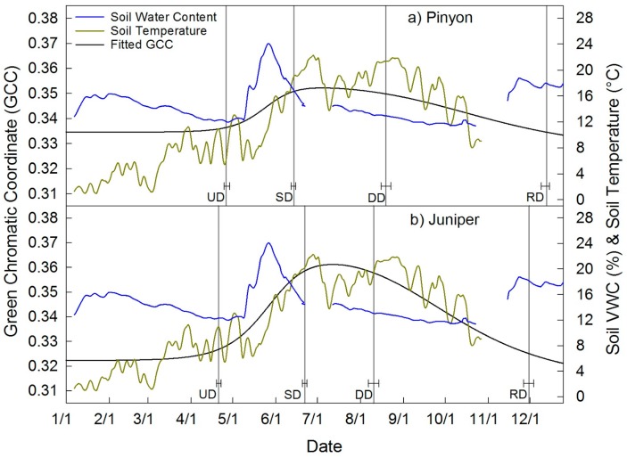
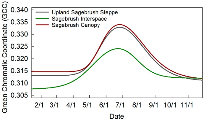
Plant phenology is recognized as important for ecological dynamics. There has been a recent advent of phenology and camera networks worldwide. The established PhenoCam Network has sites in the United States, including the western states. However, there is a paucity of published research from semi-arid regions. In this study, we demonstrate the utility of camera-based repeat digital imagery and use of R statistical package to quantify plant phenology and phenophases in four plant communities in the semi-arid cold desert region of the Great Basin. We developed an automated variable snow/night filter for removing ephemeral snow events, which allowed fitting of phenophases with a double logistic algorithm. We were able to detect low amplitude seasonal variation in pinyon and juniper canopies and sagebrush steppe, and characterize wet and mesic meadows in area-averaged analyses. We used individual pixel-based spatial analyses to separate sagebrush shrub canopy pixels from interspace by determining differences in phenophases of sagebrush relative to interspace. The ability to monitor plant phenology with camera-based images fills spatial and temporal gaps in remotely sensed data and field based surveys, allowing species level relationships between environmental variables and phenology to be developed on a fine time scale thus providing powerful new tools for land management.
植物物候学被认为对生态动态至关重要。近年来,全球范围内物候学和相机网络不断涌现。已建立的物候相机网络在美国设有站点,包括西部各州。然而,半干旱地区发表的研究较少。在本研究中,我们展示了基于相机的重复数字图像的效用,以及使用R统计软件包来量化大盆地半干旱寒冷沙漠地区四个植物群落的植物物候和物候阶段。我们开发了一种自动可变雪/夜过滤器,用于去除短暂的降雪事件,这使得能够用双逻辑算法拟合物候阶段。我们能够检测到矮松和杜松树冠以及蒿属草原的低幅度季节性变化,并在区域平均分析中表征湿润和中生草甸。我们使用基于单个像素的空间分析,通过确定蒿属灌木相对于间隙的物候阶段差异,将蒿属灌木树冠像素与间隙分开。利用基于相机的图像监测植物物候的能力填补了遥感数据和实地调查中的时空空白,使得能够在精细的时间尺度上建立环境变量与物候之间的物种水平关系,从而为土地管理提供强大的新工具。