Kim Jin-Woo, Lu Zhong
Roy M. Huffington Dept. of Earth Sciences, Southern Methodist University, Dallas, Texas, USA.
Sci Rep. 2018 Mar 16;8(1):4727. doi: 10.1038/s41598-018-23143-6.
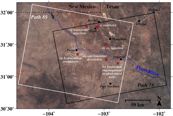
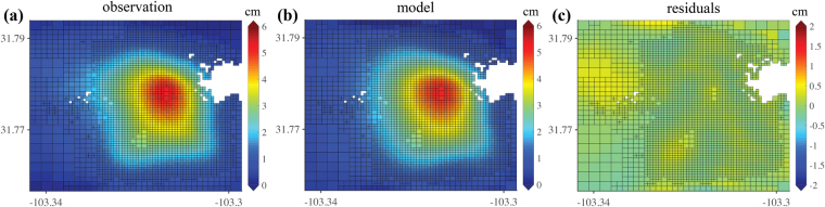
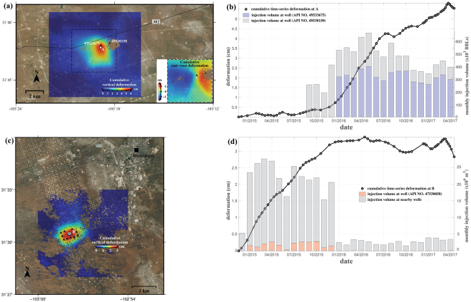
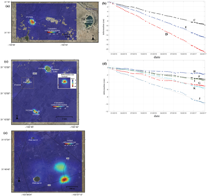
West Texas' Permian Basin, consisting of ancient marine rocks, is underlain by water-soluble rocks and multiple oil-rich formations. In the region that is densely populated with oil producing facilities, many localized geohazards, such as ground subsidence and micro-earthquakes, have gone unnoticed. Here we identify the localized geohazards in West Texas, using the satellite radar interferometry from newly launched radar satellites that provide radar images freely to public for the first time, and probe the causal mechanisms of ground deformation, encompassing oil/gas production activities and subsurface geological characteristics. Based on our observations and analyses, human activities of fluid (saltwater, CO) injection for stimulation of hydrocarbon production, salt dissolution in abandoned oil facilities, and hydrocarbon extraction each have negative impacts on the ground surface and infrastructures, including possible induced seismicity. Proactive continuous and detailed monitoring of ground deformation from space over the currently operating and the previously operated oil/gas production facilities, as demonstrated by this research, is essential to securing the safety of humanity, preserving property, and sustaining the growth of the hydrocarbon production industry.
美国得克萨斯州西部的二叠纪盆地由古老的海相岩石组成,其下伏有可溶性岩石和多个富含石油的地层。在石油生产设施密集的地区,许多局部地质灾害,如地面沉降和微地震,一直未被察觉。在此,我们利用新发射的雷达卫星的卫星雷达干涉测量技术来识别得克萨斯州西部的局部地质灾害,这些雷达卫星首次向公众免费提供雷达图像,并探究地面变形的因果机制,包括石油/天然气生产活动和地下地质特征。基于我们的观测和分析,为刺激油气生产而进行的流体(盐水、二氧化碳)注入、废弃石油设施中的盐溶解以及油气开采等人类活动,均对地表和基础设施产生负面影响,包括可能引发的地震活动。正如本研究所表明的,对当前运营和以前运营的油气生产设施进行空间地面变形的主动持续和详细监测,对于保障人类安全、保护财产以及维持油气生产行业的发展至关重要。