Chew Clara, Reager John T, Small Eric
University Corporation for Atmospheric Research, Boulder, CO, USA.
Jet Propulsion Laboratory, California Institute of Technology, Pasadena, CA, USA.
Sci Rep. 2018 Jun 19;8(1):9336. doi: 10.1038/s41598-018-27673-x.
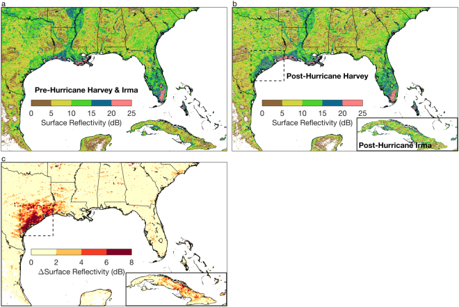
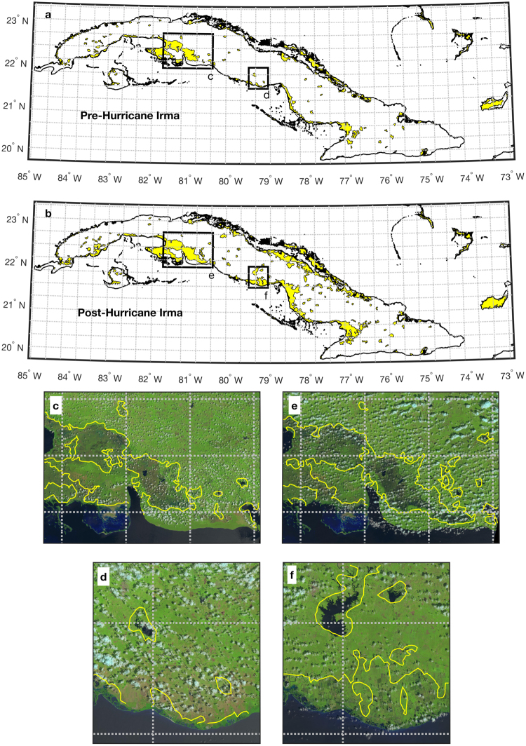
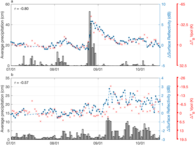
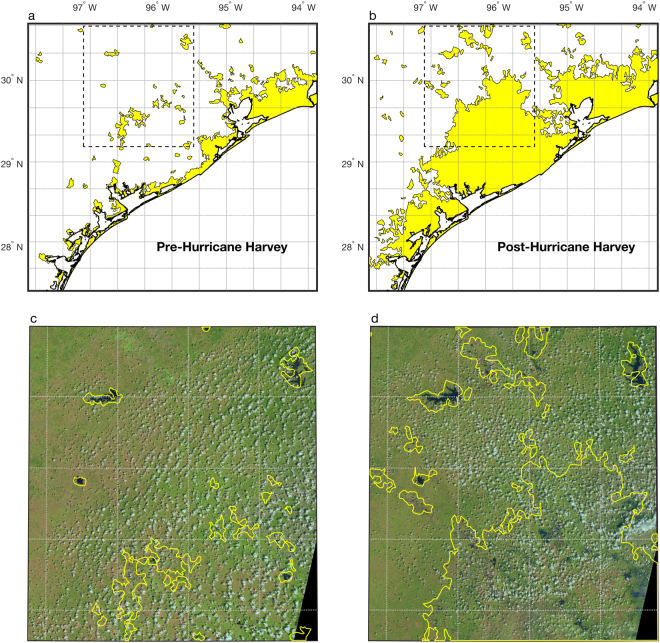
The 2017 Atlantic Hurricane Season was one of the most active and destructive on record, leading to significant flooding in many parts of the United States and the Caribbean. During flooding events such as these, there is an urgent need to quickly map in detail which areas have been severely affected, yet current satellite missions are not capable of sampling the global land surface at high enough spatio-temporal scales for flooding applications. Here, we demonstrate a novel approach to high-resolution flood mapping by repurposing data from the new NASA mission, CYGNSS. The CYGNSS multi-satellite constellation was designed for frequent temporal sampling of the ocean surface in the tropics. We demonstrate that CYGNSS data provide clear signals of surface saturation and inundation extent over land at higher spatio-temporal resolution than radiometers like SMAP. Using a simple thresholding technique, we are able to estimate that approximately 32,580 km of land area in Texas flooded during Hurricane Harvey, and approximately 7210 km of land area flooded in Cuba during Hurricane Irma, or about 7% of Cuba's total area.
2017年大西洋飓风季是有记录以来最为活跃且破坏严重的季节之一,在美国和加勒比地区的许多地方引发了严重洪灾。在诸如此类的洪水事件中,迫切需要快速详细绘制出哪些地区受到了严重影响,然而目前的卫星任务无法在足够高的时空尺度上对全球陆地表面进行采样以用于洪水应用。在此,我们展示了一种通过重新利用美国国家航空航天局(NASA)新任务CYGNSS的数据来进行高分辨率洪水测绘的新方法。CYGNSS多卫星星座旨在对热带地区的海洋表面进行频繁的时间采样。我们证明,与SMAP等辐射计相比,CYGNSS数据能以更高的时空分辨率提供陆地表面饱和度和淹没范围的清晰信号。使用一种简单的阈值技术,我们能够估计出在哈维飓风期间,得克萨斯州约32580平方公里的陆地面积被洪水淹没,在艾尔玛飓风期间,古巴约7210平方公里的陆地面积被洪水淹没,约占古巴总面积的7%。