State Key Laboratory of Resources and Environmental Information System, Institute of Geographic Sciences and Natural Resources Research, Chinese Academy of Sciences, Beijing 100101, China.
University of Chinese Academy of Sciences, Beijing 100049, China.
Int J Environ Res Public Health. 2018 Nov 5;15(11):2466. doi: 10.3390/ijerph15112466.
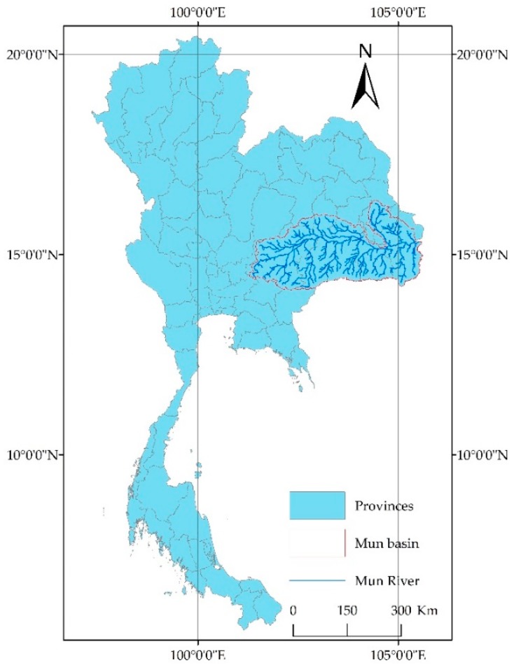
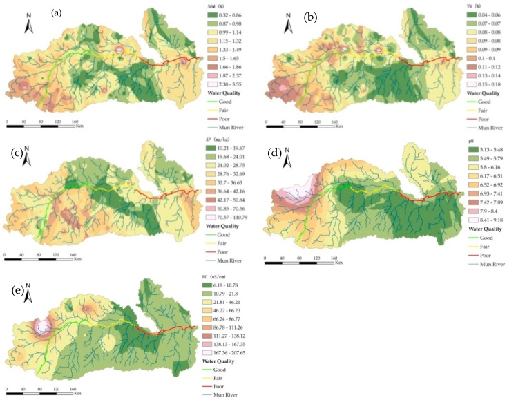
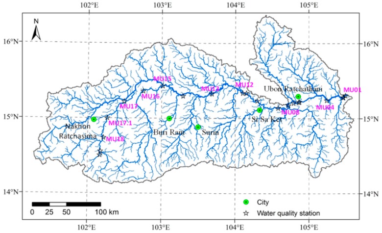
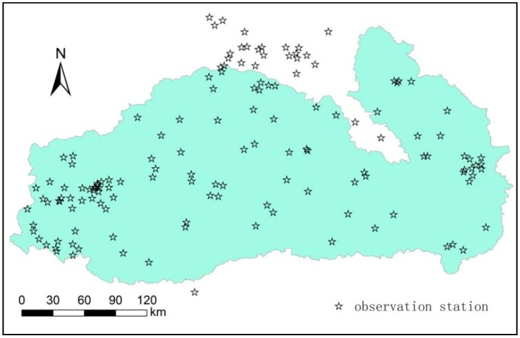
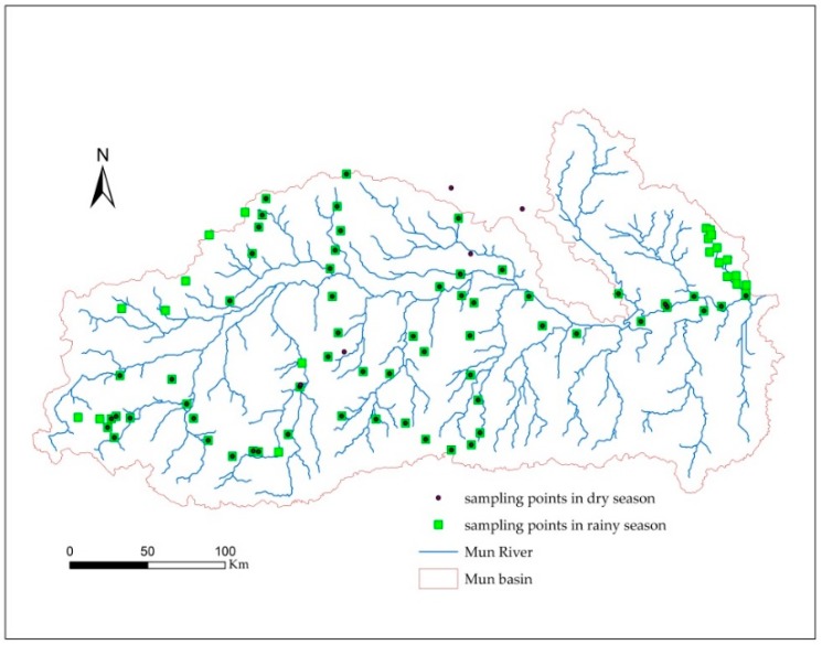
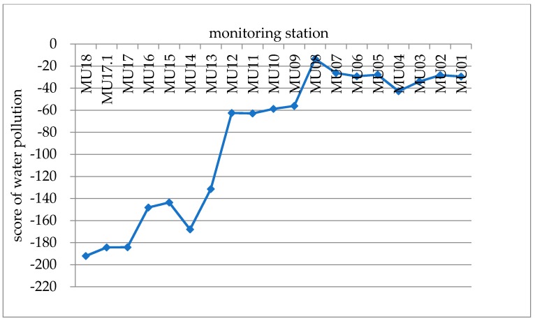
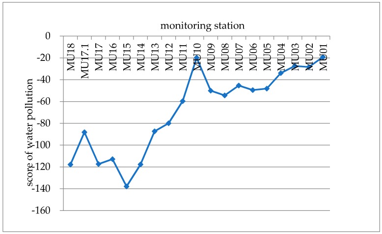
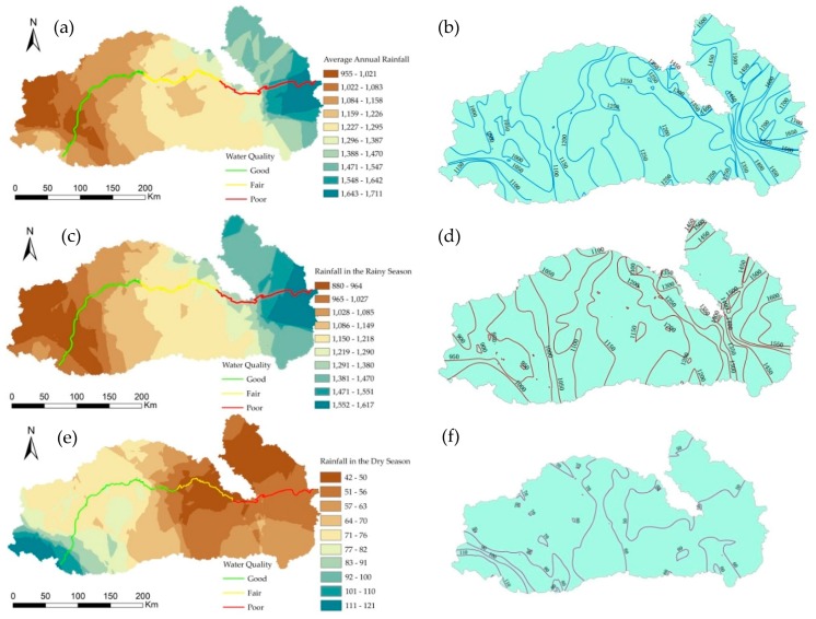
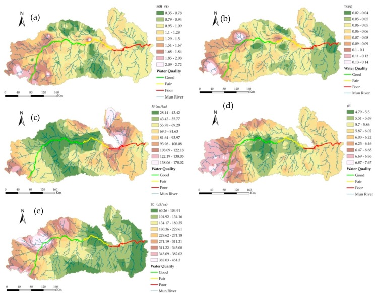
Human activities can affect soil nutrients, thereby influencing river water quality. The spatial pattern of precipitation also impacts distributions of water quality. In this paper, we employed a method that combines point survey, soil, and water quality data to analyze the spatial relationships between precipitation, soil nutrient and water quality in the basin on the basis of field surveys and laboratory analysis. The ordinary kriging method was applied to interpolate the precipitation and soil data, and the spatial pattern was analyzed. The water samples on the main stream and soil samples in the field were collected during both the dry and rainy seasons to analyze the water quality and soil nutrients. The results indicate: (1) The water quality in the dry season is better than that in the rainy season, the water quality in the upper reaches is better than that in the lower reaches, and agricultural activity is the direct source of water pollution. (2) The precipitation in the rainy and dry seasons is differente and the dilution effect of precipitation on pollutant concentrations and transport of water flow affect the spatial distribution of water quality. (3) There is a significant difference in the spatial pattern of soil nutrients between the dry and rainy seasons, and the soil nutrient content and the surface runoff directly affect the water quality. Soil nutrients are affected by human activities, and they potentially act as nonpoint source (NPS) pollution in this river basin. To improve the water quality, suitable agriculture measures need to be implemented.
人类活动会影响土壤养分,从而影响河流水质。降水的空间格局也会影响水质的分布。本文基于野外调查和实验室分析,采用点调查、土壤和水质数据相结合的方法,分析了流域降水、土壤养分与水质之间的空间关系。运用普通克里金法对降水和土壤数据进行了插值,并对空间格局进行了分析。在旱季和雨季采集了干流的水样和野外的土壤样本,分析了水质和土壤养分。结果表明:(1)旱季水质优于雨季,上游水质优于下游,农业活动是水污染的直接来源。(2)雨季和旱季的降水不同,降水对污染物浓度的稀释作用和水流的输运影响了水质的空间分布。(3)旱季和雨季土壤养分的空间格局有显著差异,土壤养分含量和地表径流直接影响水质。土壤养分受人类活动影响,在该流域可能是面源(NPS)污染的潜在来源。为改善水质,需要采取适当的农业措施。