ISTAR-IUL, Instituto Universitário de Lisboa (ISCTE-IUL), Lisboa 1649-026, Portugal.
Sensors (Basel). 2018 Dec 11;18(12):4374. doi: 10.3390/s18124374.
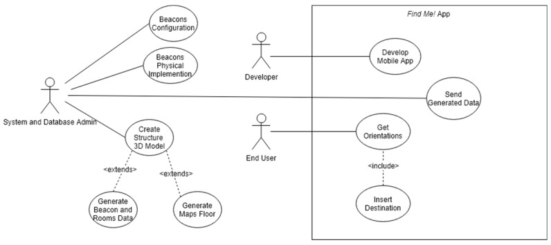
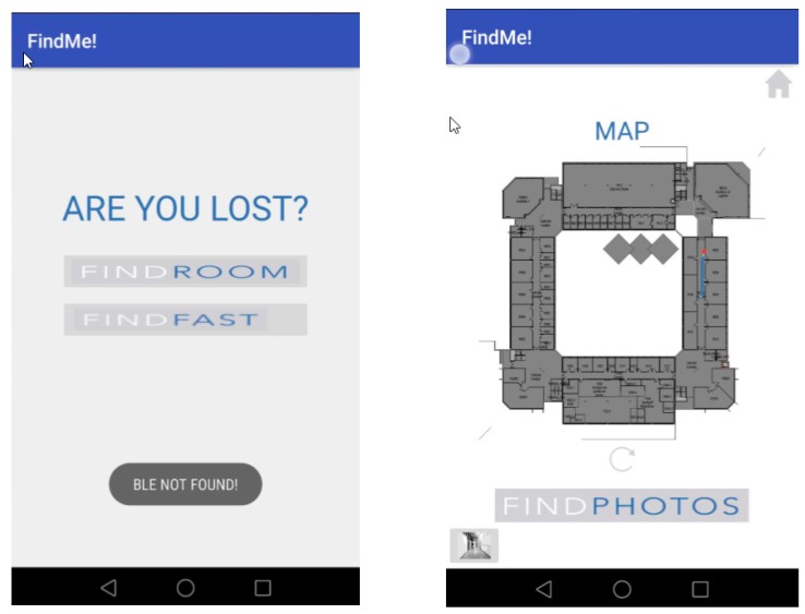
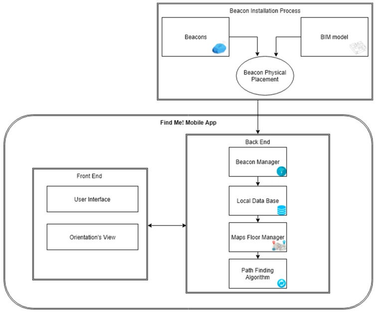
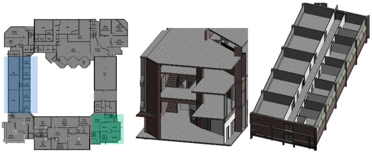
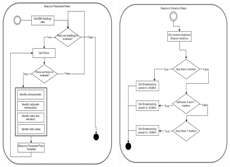
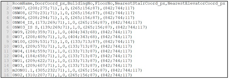
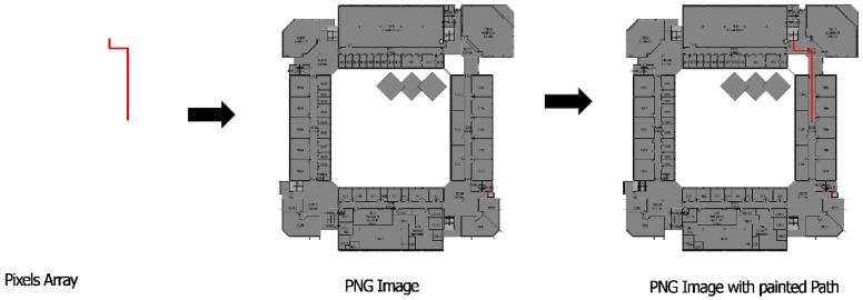
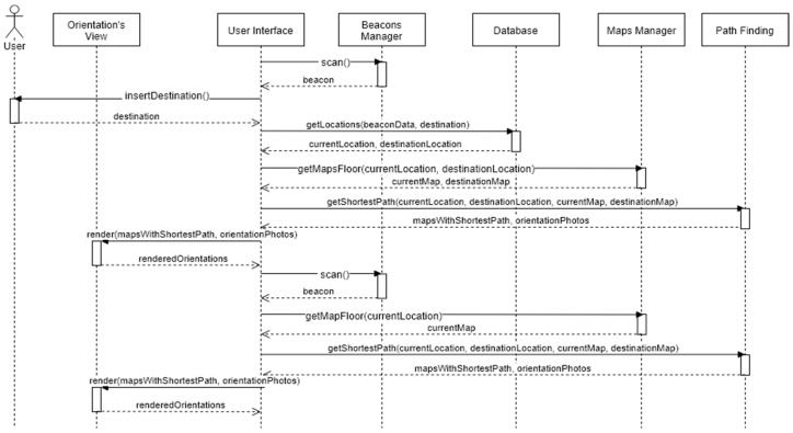
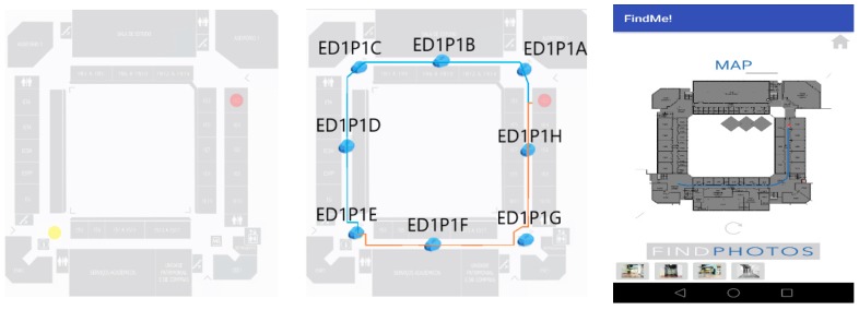
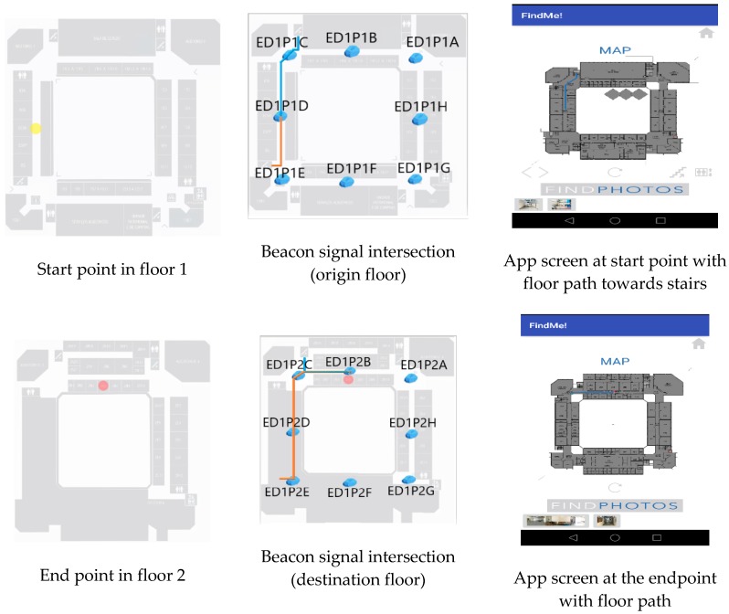
This research work uses a simplified approach to combine location information from a beacon's propagation signal interaction with a mobile device sensor (accelerometer and gyroscope) with local building information to give real-time location and guidance to a user inside a building. This is an interactive process with visualisation information that can help user's orientation inside unknown buildings and the data stored from different users can provide useful information about users' movements inside a public building. Beacons installed on the building at specific pre-defined positions emit signals that give a geographic position with an associated imprecision, related with Bluetooth's range. This uncertainty is handled by building layout and users' movement in a developed system that maps users' position, gives guidance, and stores user movements. This system is based on an App (Find Me!) for Android OS (Operating System) which captures the Bluetooth Low Energy (BLE) signal coming from the beacon(s) and shows, through a map, the location of the user's smartphone and guide him to the desired destination. Also, the beacons can deliver relevant context information. The application was tested by a panel of new and habitual campus users against traditional wayfinding alternatives yielding navigation times about 30% smaller, respectively.
这项研究工作采用简化方法,将信标传播信号与移动设备传感器(加速度计和陀螺仪)的位置信息与本地建筑物信息相结合,为建筑物内的用户提供实时位置和引导。这是一个具有可视化信息的交互过程,可以帮助用户在未知建筑物内定位,并且从不同用户存储的数据可以提供有关用户在公共建筑物内移动的有用信息。安装在建筑物特定预定义位置的信标发出信号,给出具有相关不准确性的地理位置,与蓝牙范围有关。通过开发中的系统处理这种不确定性,该系统可以映射用户的位置、提供指导并存储用户的移动轨迹。该系统基于适用于 Android 操作系统的应用程序(Find Me!),该应用程序捕获来自信标的低功耗蓝牙 (BLE) 信号,并通过地图显示用户智能手机的位置并引导他到目的地。此外,信标还可以提供相关的上下文信息。该应用程序由一组新用户和习惯使用校园的用户进行了测试,与传统的寻路替代方案相比,导航时间分别减少了约 30%。