Department of Environmental Science and Policy, University of California Davis, Davis, CA, USA.
Max Plank Institute for Human Development, Berlin, Germany.
Nat Commun. 2020 Feb 4;11(1):530. doi: 10.1038/s41467-019-13935-3.
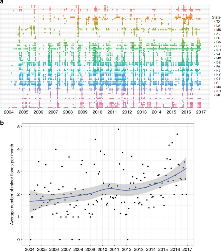
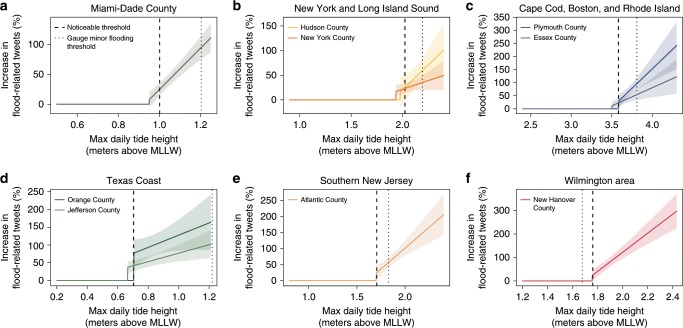
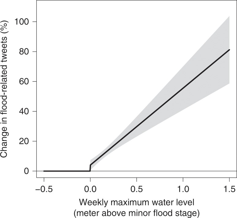
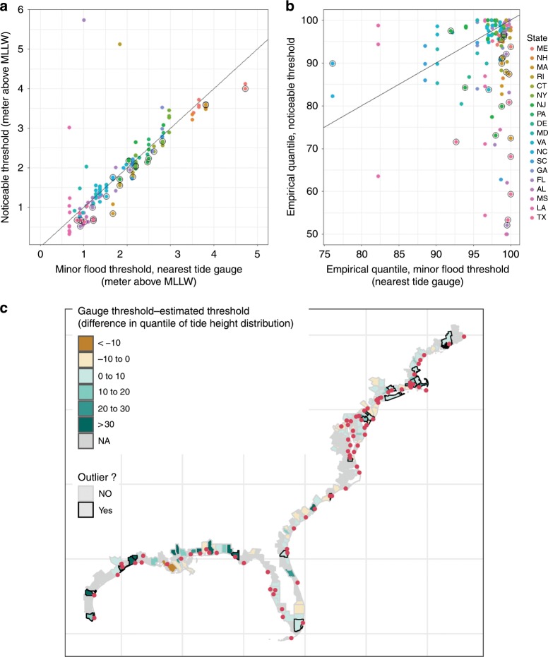
Coastal flooding is increasingly common in many areas. However, the degree of inundation and associated disruption depend on local topography as well as the distribution of people, infrastructure and economic activity along the coast. Local measures of flooding that are comparable over large areas are difficult to obtain. Here we use the remarkability of flood events, measured by flood-related posts on social media, to estimate county-specific flood thresholds for shoreline counties along the east coast of the United States. While thresholds in most counties are statistically-indistinguishable from minor flood thresholds of nearby tide gauges, we find evidence that several areas experience noticeable flooding at tide heights lower than existing flood thresholds. These 22 counties include several major cities such as Miami, New York, and Boston, with a total population over 13 million. Our analysis implies that large populations might currently be exposed to nuisance flooding not identified via standard measures.
沿海洪灾在许多地区越来越常见。然而,淹没的程度和相关的破坏程度取决于当地的地形以及沿海地区人口、基础设施和经济活动的分布。很难在大面积范围内获得可比的洪水当地测量数据。在这里,我们使用社交媒体上与洪水有关的帖子来衡量洪水事件的显著程度,以此来估计美国东海岸沿海县的具体县级洪水阈值。虽然大多数县的阈值在统计上与附近潮汐计的小洪水阈值没有区别,但我们发现有证据表明,在低于现有洪水阈值的潮汐高度下,有几个地区会出现明显的洪水。这 22 个县包括几个主要城市,如迈阿密、纽约和波士顿,总人口超过 1300 万。我们的分析表明,目前可能有大量人口面临着标准措施无法识别的滋扰性洪水。