Vanderhoof Melanie K, Christensen Jay R, Alexander Laurie C
1Geosciences and Environmental Change Science Center, U.S. Geological Survey, DFC, MS980, 25046, Lakewood, CO 80225 USA.
Office of Research and Development, National Exposure Research Laboratory, Environmental Science Division, U.S. Environmental Protection Agency, 944 E. Harmon Ave.,, Las Vegas, NV 89119 USA.
Wetl Ecol Manag. 2017;25(3):275-297. doi: 10.1007/s11273-016-9516-9. Epub 2016 Nov 19.
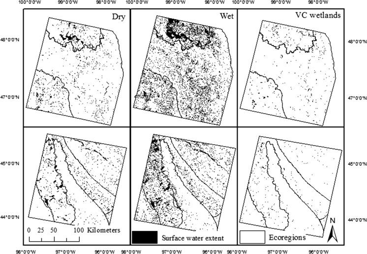
Ecosystem function in rivers, lakes and coastal waters depends on the functioning of upstream aquatic ecosystems, necessitating an improved understanding of watershed-scale interactions including variable surface-water flows between wetlands and streams. As surface water in the Prairie Pothole Region expands in wet years, surface-water connections occur between many depressional wetlands and streams. Minimal research has explored the spatial patterns and drivers for the abundance of these connections, despite their potential to inform resource management and regulatory programs including the U.S. Clean Water Act. In this study, wetlands were identified that did not intersect the stream network, but were shown with Landsat images (1990-2011) to become merged with the stream network as surface water expanded. Wetlands were found to spill into or consolidate with other wetlands within both small (2-10 wetlands) and large (>100 wetlands) wetland clusters, eventually intersecting a stream channel, most often via a riparian wetland. These surface-water connections occurred over a wide range of wetland distances from streams (averaging 90-1400 m in different ecoregions). Differences in the spatial abundance of wetlands that show a variable surface-water connection to a stream were best explained by smaller wetland-to-wetland distances, greater wetland abundance, and maximum surface-water extent. This analysis demonstrated that wetland arrangement and surface water expansion are important mechanisms for depressional wetlands to connect to streams and provides a first step to understanding the frequency and abundance of these surface-water connections across the Prairie Pothole Region.
河流、湖泊和沿海水域的生态系统功能取决于上游水生生态系统的功能,因此有必要更好地理解流域尺度的相互作用,包括湿地与溪流之间变化的地表水流动。在湿润年份,草原坑洼地区的地表水会扩张,许多洼地湿地与溪流之间会形成地表水连接。尽管这些连接有可能为包括美国《清洁水法》在内的资源管理和监管计划提供参考,但很少有研究探索这些连接丰富程度的空间模式和驱动因素。在本研究中,识别出了一些未与河网相交的湿地,但利用陆地卫星图像(1990 - 2011年)显示,随着地表水扩张,这些湿地与河网合并。研究发现,湿地会流入或合并到小型(2 - 10个湿地)和大型(>100个湿地)湿地集群内的其他湿地中,最终与河道相交,最常见的是通过河岸湿地。这些地表水连接发生在距离溪流不同范围的湿地中(不同生态区域平均距离为90 - 1400米)。与溪流呈现可变地表水连接的湿地空间丰富度差异,最好用较小的湿地间距离、更大的湿地丰度和最大地表水范围来解释。该分析表明,湿地布局和地表水扩张是洼地湿地与溪流相连的重要机制,为理解整个草原坑洼地区这些地表水连接的频率和丰富程度迈出了第一步。