Veselovskii Igor, Goloub Philippe, Podvin Thierry, Tanre Didier, da Silva Arlindo, Colarco Peter, Castellanos Patricia, Korenskiy Mikhail, Hu Qiaoyun, Whiteman David N, Pérez-Ramírez Daniel, Augustin Patrick, Fourmentin Marc, Kolgotin Alexei
Physics Instrumentation Center of GPI, Troitsk, Moscow, Russia.
Joint Center for Earth Systems Technology, UMBC, Baltimore, USA.
Atmos Meas Tech. 2018 Mar 2;11(2):949-969. doi: 10.5194/amt-11-949-2018. Epub 2018 Feb 16.
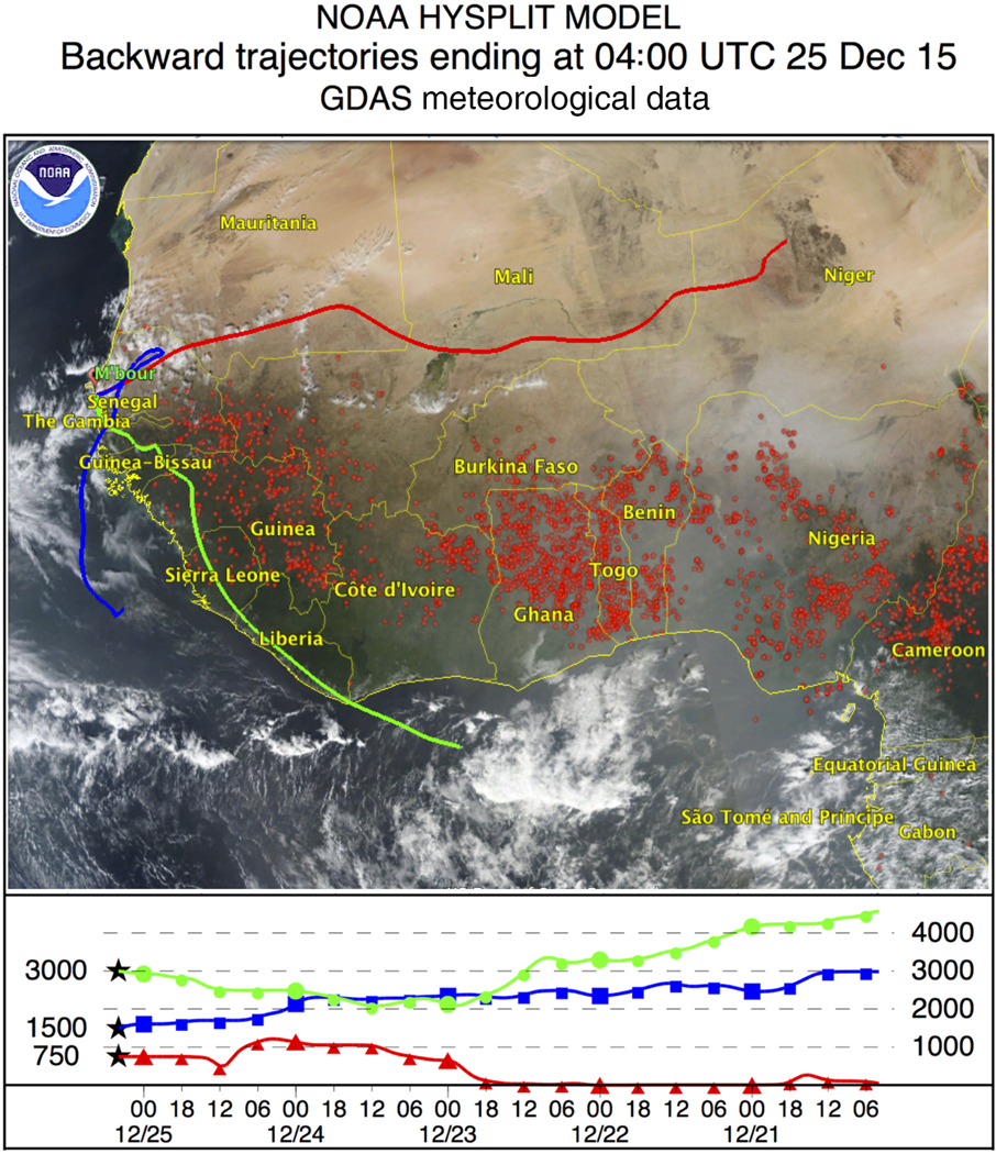
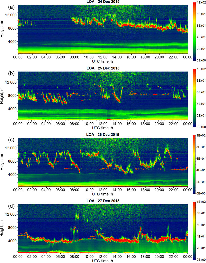
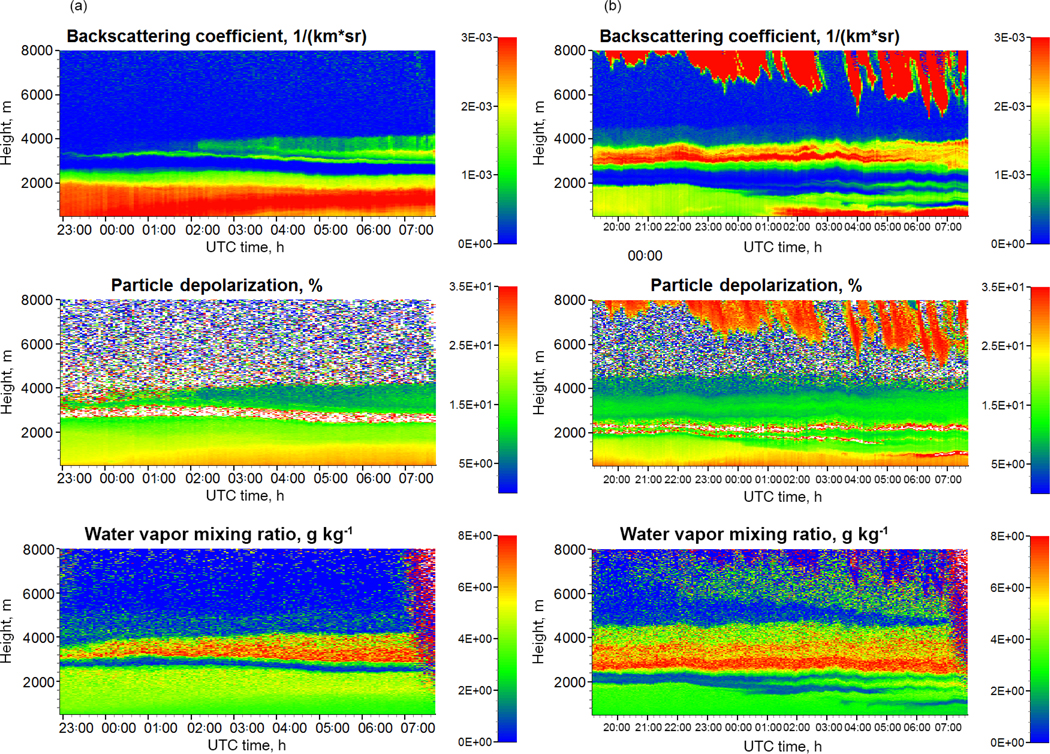
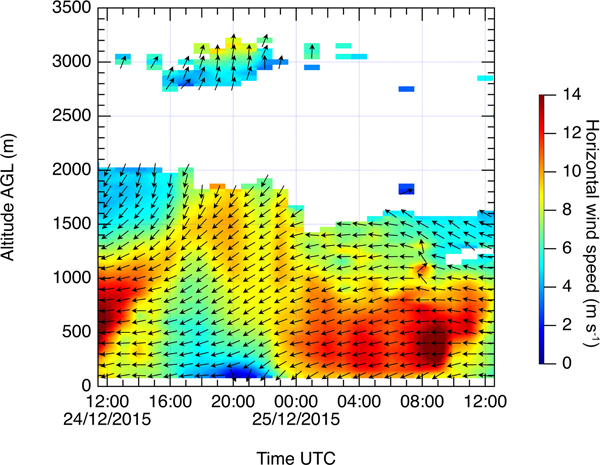
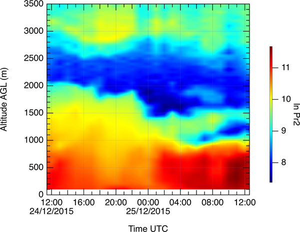
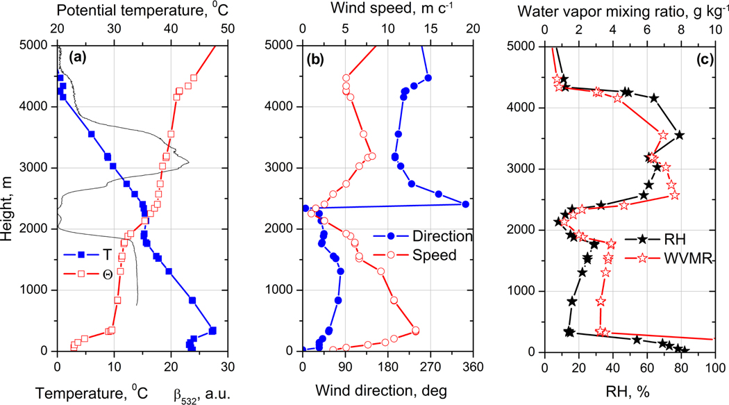
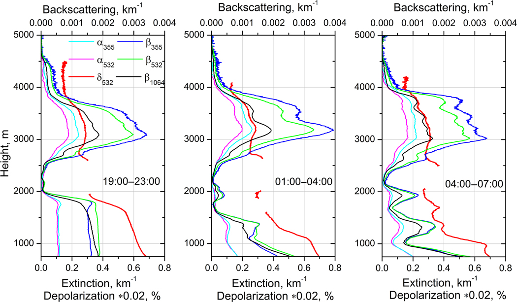
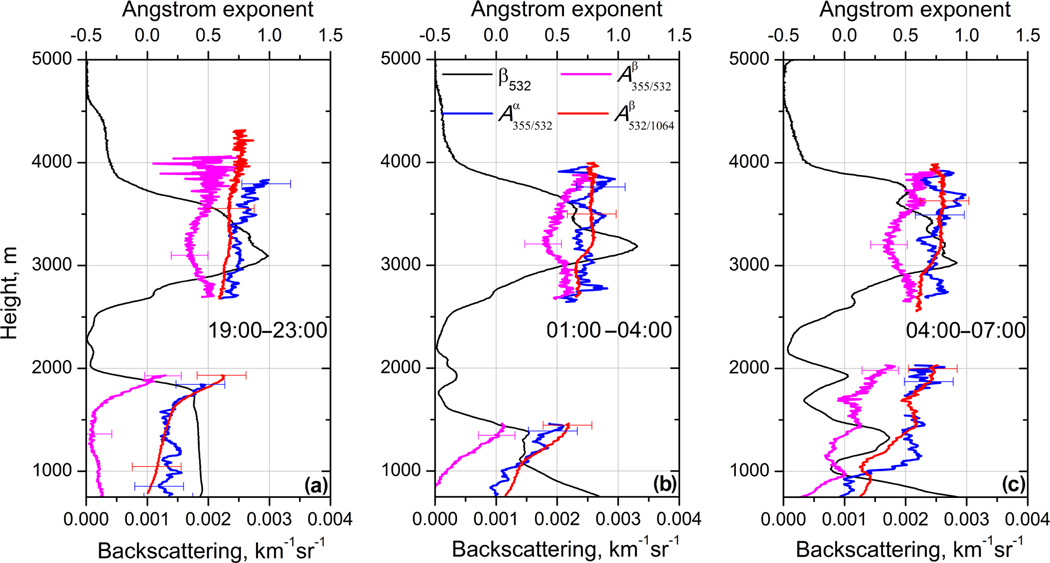
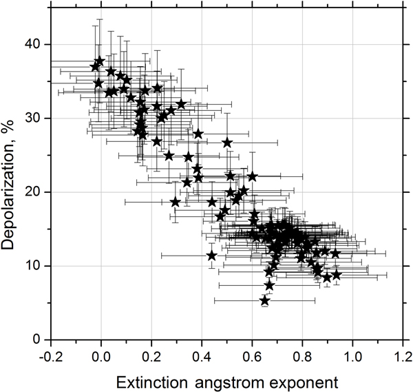
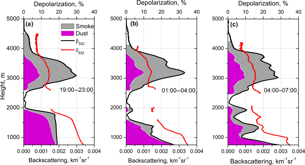
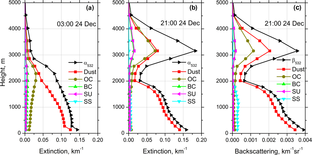
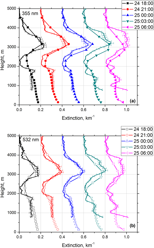
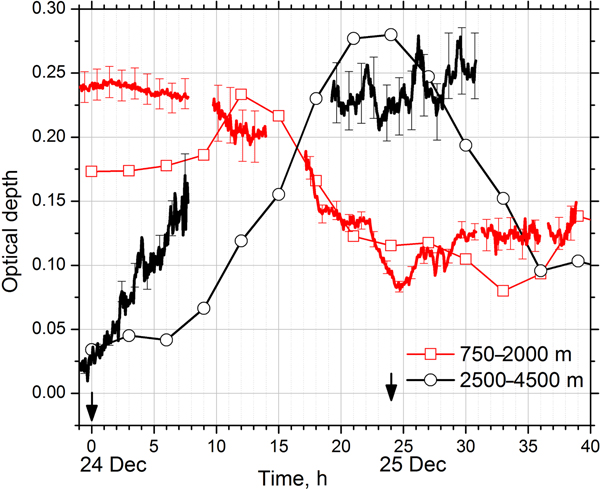
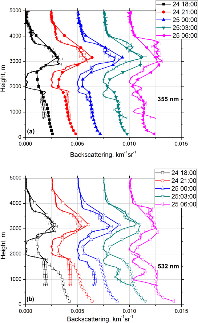
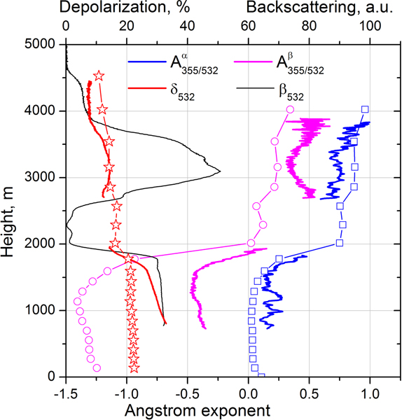
Observations of multiwavelength Mie-Raman lidar taken during the SHADOW field campaign are used to analyze a smoke-dust episode over West Africa on 24-27 December 2015. For the case considered, the dust layer extended from the ground up to approximately 2000 m while the elevated smoke layer occurred in the 2500-4000 m range. The profiles of lidar measured backscattering, extinction coefficients, and depolarization ratios are compared with the vertical distribution of aerosol parameters provided by the Modern-Era Retrospective Analysis for Research and Applications, version 2 (MERRA-2). The MERRA-2 model simulated the correct location of the near-surface dust and elevated smoke layers. The values of modeled and observed aerosol extinction coefficients at both 355 and 532 nm are also rather close. In particular, for the episode reported, the mean value of difference between the measured and modeled extinction coefficients at 355 nm is 0.01 km with SD of 0.042 km. The model predicts significant concentration of dust particles inside the elevated smoke layer, which is supported by an increased depolarization ratio of 15 % observed in the center of this layer. The modeled at 355 nm the lidar ratio of 65 sr in the near-surface dust layer is close to the observed value (70 ± 10) sr. At 532 nm, however, the simulated lidar ratio (about 40 sr) is lower than measurements (55 ± 8 sr). The results presented demonstrate that the lidar and model data are complimentary and the synergy of observations and models is a key to improve the aerosols characterization.
利用在“阴影”(SHADOW)野外考察期间获取的多波长米氏-拉曼激光雷达观测数据,对2015年12月24日至27日发生在西非的一次烟尘事件进行了分析。对于所考虑的案例,沙尘层从地面向上延伸至约2000米,而高空烟雾层出现在2500 - 4000米的范围内。将激光雷达测量的后向散射、消光系数和退偏振比剖面与第二代现代时代回顾性分析研究与应用(MERRA - 2)提供的气溶胶参数垂直分布进行了比较。MERRA - 2模型模拟出了近地面沙尘层和高空烟雾层的正确位置。在355纳米和532纳米处,模拟和气溶胶消光系数的值也相当接近。特别是对于所报道的该事件,在355纳米处测量和模拟的消光系数之间的平均差值为0.01千米,标准差为0.042千米。该模型预测在高空烟雾层内沙尘颗粒浓度较高,这得到了在该层中心观测到的退偏振比增加15%的支持。在355纳米处,近地面沙尘层模拟的激光雷达比为65 sr,接近观测值(70±10)sr。然而,在532纳米处,模拟的激光雷达比(约40 sr)低于测量值(55±8 sr)。所呈现的结果表明,激光雷达和模型数据具有互补性,观测与模型的协同作用是改善气溶胶特征描述的关键。