European Commission, Joint Research Centre (JRC), Ispra, Italy.
Environmental Geosciences, University of Basel, Basel, Switzerland.
Sci Total Environ. 2021 May 15;769:144755. doi: 10.1016/j.scitotenv.2020.144755. Epub 2021 Jan 19.
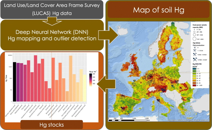
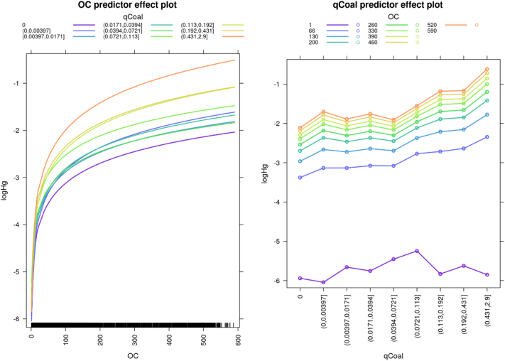
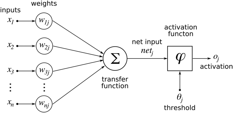
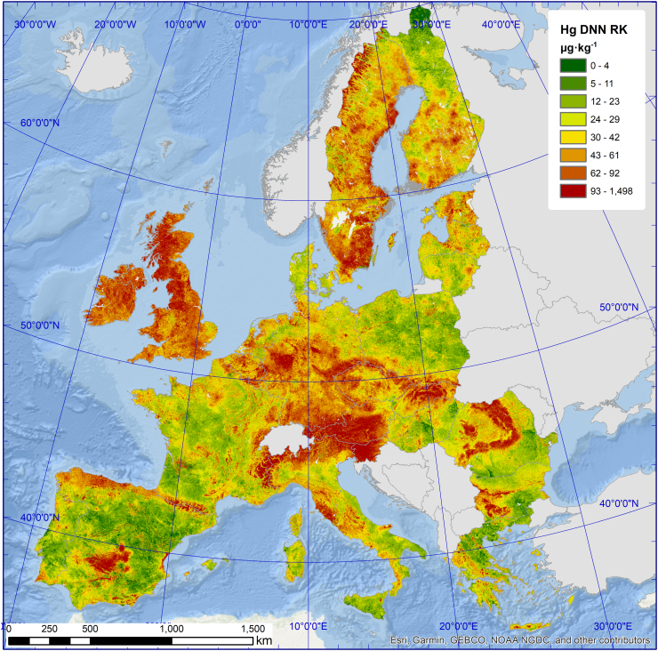
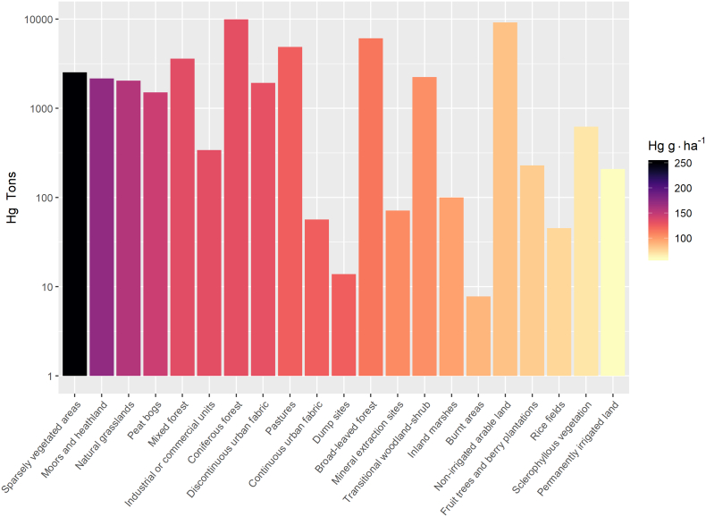
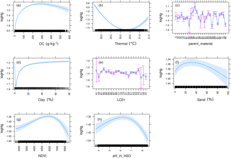
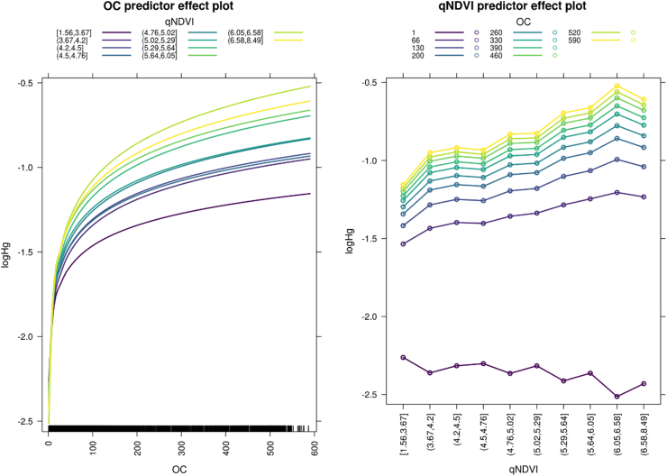
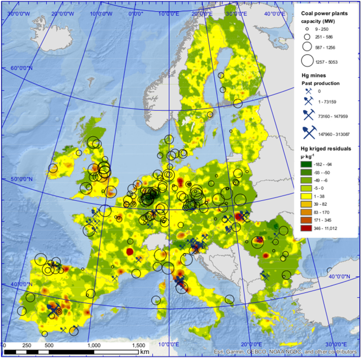
Mapping of surface soil Hg concentrations, a priority pollutant, at continental scale is important in order to identify hotspots of soil Hg distribution (e.g. mining or industrial pollution) and identify factors that influence soil Hg concentrations (e.g. climate, soil properties, vegetation). Here we present soil Hg concentrations from the LUCAS topsoil (0-20 cm) survey including 21,591 samples from 26 European Union countries (one sample every ~200 km). Deep Neural Network (DNN) learning models were used to map the European soil Hg distribution. DNN estimated a median Hg concentration of 38.3 μg kg (2.6 to 84.7 μg kg) excluding contaminated sites. At continental scale, we found that soil Hg concentrations increased with latitude from south to north and with altitude. A GLMM revealed a correlation (R = 0.35) of soil Hg concentrations with vegetation activity, normalized difference vegetation index (NDVI), and soil organic carbon content. This observation corroborates the importance of atmospheric Hg uptake by plants and the build-up of the soil Hg pool by litterfall over continental scales. The correlation of Hg concentrations with NDVI was amplified by higher soil organic matter content, known to stabilize Hg in soils through thiol bonds. We find a statistically significant relation between soil Hg levels and coal use in large power plants, proving that emissions from power plants are associated with higher mercury deposition in their proximity. In total 209 hotspots were identified, defined as the top percentile in Hg concentration (>422 μg kg). 87 sites (42% of all hotspots) were associated with known mining areas. The sources of the other hotspots could not be identified and may relate to unmined geogenic Hg or industrial pollution. The mapping effort in the framework of LUCAS can serve as a starting point to guide local and regional authorities in identifying Hg contamination hotspots in soils.
为了识别土壤汞分布的热点(例如采矿或工业污染)并确定影响土壤汞浓度的因素(例如气候、土壤特性、植被),在大陆尺度上对表层土壤汞浓度(优先污染物)进行测绘非常重要。在这里,我们展示了来自 LUCAS 表层土壤(0-20 厘米)调查的土壤汞浓度,包括来自 26 个欧盟国家的 21591 个样本(每个约 200 公里一个样本)。深度神经网络(DNN)学习模型用于绘制欧洲土壤汞分布图。DNN 估计汞浓度的中位数为 38.3μgkg(排除污染点后为 2.6 至 84.7μgkg)。在大陆尺度上,我们发现土壤汞浓度从南到北随着纬度的增加而增加,并且随着海拔的升高而增加。GLMM 揭示了土壤汞浓度与植被活动、归一化差异植被指数(NDVI)和土壤有机碳含量之间的相关性(R=0.35)。这一观察结果证实了大气汞通过植物吸收以及落叶在大陆尺度上增加土壤汞库的重要性。Hg 浓度与 NDVI 的相关性因土壤有机质含量较高而放大,已知土壤有机质通过硫醇键稳定土壤中的 Hg。我们发现土壤 Hg 水平与大型发电厂煤炭使用之间存在统计上显著的关系,证明了发电厂的排放与附近更高的汞沉积有关。共确定了 209 个热点,定义为 Hg 浓度最高的百分位数(>422μgkg)。87 个地点(所有热点的 42%)与已知采矿区有关。其他热点的来源无法确定,可能与未开采的原生汞或工业污染有关。在 LUCAS 框架内进行的测绘工作可以作为地方和地区当局识别土壤中 Hg 污染热点的起点。