• 文献检索
  • 文档翻译
  • 深度研究
  • 学术资讯
  • Suppr Zotero 插件Zotero 插件
  • 邀请有礼
  • 套餐&价格
  • 历史记录
应用&插件
Suppr Zotero 插件Zotero 插件浏览器插件Mac 客户端Windows 客户端微信小程序
定价
高级版会员购买积分包购买API积分包
服务
文献检索文档翻译深度研究API 文档MCP 服务
关于我们
关于 Suppr公司介绍联系我们用户协议隐私条款
关注我们

Suppr 超能文献

核心技术专利:CN118964589B侵权必究
粤ICP备2023148730 号-1Suppr @ 2026

文献检索

告别复杂PubMed语法,用中文像聊天一样搜索,搜遍4000万医学文献。AI智能推荐,让科研检索更轻松。

立即免费搜索

文件翻译

保留排版,准确专业,支持PDF/Word/PPT等文件格式,支持 12+语言互译。

免费翻译文档

深度研究

AI帮你快速写综述,25分钟生成高质量综述,智能提取关键信息,辅助科研写作。

立即免费体验

土壤侵蚀模型:全球综述与统计分析。

Soil erosion modelling: A global review and statistical analysis.

机构信息

Department of Earth and Environmental Sciences, University of Pavia, Via Ferrata, 1, 27100 Pavia, Italy; Department of Environmental Sciences, Environmental Geosciences, University of Basel, Basel CH-4056, Switzerland; Department of Biological Environment, Kangwon National University, Chuncheon 24341, Republic of Korea.

Department of Environmental Sciences, Environmental Geosciences, University of Basel, Basel CH-4056, Switzerland.

出版信息

Sci Total Environ. 2021 Aug 1;780:146494. doi: 10.1016/j.scitotenv.2021.146494. Epub 2021 Mar 17.

DOI:10.1016/j.scitotenv.2021.146494
PMID:33773346
原文链接:https://pmc.ncbi.nlm.nih.gov/articles/PMC8140410/
Abstract

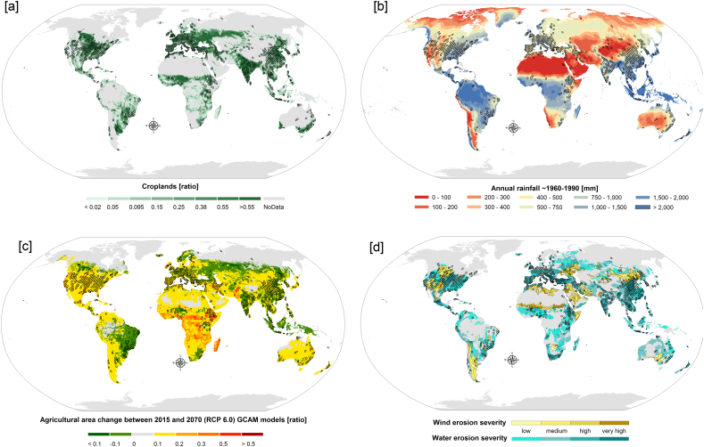
To gain a better understanding of the global application of soil erosion prediction models, we comprehensively reviewed relevant peer-reviewed research literature on soil-erosion modelling published between 1994 and 2017. We aimed to identify (i) the processes and models most frequently addressed in the literature, (ii) the regions within which models are primarily applied, (iii) the regions which remain unaddressed and why, and (iv) how frequently studies are conducted to validate/evaluate model outcomes relative to measured data. To perform this task, we combined the collective knowledge of 67 soil-erosion scientists from 25 countries. The resulting database, named 'Global Applications of Soil Erosion Modelling Tracker (GASEMT)', includes 3030 individual modelling records from 126 countries, encompassing all continents (except Antarctica). Out of the 8471 articles identified as potentially relevant, we reviewed 1697 appropriate articles and systematically evaluated and transferred 42 relevant attributes into the database. This GASEMT database provides comprehensive insights into the state-of-the-art of soil- erosion models and model applications worldwide. This database intends to support the upcoming country-based United Nations global soil-erosion assessment in addition to helping to inform soil erosion research priorities by building a foundation for future targeted, in-depth analyses. GASEMT is an open-source database available to the entire user-community to develop research, rectify errors, and make future expansions.

摘要

为了更好地了解全球土壤侵蚀预测模型的应用情况,我们全面回顾了 1994 年至 2017 年间发表的关于土壤侵蚀建模的相关同行评议研究文献。我们旨在确定:(i)文献中最常涉及的过程和模型;(ii)模型主要应用的区域;(iii)哪些区域尚未涉及以及原因;以及 (iv)相对于实测数据,验证/评估模型结果的研究频率。为了完成这项任务,我们汇集了来自 25 个国家的 67 位土壤侵蚀科学家的集体知识。由此产生的数据库名为“全球土壤侵蚀建模应用追踪器(GASEMT)”,其中包含来自 126 个国家的 3030 个单独的建模记录,涵盖了所有大陆(南极洲除外)。在确定的 8471 篇可能相关的文章中,我们回顾了 1697 篇合适的文章,并系统地评估并将 42 个相关属性转移到数据库中。该 GASEMT 数据库全面了解了全球土壤侵蚀模型和模型应用的最新情况。该数据库旨在支持即将进行的基于国家的联合国全球土壤侵蚀评估,并通过为未来有针对性的深入分析奠定基础,帮助确定土壤侵蚀研究重点。GASEMT 是一个开源数据库,可供整个用户社区使用,以开展研究、纠正错误和进行未来扩展。

https://cdn.ncbi.nlm.nih.gov/pmc/blobs/ea37/8140410/15214e3094e4/gr10.jpg
https://cdn.ncbi.nlm.nih.gov/pmc/blobs/ea37/8140410/34321af00f50/ga1.jpg
https://cdn.ncbi.nlm.nih.gov/pmc/blobs/ea37/8140410/4a71fae2b369/gr1.jpg
https://cdn.ncbi.nlm.nih.gov/pmc/blobs/ea37/8140410/eea05ff17047/gr2.jpg
https://cdn.ncbi.nlm.nih.gov/pmc/blobs/ea37/8140410/5f779bde7fff/gr3.jpg
https://cdn.ncbi.nlm.nih.gov/pmc/blobs/ea37/8140410/00de4683b970/gr4.jpg
https://cdn.ncbi.nlm.nih.gov/pmc/blobs/ea37/8140410/9243775b2eec/gr5.jpg
https://cdn.ncbi.nlm.nih.gov/pmc/blobs/ea37/8140410/4d26b12d5278/gr6.jpg
https://cdn.ncbi.nlm.nih.gov/pmc/blobs/ea37/8140410/18624749900f/gr7.jpg
https://cdn.ncbi.nlm.nih.gov/pmc/blobs/ea37/8140410/3f443fbc7984/gr8.jpg
https://cdn.ncbi.nlm.nih.gov/pmc/blobs/ea37/8140410/c569d10b2c0b/gr9.jpg
https://cdn.ncbi.nlm.nih.gov/pmc/blobs/ea37/8140410/15214e3094e4/gr10.jpg

相似文献

1
Soil erosion modelling: A global review and statistical analysis.土壤侵蚀模型:全球综述与统计分析。
Sci Total Environ. 2021 Aug 1;780:146494. doi: 10.1016/j.scitotenv.2021.146494. Epub 2021 Mar 17.
2
Soil erosion modelling: A bibliometric analysis.土壤侵蚀模拟:文献计量分析。
Environ Res. 2021 Jun;197:111087. doi: 10.1016/j.envres.2021.111087. Epub 2021 Mar 31.
3
Soil water erosion assessment in Morocco through modeling and fingerprinting applications: A review.通过建模和指纹识别应用对摩洛哥土壤水蚀进行评估:综述
Heliyon. 2022 Aug 15;8(8):e10209. doi: 10.1016/j.heliyon.2022.e10209. eCollection 2022 Aug.
4
Land use and climate change impacts on global soil erosion by water (2015-2070).土地利用和气候变化对全球水蚀土壤流失的影响(2015-2070 年)。
Proc Natl Acad Sci U S A. 2020 Sep 8;117(36):21994-22001. doi: 10.1073/pnas.2001403117. Epub 2020 Aug 24.
5
Soil erosion modelling: The new challenges as the result of policy developments in Europe.土壤侵蚀模型:欧洲政策发展带来的新挑战。
Environ Res. 2019 May;172:470-474. doi: 10.1016/j.envres.2019.02.043. Epub 2019 Feb 28.
6
Modelling the impacts of climate and land use changes on soil water erosion: Model applications, limitations and future challenges.模拟气候和土地利用变化对土壤水蚀的影响:模型应用、局限性和未来挑战。
J Environ Manage. 2019 Nov 15;250:109403. doi: 10.1016/j.jenvman.2019.109403. Epub 2019 Sep 6.
7
Predicting the Spatial Distribution and Severity of Soil Erosion in the Global Tropics using Satellite Remote Sensing.利用卫星遥感预测全球热带地区土壤侵蚀的空间分布和严重程度
Remote Sens (Basel). 2019 Jul 31;11(15):1800. doi: 10.3390/rs11151800.
8
An assessment of the global impact of 21st century land use change on soil erosion.评估 21 世纪土地利用变化对土壤侵蚀的全球影响。
Nat Commun. 2017 Dec 8;8(1):2013. doi: 10.1038/s41467-017-02142-7.
9
A method for modeling the effects of climate and land use changes on erosion and sustainability of soil in a Mediterranean watershed (Languedoc, France).一种模拟气候和土地利用变化对地中海流域(法国朗格多克)土壤侵蚀及可持续性影响的方法。
J Environ Manage. 2015 Mar 1;150:57-68. doi: 10.1016/j.jenvman.2014.10.034. Epub 2014 Nov 25.
10
How reliable are our methods for estimating soil erosion by water?我们估算水蚀土壤侵蚀的方法有多可靠?
Sci Total Environ. 2019 Aug 1;676:215-221. doi: 10.1016/j.scitotenv.2019.04.307. Epub 2019 Apr 22.

引用本文的文献

1
Assessment of soil erosion rates, carbon stocks, and erosion-induced carbon loss in dominant forest types of the Himalayan region using fallout-Cs.利用沉降铯评估喜马拉雅地区主要森林类型的土壤侵蚀速率、碳储量及侵蚀导致的碳损失。
Sci Rep. 2025 Apr 29;15(1):14950. doi: 10.1038/s41598-025-94953-8.
2
Evolution of soil rill erosion and its link to extreme precipitation in northeast China's black soil region.中国东北黑土区土壤细沟侵蚀演变及其与极端降水的关系
Sci Prog. 2025 Apr-Jun;108(2):368504251328206. doi: 10.1177/00368504251328206. Epub 2025 Apr 17.
3
From Flourish to Nourish: Cultivating Soil Health for Sustainable Floriculture.

本文引用的文献

1
Soil erosion modelling: A bibliometric analysis.土壤侵蚀模拟:文献计量分析。
Environ Res. 2021 Jun;197:111087. doi: 10.1016/j.envres.2021.111087. Epub 2021 Mar 31.
2
Land use and climate change impacts on global soil erosion by water (2015-2070).土地利用和气候变化对全球水蚀土壤流失的影响(2015-2070 年)。
Proc Natl Acad Sci U S A. 2020 Sep 8;117(36):21994-22001. doi: 10.1073/pnas.2001403117. Epub 2020 Aug 24.
3
Soil loss due to crop harvesting in the European Union: A first estimation of an underrated geomorphic process.
从繁荣到滋养:培育土壤健康以实现可持续花卉栽培。
Plants (Basel). 2024 Oct 31;13(21):3055. doi: 10.3390/plants13213055.
4
Using RS and GIS for risk management of natural disasters consequences: The case of cultural heritage in Jinan city, China.利用遥感和地理信息系统进行自然灾害后果风险管理:以中国济南市的文化遗产为例。
Heliyon. 2024 Sep 27;10(19):e38217. doi: 10.1016/j.heliyon.2024.e38217. eCollection 2024 Oct 15.
5
Enhancing geotechnical damage detection with deep learning: a convolutional neural network approach.利用深度学习增强岩土工程损伤检测:一种卷积神经网络方法。
PeerJ Comput Sci. 2024 Aug 12;10:e2052. doi: 10.7717/peerj-cs.2052. eCollection 2024.
6
Comparative analysis of RUSLE and SWPT for sub-watershed conservation prioritization in the Ayu watershed, Abay basin, Ethiopia.埃塞俄比亚阿巴伊河流域阿尤子流域水土保持优先区域划分中通用土壤流失方程(RUSLE)与土壤和水资源保护技术(SWPT)的对比分析
Heliyon. 2024 Jul 24;10(15):e35132. doi: 10.1016/j.heliyon.2024.e35132. eCollection 2024 Aug 15.
7
Development of a Device for Monitoring Erosion in the Field.一种用于现场监测侵蚀的装置的研发。
Micromachines (Basel). 2024 Jul 4;15(7):880. doi: 10.3390/mi15070880.
8
Acceleration of phosphorus weathering under warm climates.温暖气候下磷风化作用的加速
Sci Adv. 2024 Jul 12;10(28):eadm7773. doi: 10.1126/sciadv.adm7773. Epub 2024 Jul 10.
9
Analysis of Factors Influencing Spatial Distribution of Soil Erosion under Diverse Subwatershed Based on Geospatial Perspective: A Case Study at Citarum Watershed, West Java, Indonesia.基于地理空间视角的不同子流域土壤侵蚀空间分布影响因素分析:以印度尼西亚西爪哇省芝塔龙河流域为例
Scientifica (Cairo). 2024 Jan 11;2024:7251691. doi: 10.1155/2024/7251691. eCollection 2024.
10
A new high-resolution global topographic factor dataset calculated based on SRTM.基于 SRTM 计算的新的高分辨率全球地形因子数据集。
Sci Data. 2024 Jan 20;11(1):101. doi: 10.1038/s41597-024-02917-w.
欧盟作物收获导致的土壤流失:一个被低估的地貌过程的初步估计。
Sci Total Environ. 2019 May 10;664:487-498. doi: 10.1016/j.scitotenv.2019.02.009. Epub 2019 Feb 2.
4
An assessment of the global impact of 21st century land use change on soil erosion.评估 21 世纪土地利用变化对土壤侵蚀的全球影响。
Nat Commun. 2017 Dec 8;8(1):2013. doi: 10.1038/s41467-017-02142-7.
5
Global rainfall erosivity assessment based on high-temporal resolution rainfall records.基于高时间分辨率降雨记录的全球降雨侵蚀力评估。
Sci Rep. 2017 Jun 23;7(1):4175. doi: 10.1038/s41598-017-04282-8.
6
Remote sensing of land use/cover changes and its effect on wind erosion potential in southern Iran.伊朗南部土地利用/覆被变化的遥感及其对风蚀潜力的影响。
PeerJ. 2016 Jul 20;4:e1948. doi: 10.7717/peerj.1948. eCollection 2016.
7
Development: Slow down population growth.发展:减缓人口增长。
Nature. 2016 Feb 25;530(7591):409-12. doi: 10.1038/530409a.
8
Common Agricultural Policy: Tackling soil loss across Europe.共同农业政策:应对欧洲各地的土壤流失问题。
Nature. 2015 Oct 8;526(7572):195. doi: 10.1038/526195d.
9
High-resolution global maps of 21st-century forest cover change.高分辨率的 21 世纪全球森林覆盖变化地图集。
Science. 2013 Nov 15;342(6160):850-3. doi: 10.1126/science.1244693.
10
10-daily soil erosion modelling over sub-Saharan Africa.撒哈拉以南非洲地区的每日土壤侵蚀建模。
Environ Monit Assess. 2010 Feb;161(1-4):369-87. doi: 10.1007/s10661-009-0754-7. Epub 2009 Mar 4.