Dogan Gozde Guney, Yalciner Ahmet Cevdet, Yuksel Yalcin, Ulutaş Ergin, Polat Orhan, Güler Işıkhan, Şahin Cihan, Tarih Ahmet, Kânoğlu Utku
Ocean Engineering Research Center, Department of Civil Engineering, Middle East Technical University, Ankara, Turkey.
Hydraulics Division, Department of Civil Engineering, Yıldız Technical University, İstanbul, Turkey.
Pure Appl Geophys. 2021;178(3):785-812. doi: 10.1007/s00024-021-02693-3. Epub 2021 Mar 22.
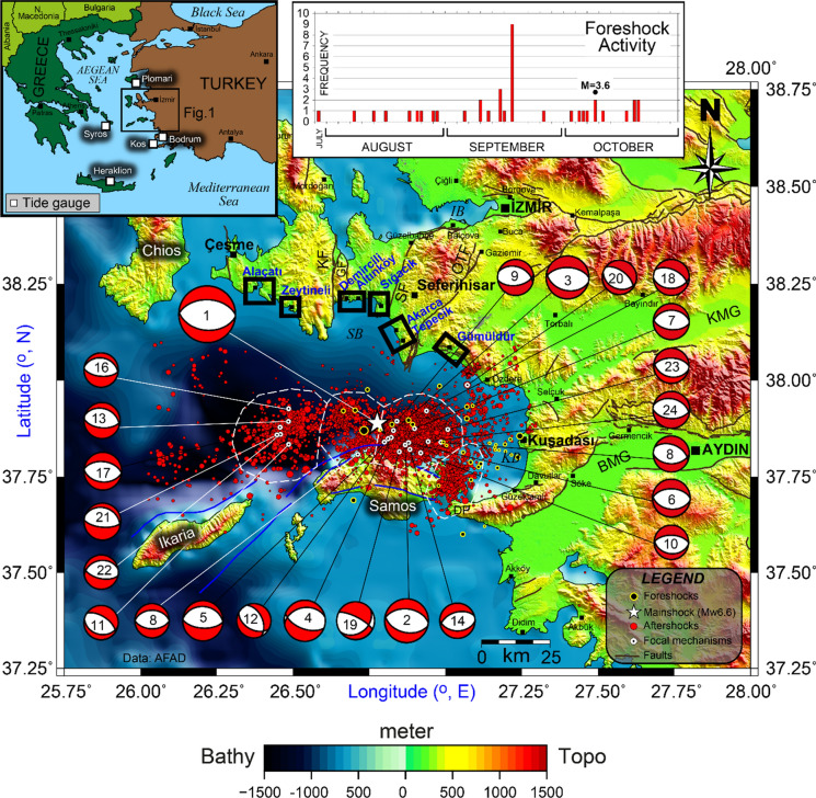
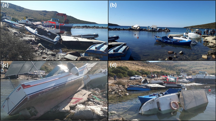
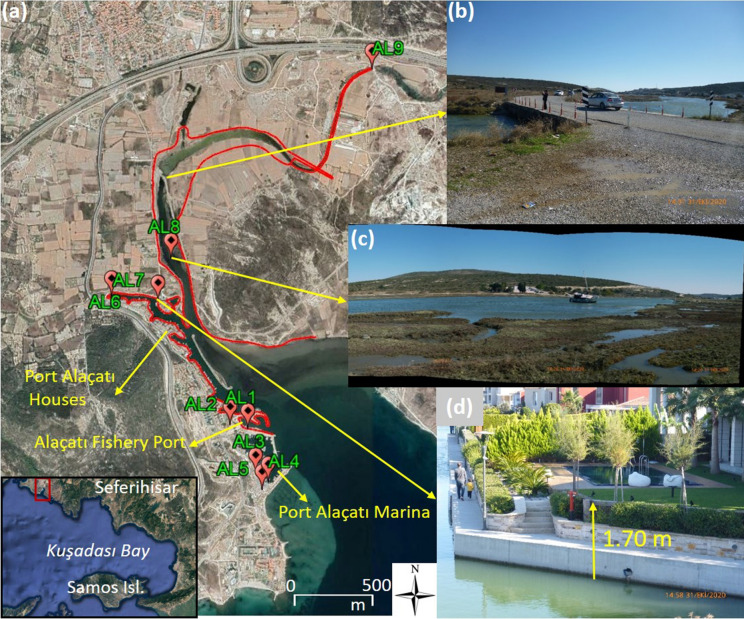
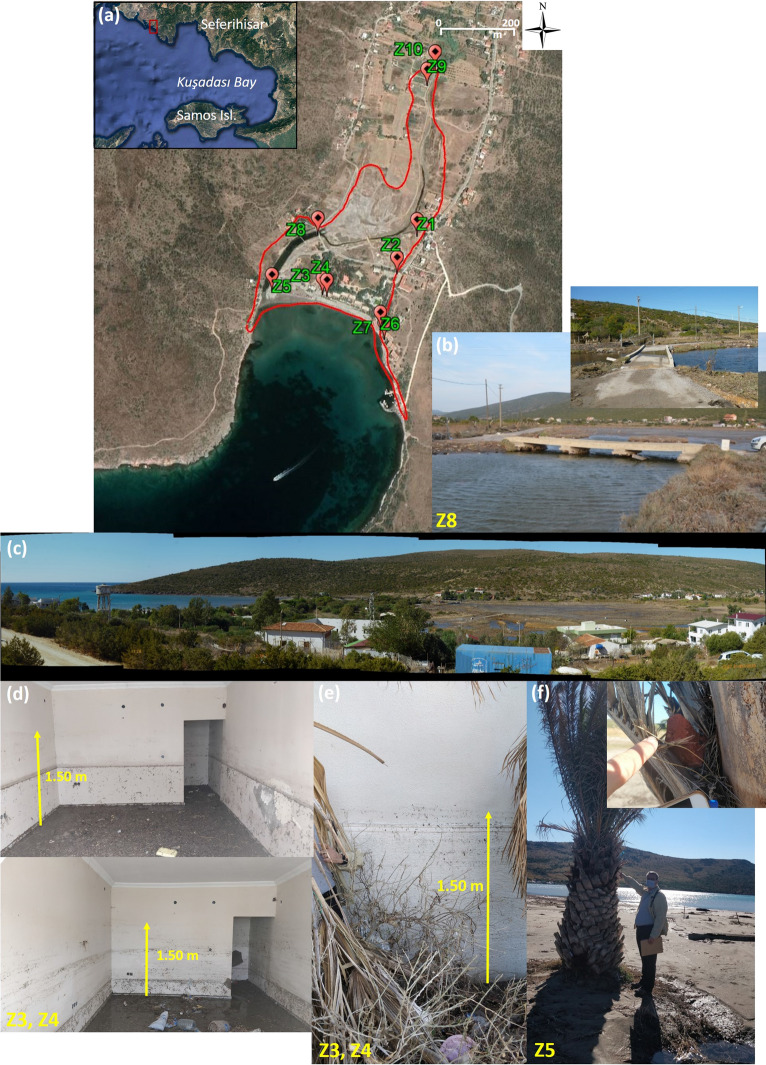
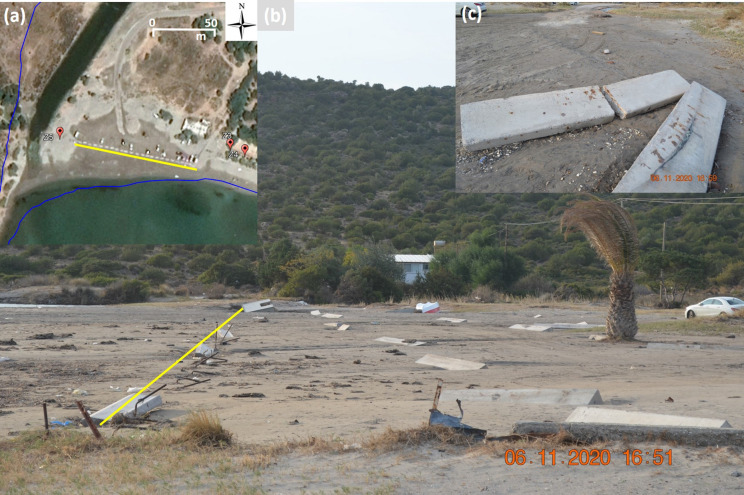
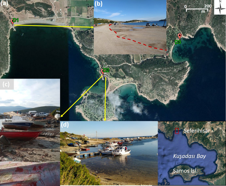
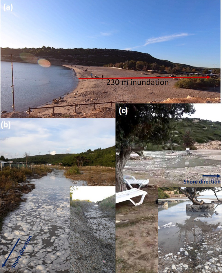
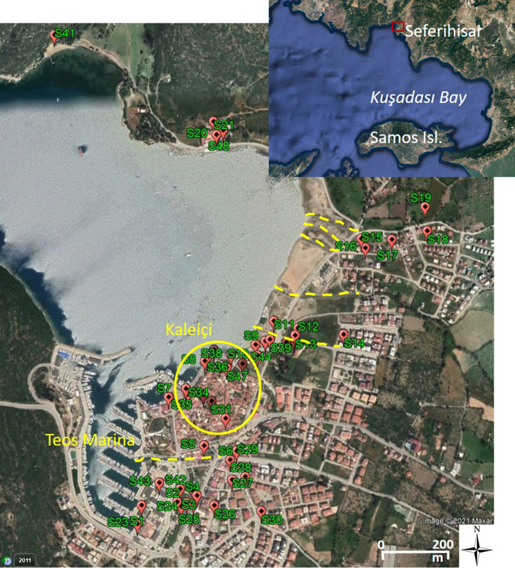
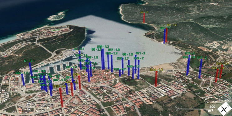
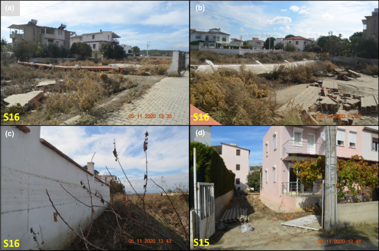
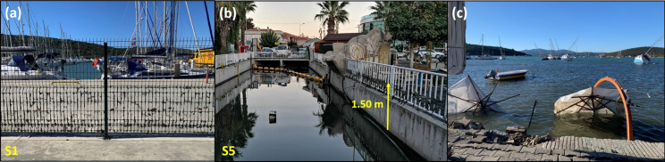
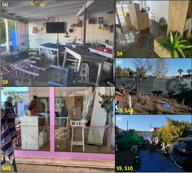
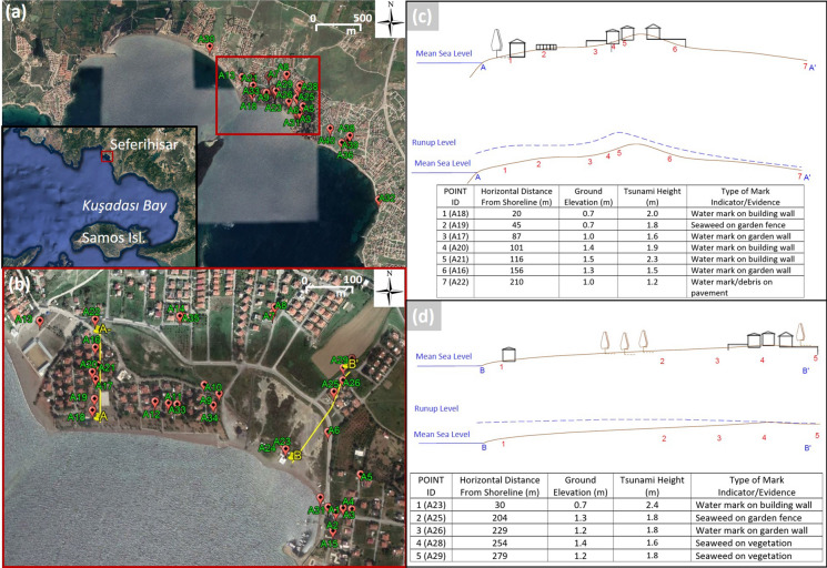
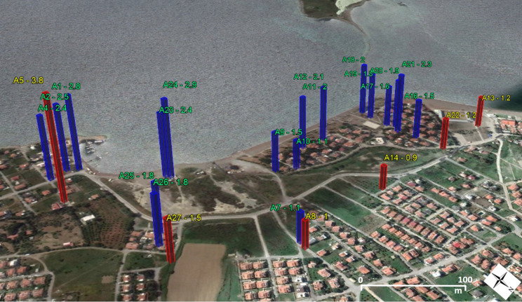
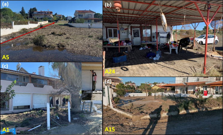
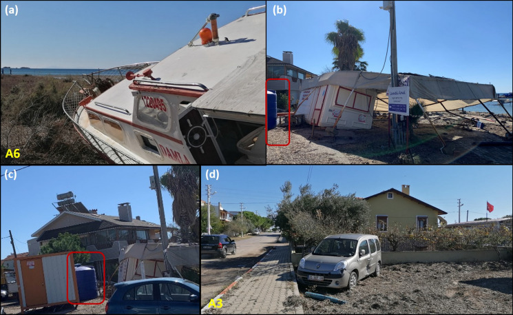
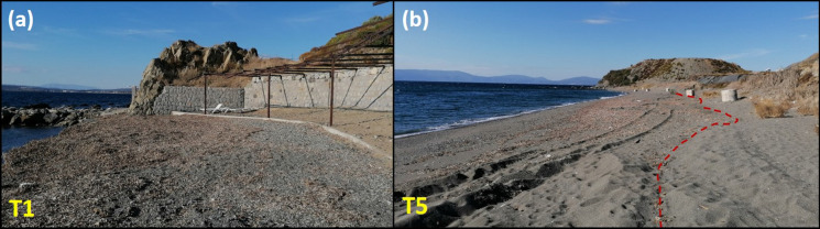
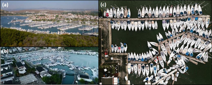
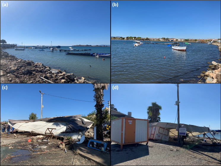
On 30 October 2020, a strong normal-faulting earthquake struck Samos Island in Greece and İzmir Province in Turkey, both in the eastern Aegean Sea. The earthquake generated a tsunami that hit the coasts of Samos Island, Greece and İzmir, Turkey. National teams performed two post-tsunami field surveys on 31 October to 1 November 2020, and 4-6 November 2020, along the Turkish coastline; while the former was a quick survey on the days following the tsunami, the latter involved more detailed measurement and investigation focusing on a ~ 110-km-long coastline extending from Alaçatı (Çeşme District of İzmir) to Gümüldür (Menderes District of İzmir). The survey teams measured runup and tsunami heights, flow depths, and inundation distances at more than 120 points at eight different localities. The largest tsunami runup among the surveyed locations was measured as 3.8 m in Akarca at a distance of 91 m from the shoreline. The maximum tsunami height of 2.3 m (with a flow depth of 1.4 m) was observed at Kaleiçi region in Sığacık, where the most severe tsunami damage was observed. There, the maximum runup height was measured as 1.9 m at the northeastern side of the bay. The survey team also investigated tsunami damage to coastal structures, noticing a gradual decrease in the impact from Gümüldür to further southeast. The findings of this field survey provide insights into the coastal impact of local tsunamis in the Aegean Sea.
2020年10月30日,希腊的萨摩斯岛和土耳其的伊兹密尔省(均位于爱琴海东部)发生了强烈的正断层地震。此次地震引发了海啸,袭击了希腊萨摩斯岛和土耳其伊兹密尔的海岸。国家队于2020年10月31日至11月1日以及2020年11月4日至6日沿着土耳其海岸线进行了两次海啸后实地调查;前者是在海啸过后几天进行的快速调查,后者则是针对从阿拉恰蒂(伊兹密尔切什梅区)到居姆吕杜尔(伊兹密尔门德雷斯区)延伸约110公里长的海岸线进行更详细的测量和调查。调查团队在八个不同地点的120多个点测量了海啸爬高、海啸高度、水流深度和淹没距离。在调查地点中,离海岸线91米处的阿卡卡测得最大海啸爬高为3.8米。在锡贾吉克的卡莱伊奇地区观测到最大海啸高度为2.3米(水流深度为1.4米),该地区观测到了最严重的海啸破坏。在那里,海湾东北侧测得最大爬高为1.9米。调查团队还调查了海啸对沿海建筑的破坏情况,注意到从居姆吕杜尔到更东南部,影响逐渐减弱。此次实地调查的结果为了解爱琴海局部海啸对沿海地区的影响提供了见解。