Virtual Reality and Multimedia Group, Institute of Computer Science, Freiberg University of Mining and Technology, 09599 Freiberg, Germany.
Operating Systems and Communication Technologies Group, Institute of Computer Science, Freiberg University of Mining and Technology, 09599 Freiberg, Germany.
Sensors (Basel). 2021 Mar 18;21(6):2144. doi: 10.3390/s21062144.
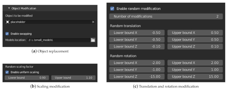
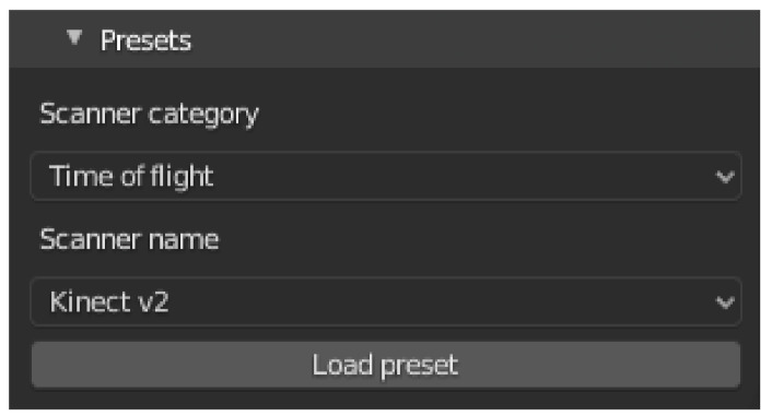
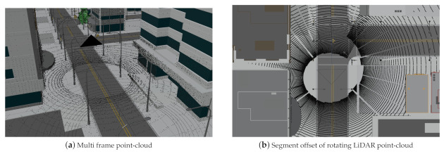
Common Machine-Learning (ML) approaches for scene classification require a large amount of training data. However, for classification of depth sensor data, in contrast to image data, relatively few databases are publicly available and manual generation of semantically labeled 3D point clouds is an even more time-consuming task. To simplify the training data generation process for a wide range of domains, we have developed the add-on package for the open-source 3D modeling software Blender, which enables a largely automated generation of semantically annotated point-cloud data in virtual 3D environments. In this paper, we focus on classical depth-sensing techniques Light Detection and Ranging (LiDAR) and Sound Navigation and Ranging (Sonar). Within the add-on, different depth sensors can be loaded from presets, customized sensors can be implemented and different environmental conditions (e.g., influence of rain, dust) can be simulated. The semantically labeled data can be exported to various 2D and 3D formats and are thus optimized for different ML applications and visualizations. In addition, semantically labeled images can be exported using the rendering functionalities of Blender.
常见的场景分类机器学习 (ML) 方法需要大量的训练数据。然而,与图像数据相比,对于深度传感器数据的分类,相对较少的数据库是公开可用的,并且手动生成语义标记的 3D 点云更是一项耗时的任务。为了简化广泛领域的训练数据生成过程,我们开发了用于开源 3D 建模软件 Blender 的附加组件,该组件能够在虚拟 3D 环境中实现语义注释点云数据的自动化生成。在本文中,我们重点介绍了经典的深度感应技术 光检测和测距 (LiDAR) 和声纳导航和测距 (Sonar)。在附加组件中,可以从预设中加载不同的深度传感器,可以实现自定义传感器,并且可以模拟不同的环境条件(例如,雨、灰尘的影响)。语义标记的数据可以导出到各种 2D 和 3D 格式,因此针对不同的 ML 应用程序和可视化进行了优化。此外,还可以使用 Blender 的渲染功能导出语义标记的图像。