Department of Civil and Environmental Engineering, University of California, Irvine, CA, 92697, USA.
Sci Rep. 2021 Apr 22;11(1):8779. doi: 10.1038/s41598-021-88131-9.
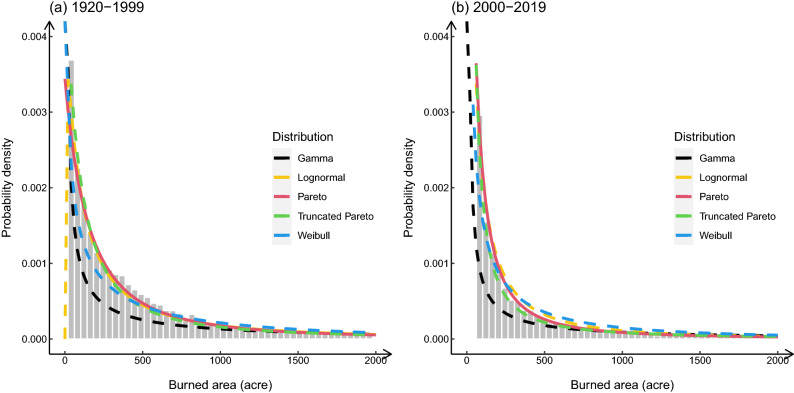
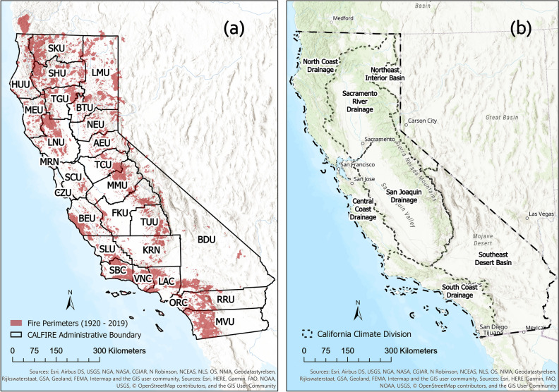
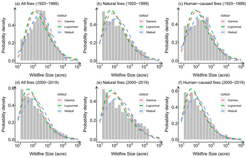
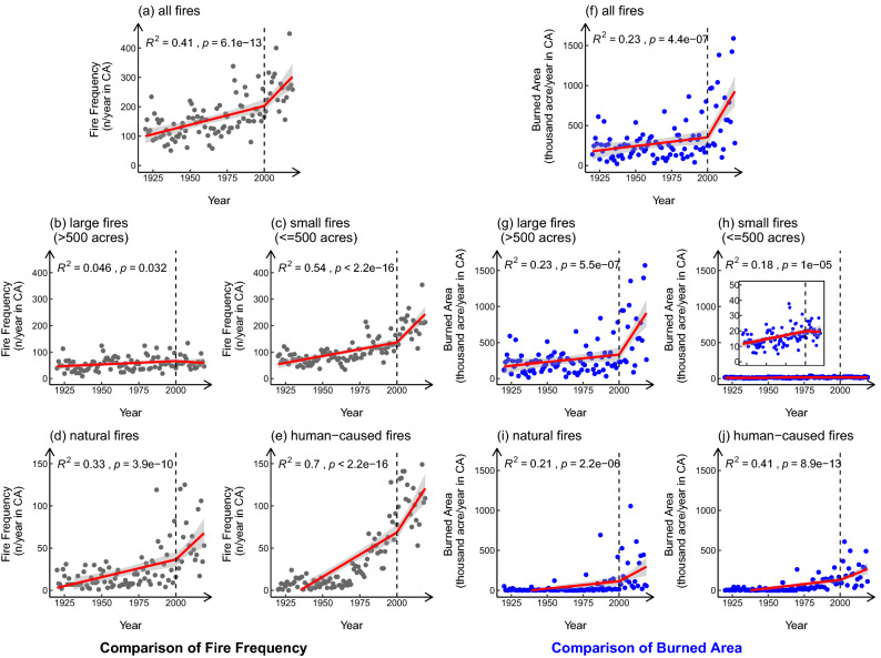
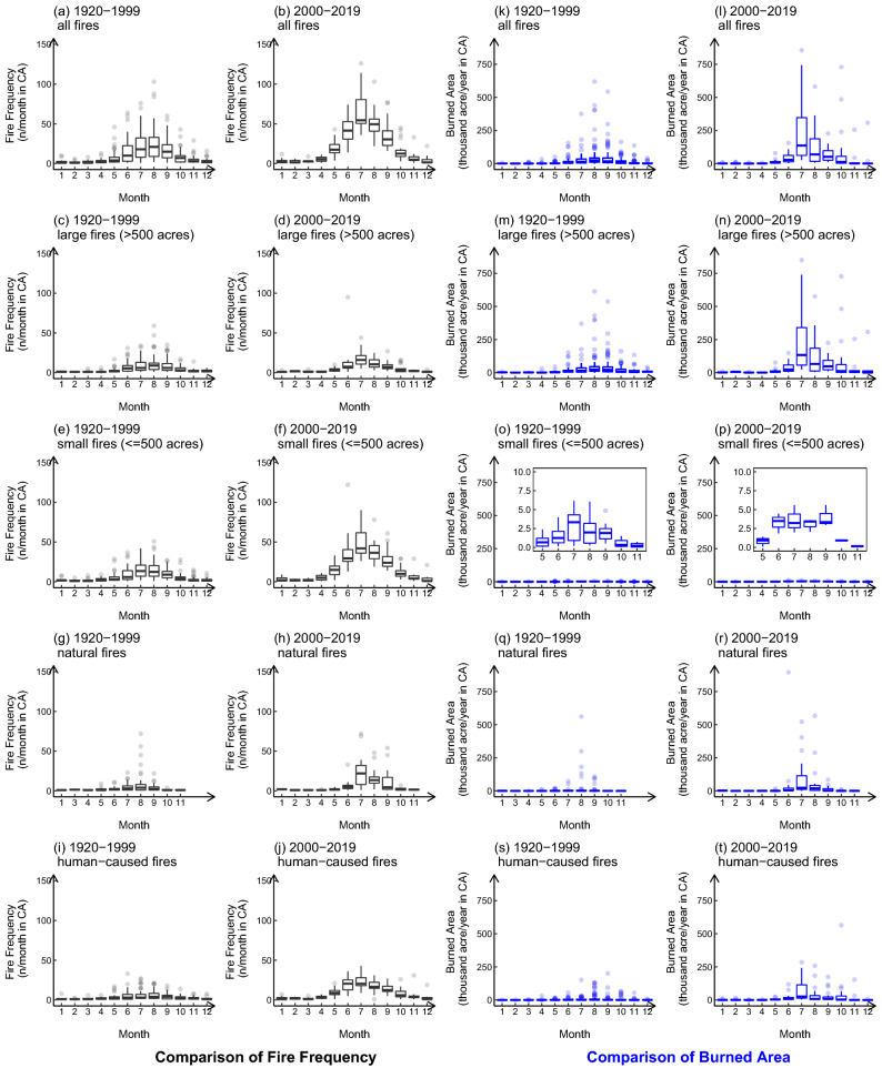
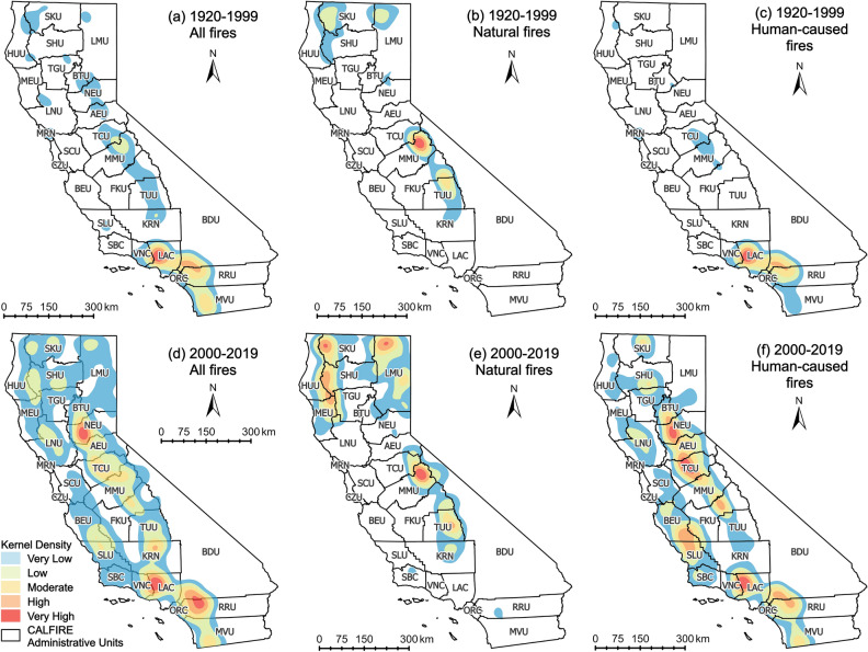
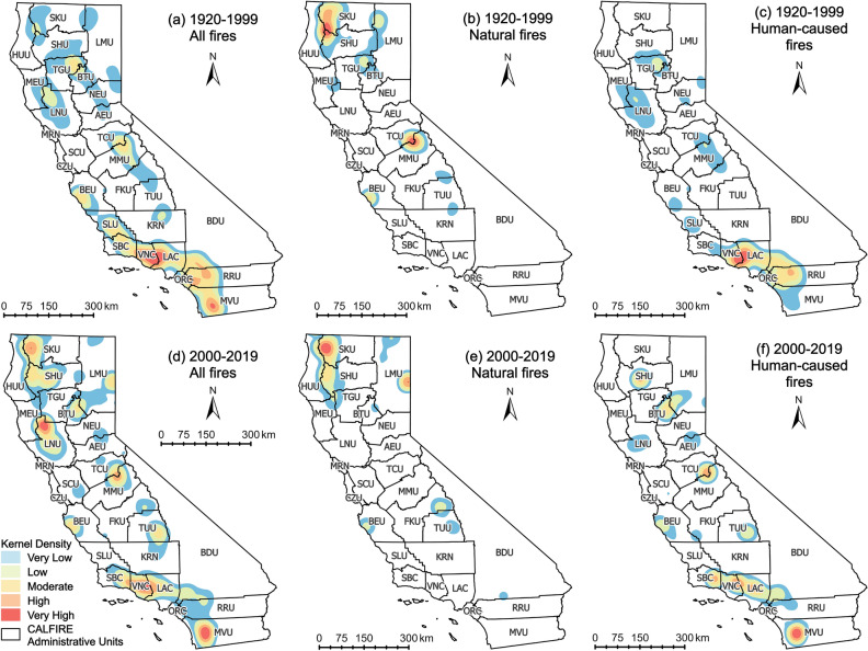
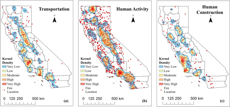
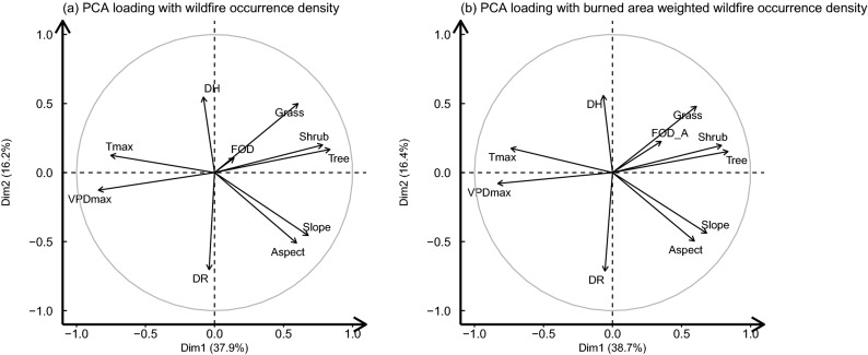
The environmental pollution, property losses and casualties caused by wildfires in California are getting worse by the year. To minimize the interference of wildfires on economic and social development, and formulate targeted mitigation strategies, it is imperative to understand the scale and extent of previous wildfire occurrences. In this study, we first investigated the temporal distributions of past wildfires in California divided by size and causes and analyzed the changes observed in the past two decades against the last century. The trend of wildfires in different time scales (yearly and monthly), as well as the distribution of wildfires across different spatial scales (administrative units, climate divisions in California from 2000 to 2019) were also studied. Furthermore, to extract the significant variables on the risk of wildfire occurrence, multivariate analyses of environmental and human-related variables with wildfire densities were carried out. The results show that the wildfire density distribution of the burned area in California conforms to the characteristics of the Pareto distribution. Over the past two decades, the frequency of small (< 500 acres), human-caused wildfires has increased most rapidly, and they are widely distributed in central and western California. The wildfire season has lengthened and the peak months have been advanced from August to July. In terms of the variables related to the risk of wildfire occurrence, the temperature, vapor pressure deficit, grass cover, and the distance to roads are crucial. This study reveals the relationship between environmental and social background conditions and the spatial-temporal distribution of wildfires, which can provide a reference for wildfire management, the formulation of future targeted wildfire emergency plans, and the planning of future land use in California.
加利福尼亚州的森林火灾造成的环境污染、财产损失和人员伤亡逐年恶化。为了最大限度地减少森林火灾对经济和社会发展的干扰,并制定有针对性的缓解策略,了解以往森林火灾发生的规模和范围至关重要。在本研究中,我们首先调查了按规模和原因划分的加利福尼亚州过去森林火灾的时间分布,并分析了过去二十年与上个世纪相比观察到的变化。还研究了不同时间尺度(年和月)的森林火灾趋势以及不同空间尺度(行政单位、加利福尼亚州的气候分区)的森林火灾分布。此外,为了提取与森林火灾发生风险相关的显著变量,对环境和人为相关变量与森林火灾密度进行了多元分析。结果表明,加利福尼亚州燃烧面积的森林火灾密度分布符合帕累托分布的特征。在过去的二十年中,面积小于 500 英亩的人为引起的森林火灾发生频率增长最快,并且广泛分布在加利福尼亚州中部和西部。森林火灾季节延长,高峰期从 8 月提前到 7 月。就与森林火灾发生风险相关的变量而言,温度、水汽压亏缺、草皮覆盖率和距道路的距离是至关重要的。本研究揭示了环境和社会背景条件与森林火灾时空分布之间的关系,可为森林火灾管理、未来有针对性的森林火灾应急预案的制定以及加利福尼亚州未来土地利用规划提供参考。