• 文献检索
  • 文档翻译
  • 深度研究
  • 学术资讯
  • Suppr Zotero 插件Zotero 插件
  • 邀请有礼
  • 套餐&价格
  • 历史记录
应用&插件
Suppr Zotero 插件Zotero 插件浏览器插件Mac 客户端Windows 客户端微信小程序
定价
高级版会员购买积分包购买API积分包
服务
文献检索文档翻译深度研究API 文档MCP 服务
关于我们
关于 Suppr公司介绍联系我们用户协议隐私条款
关注我们

Suppr 超能文献

核心技术专利:CN118964589B侵权必究
粤ICP备2023148730 号-1Suppr @ 2026

文献检索

告别复杂PubMed语法,用中文像聊天一样搜索,搜遍4000万医学文献。AI智能推荐,让科研检索更轻松。

立即免费搜索

文件翻译

保留排版,准确专业,支持PDF/Word/PPT等文件格式,支持 12+语言互译。

免费翻译文档

深度研究

AI帮你快速写综述,25分钟生成高质量综述,智能提取关键信息,辅助科研写作。

立即免费体验

多无人机感知舰队的能量感知动态三维布局。

Energy-Aware Dynamic 3D Placement of Multi-Drone Sensing Fleet.

机构信息

Department of Electrical and Computer Engineering, University of Houston, Houston, TX 77204, USA.

出版信息

Sensors (Basel). 2021 Apr 8;21(8):2622. doi: 10.3390/s21082622.

DOI:10.3390/s21082622
PMID:33918003
原文链接:https://pmc.ncbi.nlm.nih.gov/articles/PMC8068405/
Abstract

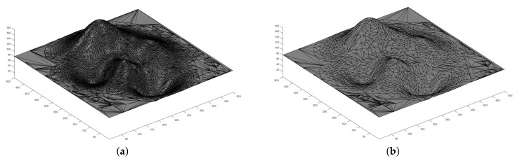
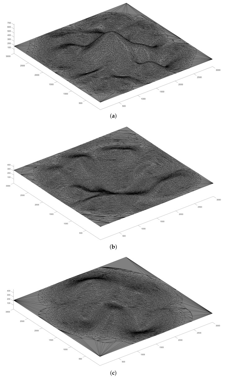
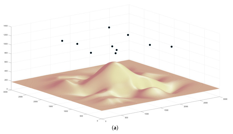
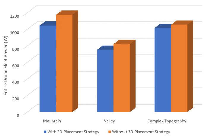
Unmanned Aerial Vehicles (UAVs, also known as drones) have become increasingly appealing with various applications and services over the past years. Drone-based remote sensing has shown its unique advantages in collecting ground-truth and real-time data due to their affordable costs and relative ease of operability. This paper presents a 3D placement scheme for multi-drone sensing/monitoring platforms, where a fleet of drones are sent for conducting a mission in a given area. It can range from environmental monitoring of forestry, survivors searching in a disaster zone to exploring remote regions such as deserts and mountains. The proposed drone placing algorithm covers the entire region without dead zones while minimizing the number of cooperating drones deployed. Naturally, drones have limited battery supplies which need to cover mechanical motions, message transmissions and data calculation. Consequently, the drone energy model is explicitly investigated and dynamic adjustments are deployed on drone locations. The proposed drone placement algorithm is 3D landscaping-aware and it takes the line-of-sight into account. The energy model considers inter-communications within drones. The algorithm not only minimizes the overall energy consumption, but also maximizes the whole drone team's lifetime in situations where no power recharging facilities are available in remote/rural areas. Simulations show the proposed placement scheme has significantly prolonged the lifetime of the drone fleet with the least number of drones deployed under various complex terrains.

摘要

近年来,随着各种应用和服务的出现,无人飞行器(UAV,也称为无人机)变得越来越吸引人。由于成本低廉且相对易于操作,基于无人机的遥感在收集地面真实数据和实时数据方面显示出了独特的优势。本文提出了一种多无人机感测/监测平台的 3D 布置方案,其中派遣一队无人机在给定区域执行任务。任务范围可以从林业环境监测、灾区幸存者搜索到探索沙漠和山区等偏远地区。所提出的无人机布置算法可以覆盖整个区域而没有死区,同时最小化部署的合作无人机数量。当然,无人机的电池电量有限,需要覆盖机械运动、消息传输和数据计算。因此,明确研究了无人机的能量模型,并对无人机位置进行了动态调整。所提出的无人机布置算法具有 3D 景观感知能力,并考虑了视线。能量模型考虑了无人机内部的相互通信。在没有充电设施的偏远/农村地区,该算法不仅可以最小化整体能耗,还可以最大化整个无人机团队的寿命。仿真结果表明,在所提出的布置方案下,在各种复杂地形下,无人机队的寿命得到了显著延长,同时部署的无人机数量最少。

https://cdn.ncbi.nlm.nih.gov/pmc/blobs/68c4/8068405/4c056ba19212/sensors-21-02622-g010.jpg
https://cdn.ncbi.nlm.nih.gov/pmc/blobs/68c4/8068405/1f9914ff0446/sensors-21-02622-g001.jpg
https://cdn.ncbi.nlm.nih.gov/pmc/blobs/68c4/8068405/4a0d9a5f48d5/sensors-21-02622-g002.jpg
https://cdn.ncbi.nlm.nih.gov/pmc/blobs/68c4/8068405/4c27dc906c4b/sensors-21-02622-g003.jpg
https://cdn.ncbi.nlm.nih.gov/pmc/blobs/68c4/8068405/be3da123a0ba/sensors-21-02622-g004.jpg
https://cdn.ncbi.nlm.nih.gov/pmc/blobs/68c4/8068405/ca3f734720c1/sensors-21-02622-g005.jpg
https://cdn.ncbi.nlm.nih.gov/pmc/blobs/68c4/8068405/887eaaad50e4/sensors-21-02622-g006a.jpg
https://cdn.ncbi.nlm.nih.gov/pmc/blobs/68c4/8068405/8f9f4569b1a6/sensors-21-02622-g007a.jpg
https://cdn.ncbi.nlm.nih.gov/pmc/blobs/68c4/8068405/db7dd70a92e4/sensors-21-02622-g008.jpg
https://cdn.ncbi.nlm.nih.gov/pmc/blobs/68c4/8068405/549b89dfb203/sensors-21-02622-g009.jpg
https://cdn.ncbi.nlm.nih.gov/pmc/blobs/68c4/8068405/4c056ba19212/sensors-21-02622-g010.jpg

相似文献

1
Energy-Aware Dynamic 3D Placement of Multi-Drone Sensing Fleet.多无人机感知舰队的能量感知动态三维布局。
Sensors (Basel). 2021 Apr 8;21(8):2622. doi: 10.3390/s21082622.
2
Proactive Deployment of Aerial Drones for Coverage over Very Uneven Terrains: A Version of the 3D Art Gallery Problem.主动部署无人机以覆盖非常不平坦的地形:三维艺术画廊问题的一个版本。
Sensors (Basel). 2019 Mar 23;19(6):1438. doi: 10.3390/s19061438.
3
Scheduling of a Parcel Delivery System Consisting of an Aerial Drone Interacting with Public Transportation Vehicles.由与公共运输车辆交互的空中无人机组成的包裹投递系统的调度。
Sensors (Basel). 2020 Apr 5;20(7):2045. doi: 10.3390/s20072045.
4
Provably Secure Mutual Authentication and Key Agreement Scheme Using PUF in Internet of Drones Deployments.基于 PUF 的无人机物联网中可证明安全的相互认证和密钥协商方案。
Sensors (Basel). 2023 Feb 10;23(4):2034. doi: 10.3390/s23042034.
5
A Mission-Oriented Flight Path and Charging Mechanism for Internet of Drones.面向任务的无人机物联网飞行路径和充电机制。
Sensors (Basel). 2023 Apr 25;23(9):4269. doi: 10.3390/s23094269.
6
Analyzing unmanned aerial vehicle (drone) attacks; a disaster medicine perspective.分析无人机(drone)袭击;灾难医学视角。
Am J Emerg Med. 2024 Oct;84:135-140. doi: 10.1016/j.ajem.2024.08.001. Epub 2024 Aug 3.
7
LoRa Communications as an Enabler for Internet of Drones towards Large-Scale Livestock Monitoring in Rural Farms.LoRa 通信作为无人机物联网在农村农场大规模牲畜监测中的使能技术。
Sensors (Basel). 2021 Jul 26;21(15):5044. doi: 10.3390/s21155044.
8
Handover Management for Drones in Future Mobile Networks-A Survey.未来移动网络中无人机的切换管理研究综述。
Sensors (Basel). 2022 Aug 25;22(17):6424. doi: 10.3390/s22176424.
9
Unmanned aerial vehicles (drones) in out-of-hospital-cardiac-arrest.院外心脏骤停中的无人机
Scand J Trauma Resusc Emerg Med. 2016 Oct 12;24(1):124. doi: 10.1186/s13049-016-0313-5.
10
Cooperatively Routing a Truck and Multiple Drones for Target Surveillance.协同规划卡车和多架无人机进行目标监测。
Sensors (Basel). 2022 Apr 10;22(8):2909. doi: 10.3390/s22082909.

本文引用的文献

1
DeepMesh: Differentiable Iso-Surface Extraction.深度网格:可微等值面提取
IEEE Trans Pattern Anal Mach Intell. 2024 Nov;46(11):7072-7087. doi: 10.1109/TPAMI.2024.3392291. Epub 2024 Oct 3.
2
High-throughput drone-based remote sensing reliably tracks phenology in thousands of conifer seedlings.基于无人机的高通量遥感技术能够可靠地追踪数千株针叶树苗的物候变化。
New Phytol. 2020 Jun;226(6):1667-1681. doi: 10.1111/nph.16488. Epub 2020 Mar 20.
3
Quantitative Image Feature Engine (QIFE): an Open-Source, Modular Engine for 3D Quantitative Feature Extraction from Volumetric Medical Images.
定量影像特征引擎(QIFE):一个开源的、模块化的引擎,用于从容积医学影像中提取 3D 定量特征。
J Digit Imaging. 2018 Aug;31(4):403-414. doi: 10.1007/s10278-017-0019-x.