VRAI Lab, Dipartimento di Ingegneria dell'Informazione, Università Politecnica delle Marche, 60131 Ancona, Italy.
CNR-IRBIM, Institute for Marine Biological Resources and Biotechnology, National Research Council, 60125 Ancona, Italy.
Sensors (Basel). 2021 Apr 13;21(8):2756. doi: 10.3390/s21082756.
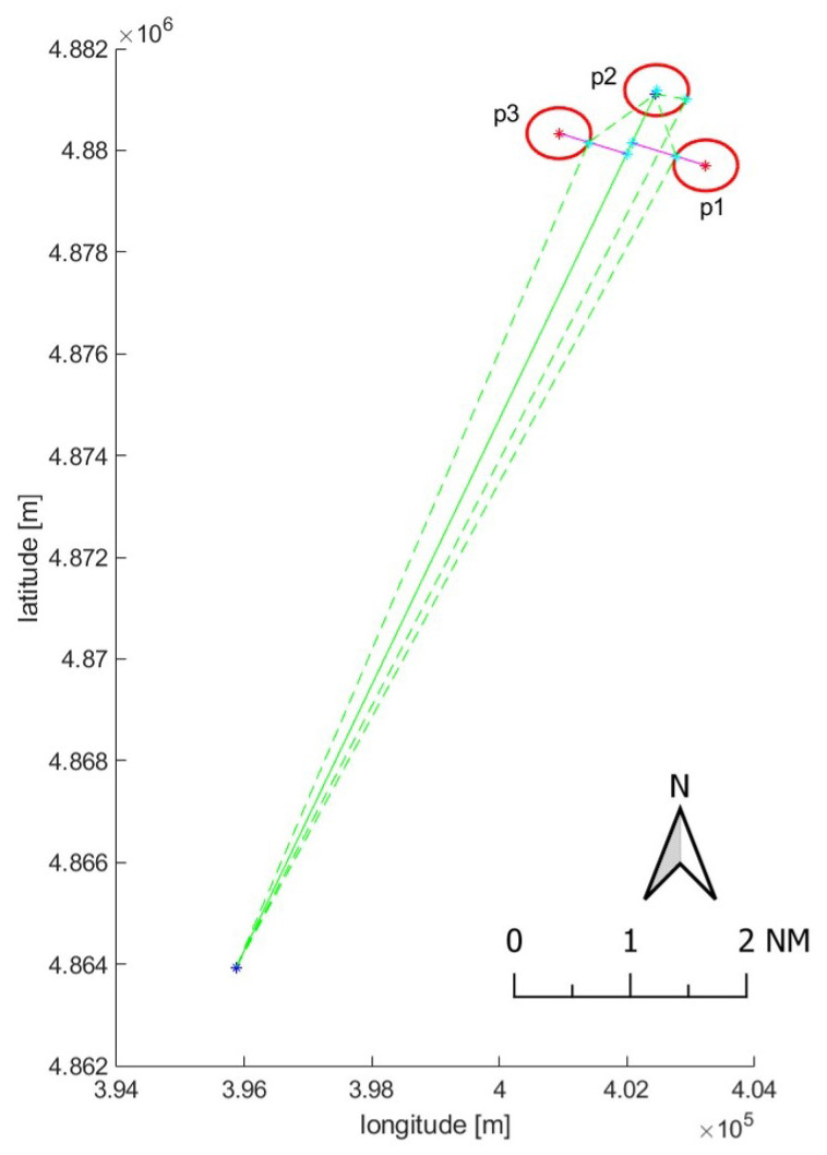
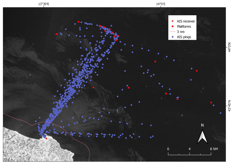
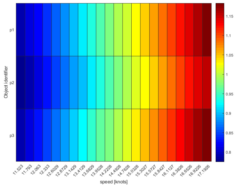
Maritime traffic and fishing activities have accelerated considerably over the last decade, with a consequent impact on the environment and marine resources. Meanwhile, a growing number of ship-reporting technologies and remote-sensing systems are generating an overwhelming amount of spatio-temporal and geographically distributed data related to large-scale vessels and their movements. Individual technologies have distinct limitations but, when combined, can provide a better view of what is happening at sea, lead to effectively monitor fishing activities, and help tackle the investigations of suspicious behaviors in close proximity of managed areas. The paper integrates non-cooperative Synthetic Aperture Radar (SAR) Sentinel-1 images and cooperative Automatic Identification System (AIS) data, by proposing two types of associations: (i) point-to-point and (ii) point-to-line. They allow the fusion of ship positions and highlight "suspicious" AIS data gaps in close proximity of managed areas that can be further investigated only once the vessel-and the gear it adopts-is known. This is addressed by a machine-learning approach based on the Fast Fourier Transform that classifies single sea trips. The approach is tested on a case study in the central Adriatic Sea, automatically reporting AIS-SAR associations and seeking ships that are not broadcasting their positions (intentionally or not). Results allow the discrimination of collaborative and non-collaborative ships, playing a key role in detecting potential suspect behaviors especially in close proximity of managed areas.
过去十年中,海上交通和捕鱼活动显著增加,对环境和海洋资源产生了相应的影响。与此同时,越来越多的船舶报告技术和遥感系统正在生成大量与大型船舶及其运动相关的时空和地理分布式数据。个别技术有明显的局限性,但结合使用时,可以更好地了解海上发生的情况,有效监测捕鱼活动,并有助于解决在管理区域附近发生的可疑行为的调查。本文通过提出两种关联类型(点到点和点到线)整合了非合作合成孔径雷达 (SAR) Sentinel-1 图像和合作自动识别系统 (AIS) 数据:(i) 点到点和 (ii) 点到线。它们允许融合船舶位置,并突出显示管理区域附近的“可疑”AIS 数据空白,只有在知道船舶及其采用的渔具后,才能对其进行进一步调查。这是通过基于快速傅里叶变换的机器学习方法来实现的,该方法可以对单次海上航行进行分类。该方法在亚得里亚海中部的一个案例研究中进行了测试,自动报告 AIS-SAR 关联,并寻找未广播其位置的船舶(无论是故意还是无意)。结果可以区分协作和非协作船舶,在检测管理区域附近的潜在可疑行为方面发挥着关键作用。