Simonetti D, Pimple U, Langner A, Marelli A
European Commission, Joint Research Centre, Ispra, VA 21027, Italy.
The Joint Graduate School of Energy and Environment (JGSEE) and Centre of Excellence on Energy Technology and Environment, King Mongkut's University of Technology Thonburi, Bangkok 10140, Thailand.
Data Brief. 2021 Oct 18;39:107488. doi: 10.1016/j.dib.2021.107488. eCollection 2021 Dec.
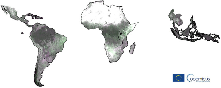
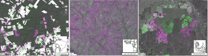
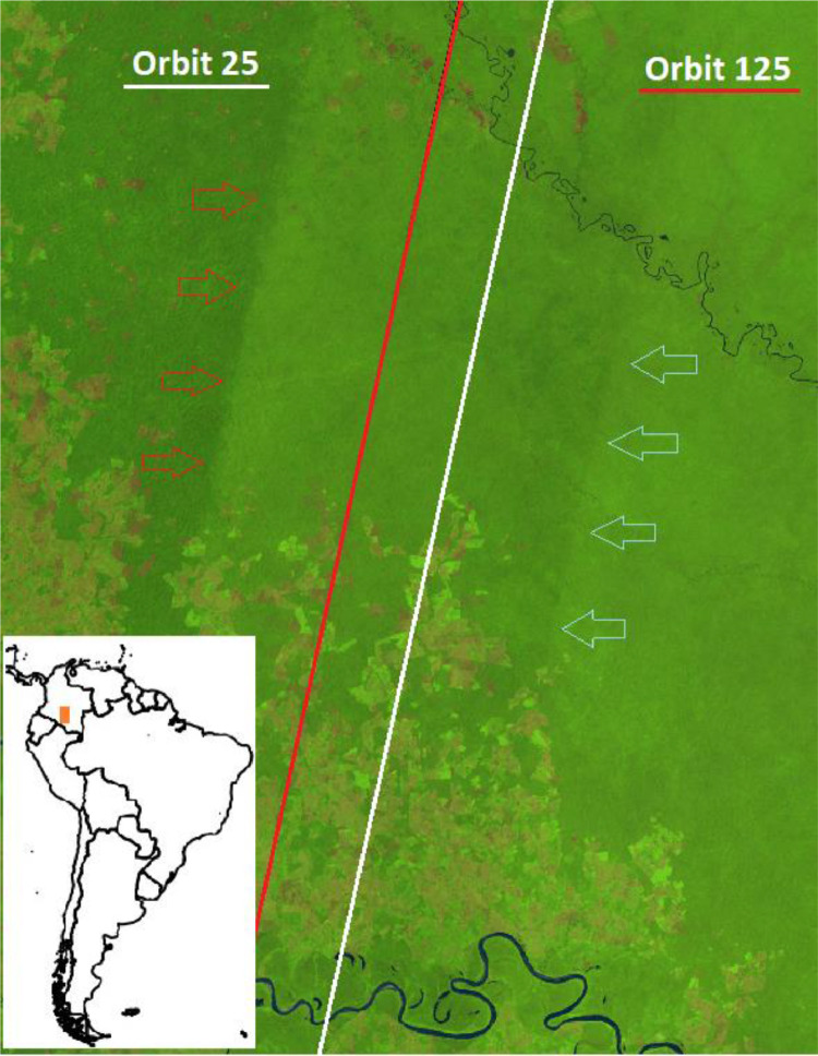
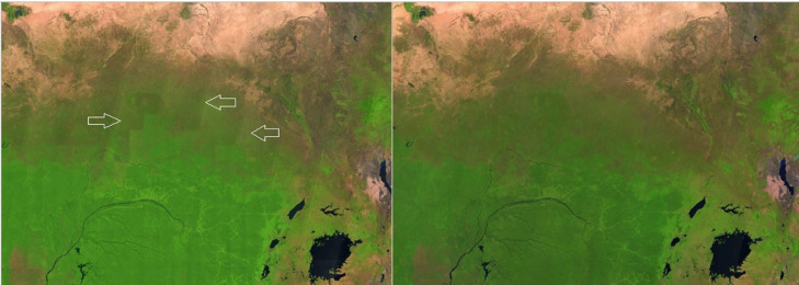
Sentinel-2 MSI is one of the core missions of the Copernicus Earth Observation programme of the European Union. This mission shows great potential to map the regional high-resolution spatio-temporal dynamics of land use and land cover. In tropical regions, despite the high revisiting time of 5 days including both Sentinel-2A and 2B satellites, the frequent presence of clouds, cloud-shadows, haze and other atmospheric contaminants are precluding the visibility of the Earth surface up to several months. In this paper we present four annual pan-tropical cloud-free composites computed and exported from Google Earth Engine (GEE) by making use of available Sentinel-2 L1C collection for the period spanning from 2015 to 2020. We furthermore propose empirical approaches to reduce the BRDF effect over tropical forest areas by showing pros and cons of image-based versus swath-based methodologies. Additionally, we provide a dedicated web-platform offering a fast and intuitive way to browse and explore the proposed annual composites as well as layers of potential annual changes as a ready-to-use means to visually identify and verify degradation and deforestation activities as well as other land cover changes.
哨兵 - 2 多光谱仪器(MSI)是欧盟哥白尼地球观测计划的核心任务之一。该任务在绘制区域高分辨率土地利用和土地覆盖的时空动态方面显示出巨大潜力。在热带地区,尽管包括哨兵 - 2A 和 2B 卫星在内的重访时间为 5 天,但频繁出现的云层、云影、雾霾和其他大气污染物使得地球表面连续数月无法被观测到。在本文中,我们展示了利用 2015 年至 2020 年期间可用的哨兵 - 2 L1C 数据集,在谷歌地球引擎(GEE)中计算并导出的四个年度泛热带无云合成图像。此外,我们通过展示基于图像和基于条带的方法的优缺点,提出了减少热带森林地区双向反射分布函数(BRDF)效应的经验方法。此外,我们提供了一个专用的网络平台,以快速直观的方式浏览和探索所提出的年度合成图像以及潜在年度变化图层,作为一种即用型手段,以直观地识别和验证退化、森林砍伐活动以及其他土地覆盖变化。