Department of Smart Car Engineering, Chungbuk National University, Cheongju 28644, Korea.
Department of Control and Robot Engineering, Chungbuk National University, Cheongju 28644, Korea.
Sensors (Basel). 2021 Nov 17;21(22):7623. doi: 10.3390/s21227623.
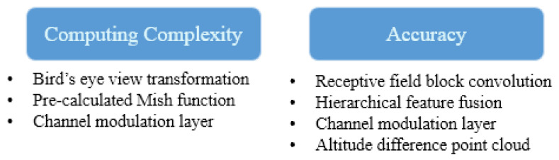
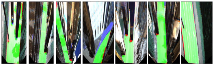
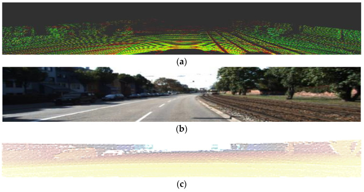
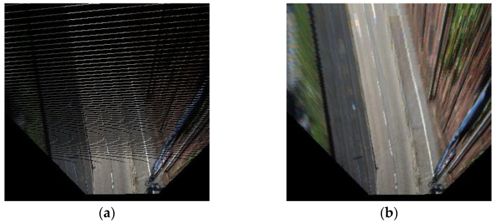
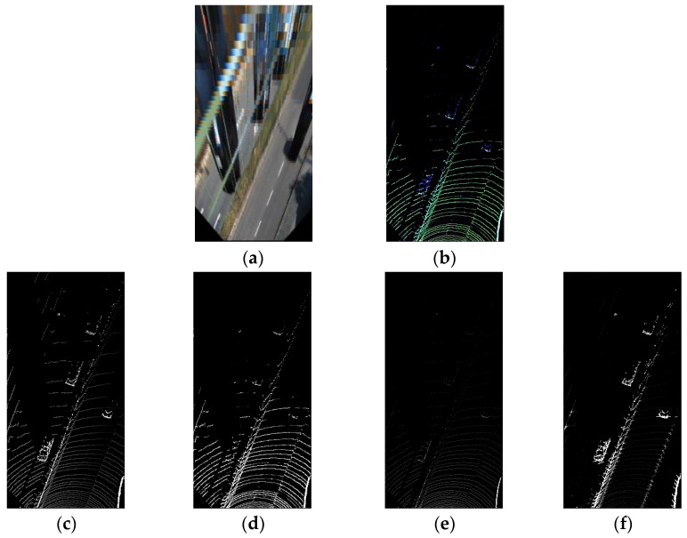
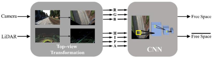
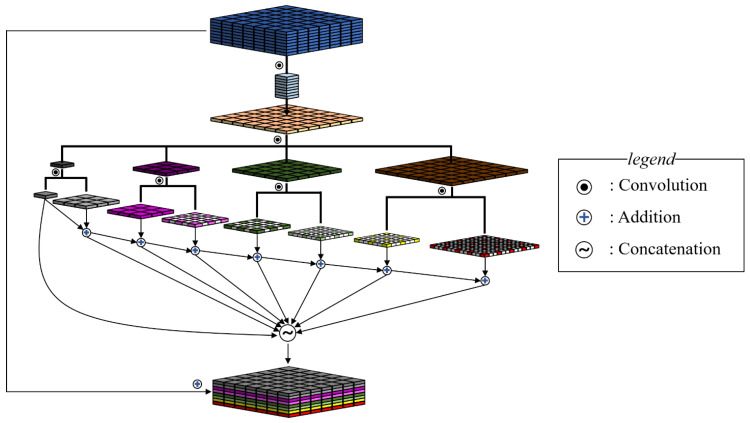
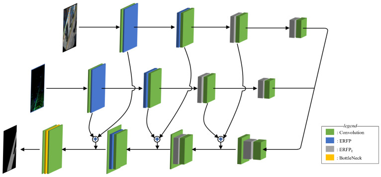
Although numerous road segmentation studies have utilized vision data, obtaining robust classification is still challenging due to vision sensor noise and target object deformation. Long-distance images are still problematic because of blur and low resolution, and these features make distinguishing roads from objects difficult. This study utilizes light detection and ranging (LiDAR), which generates information that camera images lack, such as distance, height, and intensity, as a reliable supplement to address this problem. In contrast to conventional approaches, additional domain transformation to a bird's eye view space is executed to obtain long-range data with resolutions comparable to those of short-range data. This study proposes a convolutional neural network architecture that processes data transformed to a bird's eye view plane. The network's pathways are split into two parts to resolve calibration errors in the transformed image and point cloud. The network, which has modules that operate sequentially at various scaled dilated convolution rates, is designed to quickly and accurately handle a wide range of data. Comprehensive empirical studies using the Karlsruhe Institute of Technology and Toyota Technological Institute's (KITTI's) road detection benchmarks demonstrate that this study's approach takes advantage of camera and LiDAR information, achieving robust road detection with short runtimes. Our result ranks 22nd in the KITTI's leaderboard and shows real-time performance.
尽管许多道路分割研究都利用了视觉数据,但由于视觉传感器噪声和目标物体变形,获得稳健的分类仍然具有挑战性。远距离图像仍然存在问题,因为模糊和低分辨率,这些特征使得从物体中区分道路变得困难。本研究利用激光雷达(LiDAR),它生成了相机图像缺乏的信息,如距离、高度和强度,作为可靠的补充来解决这个问题。与传统方法相比,还执行了额外的域变换到鸟瞰空间,以获得与近距离数据相当的远距离数据分辨率。本研究提出了一种处理转换到鸟瞰平面的数据的卷积神经网络架构。网络的路径分为两部分,以解决变换图像和点云中的校准误差。该网络具有在不同比例的扩张卷积率下顺序运行的模块,旨在快速准确地处理广泛的数据。使用卡尔斯鲁厄理工学院和丰田技术研究所(KITTI)的道路检测基准进行的全面实证研究表明,本研究的方法利用了相机和 LiDAR 信息,实现了具有短运行时间的稳健道路检测。我们的结果在 KITTI 的排行榜上排名第 22 位,并展示了实时性能。