Fredianelli Luca, Gaggero Tomaso, Bolognese Matteo, Borelli Davide, Fidecaro Francesco, Schenone Corrado, Licitra Gaetano
Physics Department, University of Pisa, Largo Bruno Pontecorvo 3, 56127, Pisa, Italy.
Institute of Chemical and Physical Processes of National Research Council, Via G. Moruzzi 1, 56124 Pisa, Italy.
Heliyon. 2022 Mar 7;8(3):e09021. doi: 10.1016/j.heliyon.2022.e09021. eCollection 2022 Mar.
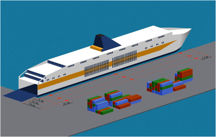
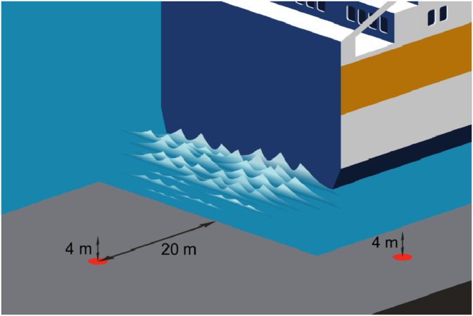
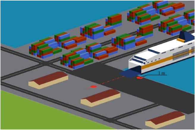
Maritime transport for both passengers and freight is continuously increasing and, consequently, the global attention toward its sustainability is growing. Ships offer advantages in terms of environmental impact compared to other transportation systems but the increasing traffic volume is expected to increase pollutants. Noise produced in port areas has been neglected for too long, until the INTERREG Maritime programme Italy-France 2014-2020 has brought to light how citizen complaints are emerging for some of the main ports in the Mediterranean. However, port noise prevention and management is difficult as knowledge on specific sources is very limited in the literature. Furthermore, on field measurements are difficult to be performed given the complexity of the port area, where multiple types of sound emitters mix and confuse each other. Noise maps represent the first important step in order to align ports to the requirements set by the Environmental Noise Directive to the transportation infrastructures. Once computed, they are an excellent tool supporting port management towards the reduction of citizens' noise exposure while ensuring traffic growth. The present paper reports a guideline for the characterization of noise sources needed as inputs for the noise maps, as developed in the framework of the INTERREG Maritime programme Italy-France 2014-2020. On the basis of the current state of the art, a procedure has been elaborated for different categories of noise sources acting in port, ranging from stationary to moving ships, from mooring operations to loading/unloading operations, from industrial activities to road and railway traffic.
客运和货运的海上运输都在持续增长,因此,全球对其可持续性的关注度也在不断提高。与其他运输系统相比,船舶在环境影响方面具有优势,但预计不断增加的交通量将增加污染物排放。港口区域产生的噪音长期以来一直被忽视,直到2014 - 2020年意大利 - 法国INTERREG海事计划揭示了地中海一些主要港口出现了市民投诉。然而,港口噪音的预防和管理很困难,因为文献中关于特定噪音源的知识非常有限。此外,鉴于港口区域的复杂性,现场测量很难进行,因为多种类型的声源相互混合并相互干扰。噪音地图是使港口符合《环境噪音指令》对交通基础设施所规定要求的重要的第一步。一旦计算出来,它们就是一个很好的工具,可支持港口管理在确保交通增长的同时减少市民的噪音暴露。本文报告了一份作为噪音地图输入所需的噪音源特征描述指南,该指南是在2014 - 2020年意大利 - 法国INTERREG海事计划框架内制定的。基于当前的技术水平,已针对港口中不同类别的噪音源制定了一个程序,这些噪音源包括从固定船舶到移动船舶、从系泊作业到装卸作业、从工业活动到公路和铁路交通。