College of Geography and Remote Sensing Sciences, Xinjiang University, Urumqi, 830046, China.
Key Laboratory of Oasis Ecology, Xinjiang University, Urumqi, 830046, China.
Environ Sci Pollut Res Int. 2022 Aug;29(38):56887-56907. doi: 10.1007/s11356-022-21348-x. Epub 2022 Jun 16.
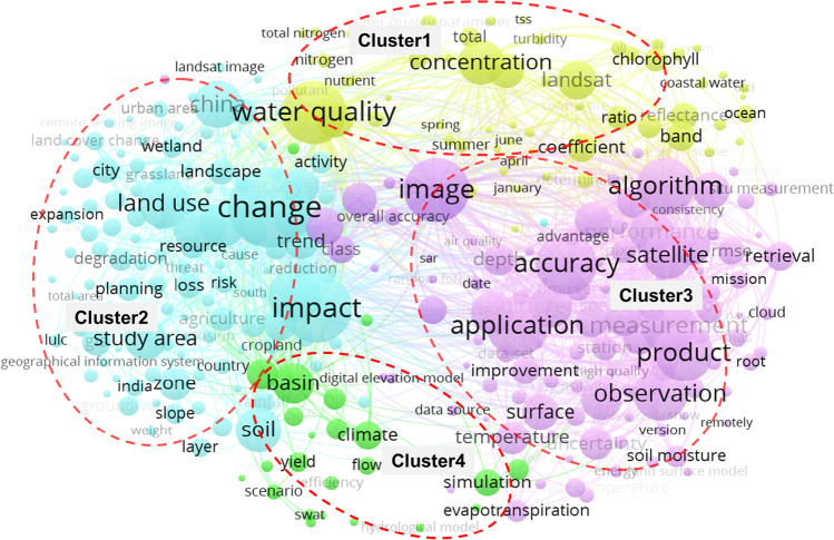
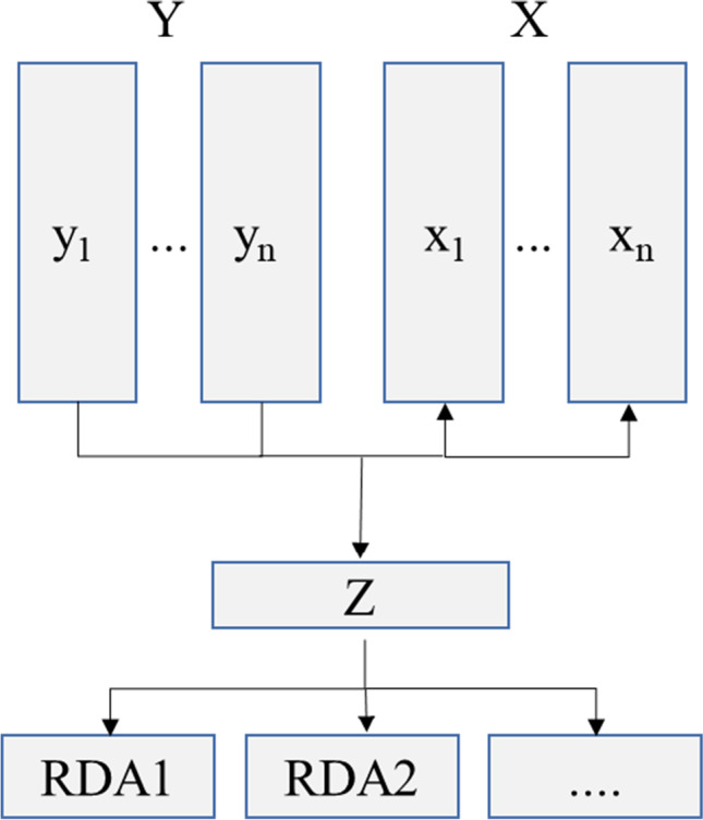
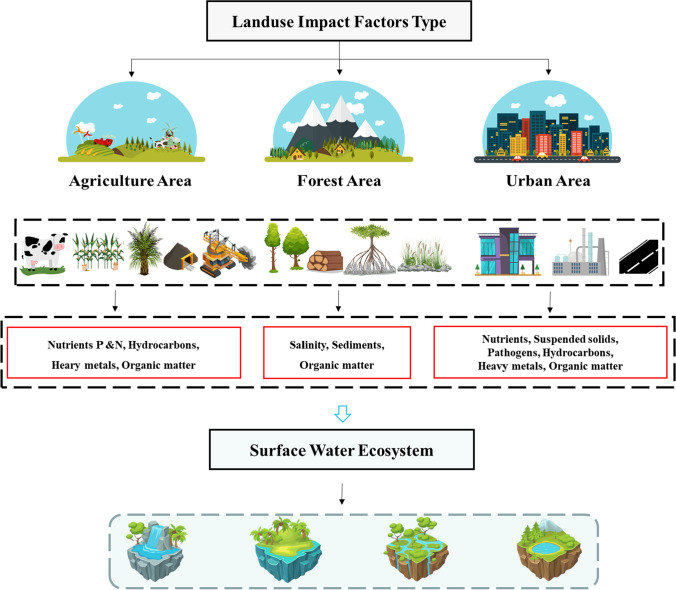
Good surface water quality is critical to human health and ecology. Land use determines the surface water heat and material balance, which cause climate change and affect water quality. There are many factors affecting water quality degradation, and the process of influence is complex. As rivers, lakes, and other water bodies are used as environmental receiving carriers, evaluating and quantifying how impacts occur between land use types and surface water quality is extremely important. Based on the summary of published studies, we can see that (1) land use for agricultural and construction has a negative impact on surface water quality, while woodland use has a certain degree of improvement on surface water quality; (2) statistical methods used in relevant research mainly include correlation analysis, regression analysis, redundancy analysis, etc. Different methods have their own advantages and limitations; (3) in recent years, remote sensing monitoring technology has developed rapidly, and has developed into an effective tool for comprehensive water quality assessment and management. However, the increase in spatial resolution of remote sensing data has been accompanied by a surge in data volume, which has caused difficulties in information interpretation and other aspects.
良好的地表水质量对人类健康和生态至关重要。土地利用决定了地表水的热和物质平衡,这会导致气候变化并影响水质。有许多因素会影响水质恶化,影响过程复杂。由于河流、湖泊和其他水体被用作环境接收载体,评估和量化土地利用类型与地表水质量之间的影响非常重要。基于已发表研究的总结,我们可以看到:(1)农业和建设用地会对地表水质量产生负面影响,而林地利用对地表水质量有一定程度的改善;(2)相关研究中使用的统计方法主要包括相关分析、回归分析、冗余分析等,不同方法都有其优点和局限性;(3)近年来,遥感监测技术发展迅速,已成为全面水质评估和管理的有效工具。但是,遥感数据空间分辨率的提高伴随着数据量的剧增,这给信息解译等方面带来了困难。