College of Geomatics and Geoinformation, Guilin University of Technology, No.319 Yanshan Street, Guilin, 541006, China.
Sci Rep. 2022 Aug 2;12(1):13270. doi: 10.1038/s41598-022-17620-2.
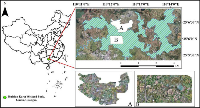
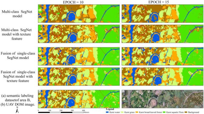
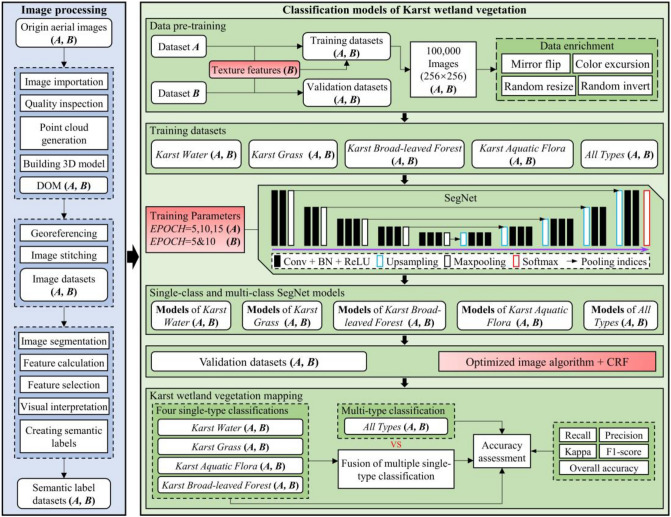
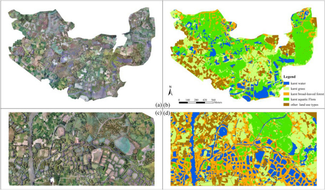
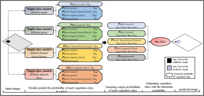
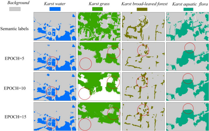
Wetland vegetation classification using deep learning algorithm and unmanned aerial vehicle (UAV) images have attracted increased attentions. However, there exist several challenges in mapping karst wetland vegetation due to its fragmentation, intersection, and high heterogeneity of vegetation patches. This study proposed a novel approach to classify karst vegetation in Huixian National Wetland Park, the largest karst wetland in China by fusing single-class SegNet classification using the maximum probability algorithm. A new optimized post-classification algorithm was developed to eliminate the stitching traces caused by SegNet model prediction. This paper evaluated the effect of multi-class and fusion of multiple single-class SegNet models with different EPOCH values on mapping karst vegetation using UAV images. Finally, this paper carried out a comparison of classification accuracies between object-based Random Forest (RF) and fusion of single-class SegNet models. The specific conclusions of this paper include the followings: (1) fusion of four single-class SegNet models produced better classification for karst wetland vegetation than multi-class SegNet model, and achieved the highest overall accuracy of 87.34%; (2) the optimized post-classification algorithm improved classification accuracy of SegNet model by eliminating splicing traces; (3) classification performance of single-class SegNet model outperformed multi-class SegNet model, and improved classification accuracy (F1-Score) ranging from 10 to 25%; (4) Fusion of single-class SegNet models and object-based RF classifier both produced good classifications for karst wetland vegetation, and achieved over 87% overall accuracy.
基于深度学习算法和无人机(UAV)图像的湿地植被分类已经引起了越来越多的关注。然而,由于喀斯特湿地植被的破碎化、交叉和植被斑块的高度异质性,在对其进行测绘时仍存在一些挑战。本研究提出了一种新的方法,通过融合使用最大概率算法的单类 SegNet 分类,对中国最大的喀斯特湿地——惠仙国家湿地公园的喀斯特植被进行分类。开发了一种新的优化后分类算法,以消除 SegNet 模型预测产生的拼接痕迹。本文评估了使用无人机图像对喀斯特植被进行多类和融合多种不同 EPOCH 值的单类 SegNet 模型分类的效果。最后,本文对基于对象的随机森林(RF)分类和单类 SegNet 模型融合的分类精度进行了比较。本文的具体结论如下:(1)融合四个单类 SegNet 模型对喀斯特湿地植被的分类效果优于多类 SegNet 模型,总体精度最高,达到 87.34%;(2)优化后的后分类算法通过消除拼接痕迹提高了 SegNet 模型的分类精度;(3)单类 SegNet 模型的分类性能优于多类 SegNet 模型,分类精度(F1-Score)提高了 10%至 25%;(4)单类 SegNet 模型融合和基于对象的 RF 分类器都对喀斯特湿地植被进行了很好的分类,总体精度超过 87%。