Research Center for Eco-Environmental Sciences, Chinese Academy of Sciences, Beijing, 100085, China.
University of Chinese Academy of Sciences, Beijing, 100190, China.
Sci Data. 2023 May 26;10(1):319. doi: 10.1038/s41597-023-02246-4.
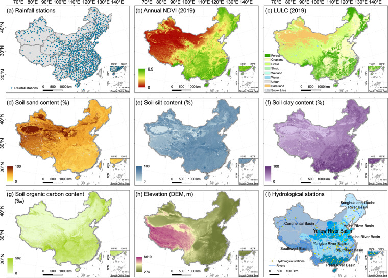
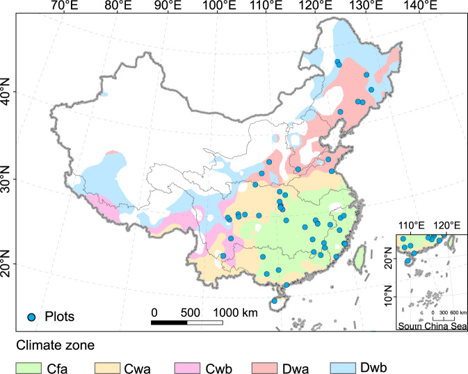
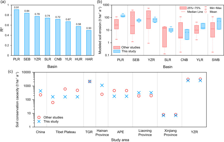
Soil conservation service (SC) is defined as the ability of terrestrial ecosystems to control soil erosion and protect soil function. A long-term and high-resolution estimation of SC is urgent for ecological assessment and land management on a large scale. Here, a 300-m resolution Chinese soil conservation dataset (CSCD) from 1992 to 2019, for the first time, is established based on the Revised Universal Soil Loss Equation (RUSLE) model. The RUSLE modelling was conducted based on five key parameters, including the rainfall erosivity (interpolation of daily rainfall), land cover management (provincial data), conservation practices (weighted by terrain and crop types), topography (30 m), and soil properties (250 m). The dataset agrees with previous measurements in all basins (R > 0.5) and other regional simulations. Compared with current studies, the dataset has long-term, large-scale, and relatively high-resolution characteristics. This dataset will serve as a base to open out the mechanism of SC variations in China and could help assess the ecological effects of land management policies.
土壤保持服务(SC)被定义为陆地生态系统控制土壤侵蚀和保护土壤功能的能力。为了进行大规模的生态评估和土地管理,迫切需要对 SC 进行长期的、高分辨率的估计。本研究首次基于修正的通用土壤流失方程(RUSLE)模型,建立了一个 300 米分辨率的中国土壤保持数据集(CSCD),时间跨度为 1992 年至 2019 年。RUSLE 模型的建立基于五个关键参数,包括降雨侵蚀力(逐日降雨量插值)、土地覆盖管理(省级数据)、保护措施(根据地形和作物类型加权)、地形(30 米)和土壤特性(250 米)。该数据集与所有流域的先前测量结果(R > 0.5)和其他区域模拟结果一致。与当前的研究相比,该数据集具有长期、大规模和相对高分辨率的特点。该数据集将作为揭示中国 SC 变化机制的基础,并有助于评估土地管理政策的生态效应。