Virtual Reality and Nature Lab, Department of Parks, Recreation and Tourism Management, Clemson University, Clemson, SC 29631, USA.
USDA Forest Service, Northern Research Station, Baltimore Field Station, Suite 350, 5523 Research Park Drive, Baltimore, MD 21228, USA.
Sci Total Environ. 2024 Jan 10;907:167739. doi: 10.1016/j.scitotenv.2023.167739. Epub 2023 Oct 11.
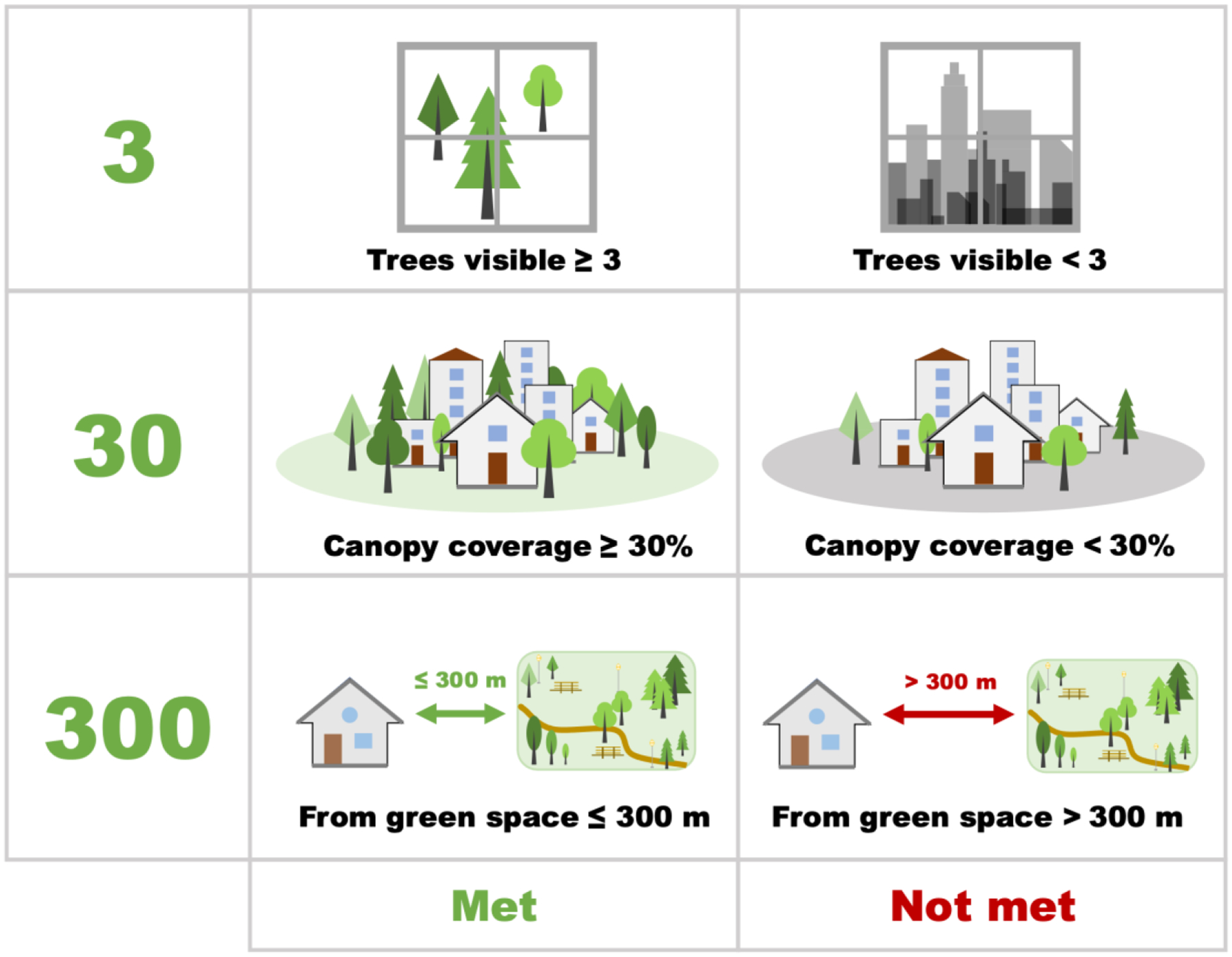
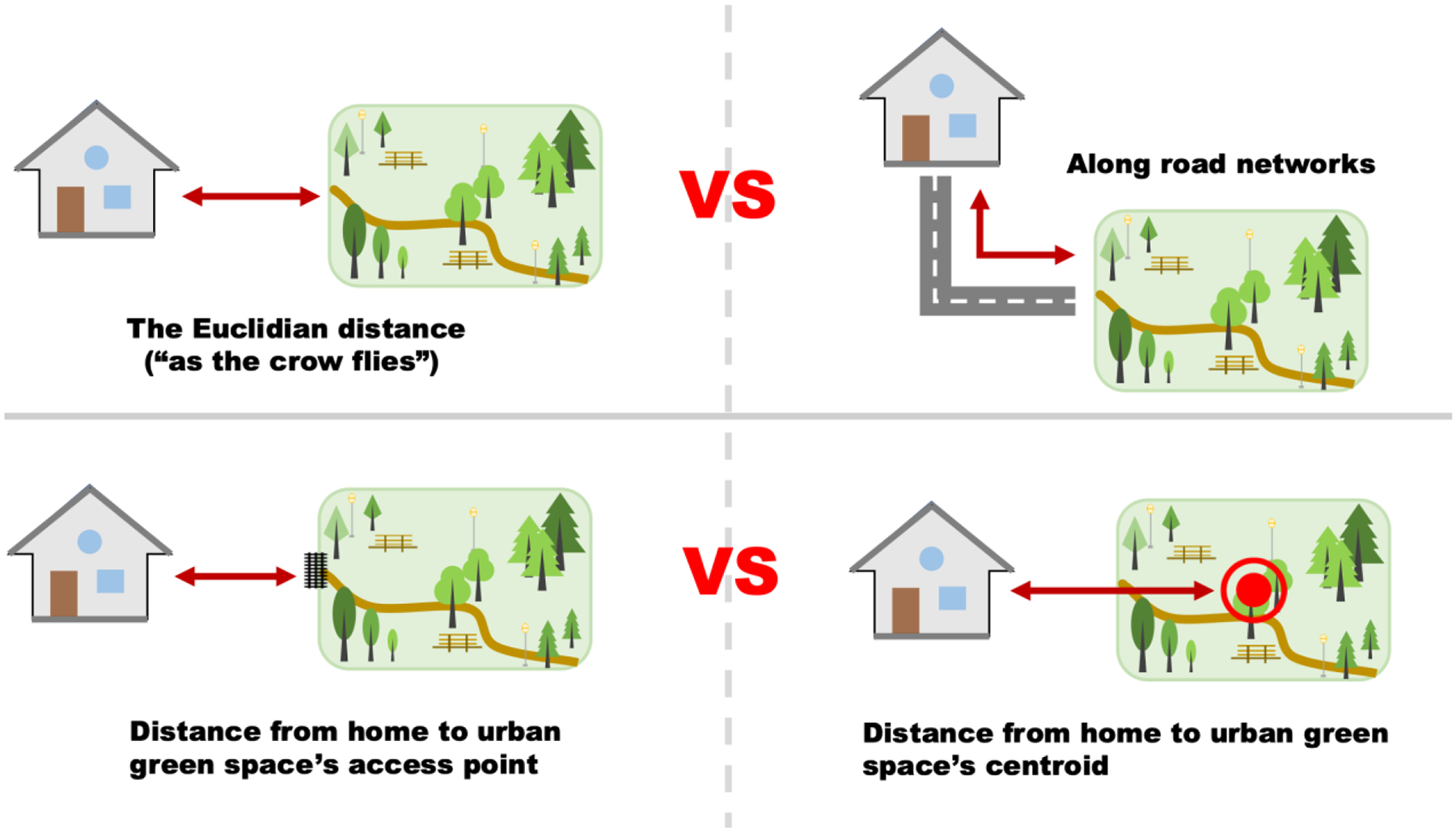
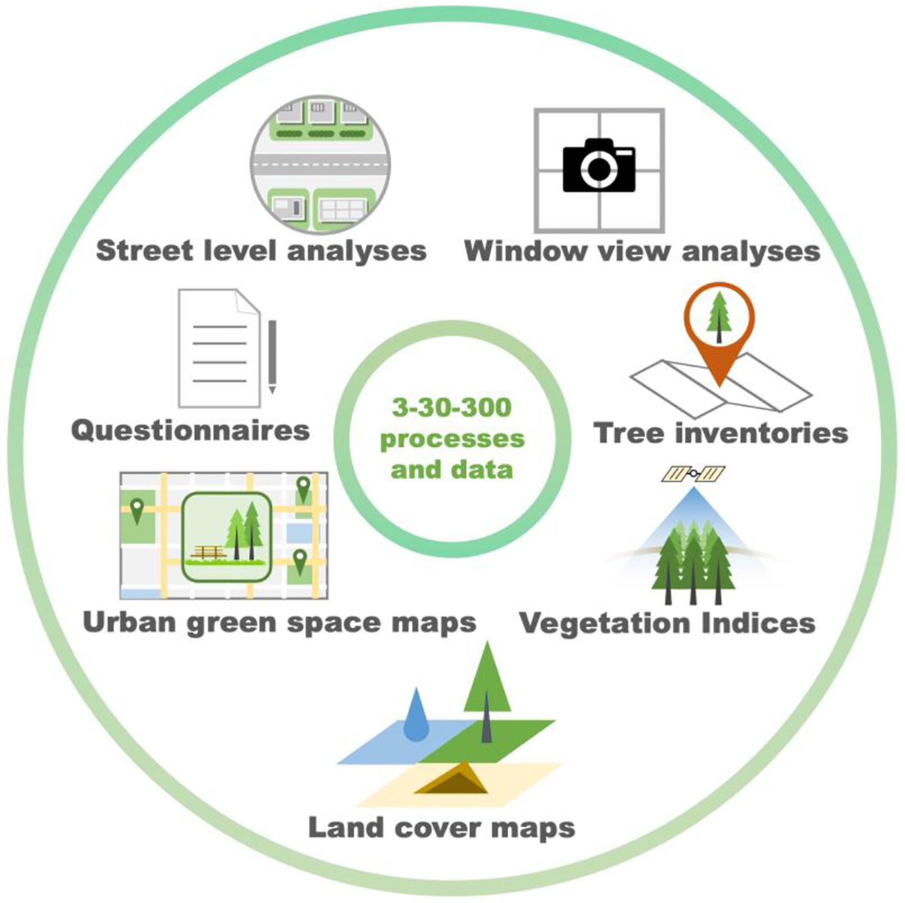
The 3-30-300 rule offers benchmarks for cities to promote equitable nature access. It dictates that individuals should see three trees from their dwelling, have 30 % tree canopy in their neighborhood, and live within 300 m of a high-quality green space. Implementing this demands thorough measurement, monitoring, and evaluation methods, yet little guidance is currently available to pursue these actions. To overcome this gap, we employed an expert-based consensus approach to review the available ways to measure 3-30-300 as well as each measure's strengths and weaknesses. We described seven relevant data and processes: vegetation indices, street level analyses, tree inventories, questionnaires, window view analyses, land cover maps, and green space maps. Based on the reviewed strengths and weaknesses of each measure, we presented a suitability matrix to link recommended measures with each component of the rule. These recommendations included surveys and window-view analyses for the '3 component', high-resolution land cover maps for the '30 component', and green space maps with network analyses for the '300 component'. These methods, responsive to local situations and resources, not only implement the 3-30-300 rule but foster broader dialogue on local desires and requirements. Consequently, these techniques can guide strategic investments in urban greening for health, equity, biodiversity, and climate adaptation.
3-30-300 规则为城市促进公平自然可达性提供了基准。它规定个人应该从住所看到三棵树,邻里有 30%的树冠覆盖率,并且居住在 300 米以内有高质量的绿地。实施这一规则需要彻底的测量、监测和评估方法,但目前几乎没有指导来实施这些行动。为了克服这一差距,我们采用了基于专家共识的方法来审查现有的衡量 3-30-300 的方法以及每种方法的优缺点。我们描述了七种相关的数据和流程:植被指数、街道水平分析、树木清查、问卷调查、窗口视图分析、土地覆盖图和绿地图。根据每种方法的优缺点,我们提出了一个适用性矩阵,将推荐的方法与规则的每个组成部分联系起来。这些建议包括对“3 要素”进行调查和窗口视图分析,对“30 要素”使用高分辨率土地覆盖图,对“300 要素”使用带有网络分析的绿地图。这些方法针对当地情况和资源,不仅实施了 3-30-300 规则,还促进了关于当地愿望和需求的更广泛对话。因此,这些技术可以指导城市绿化的战略投资,以促进健康、公平、生物多样性和气候适应。