Roelofs Bart, Vos Daniella, Halabi Yaskara, Gerstenbluth Izzy, Duits Ashley, Grillet Maria E, Tami Adriana, Vincenti-Gonzalez Maria F
University of Groningen, Faculty of Spatial Sciences, Groningen, the Netherlands.
GGD Curaçao, Ministry of Health, Curaçao.
Parasite Epidemiol Control. 2024 Jan 26;24:e00338. doi: 10.1016/j.parepi.2024.e00338. eCollection 2024 Feb.
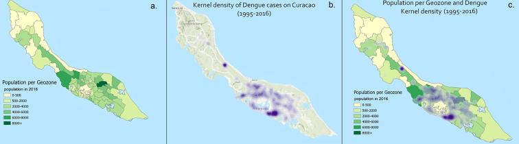
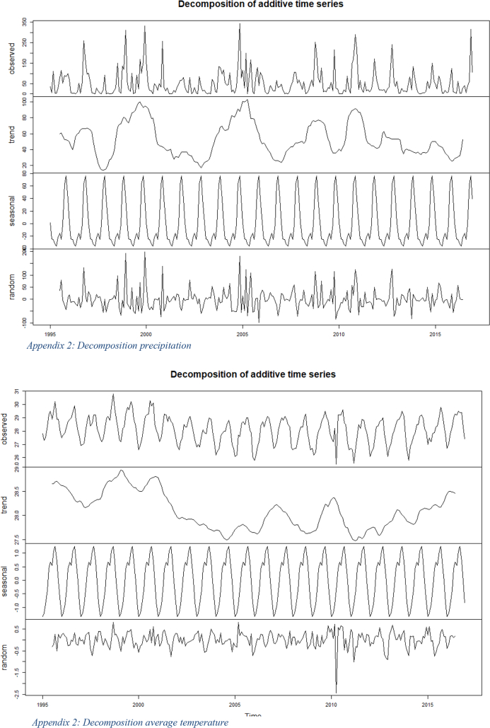
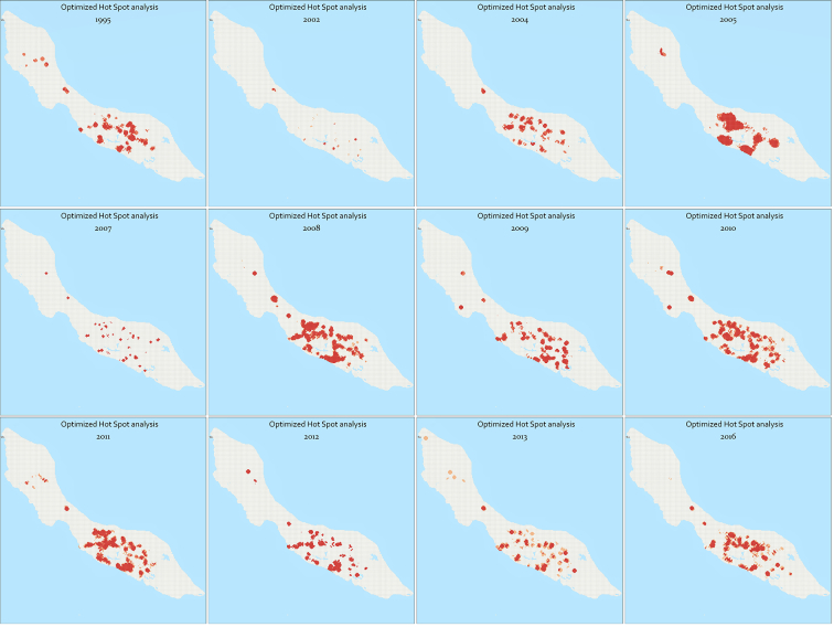
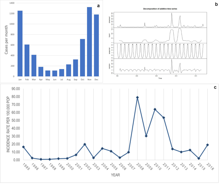
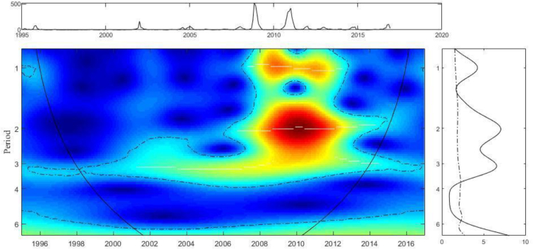
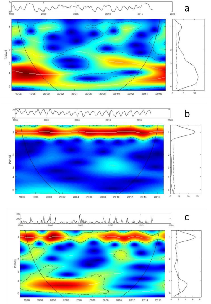
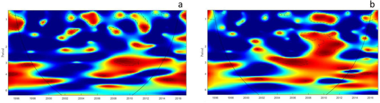
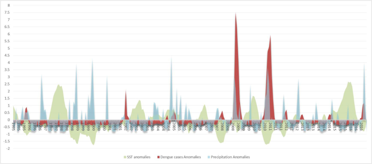
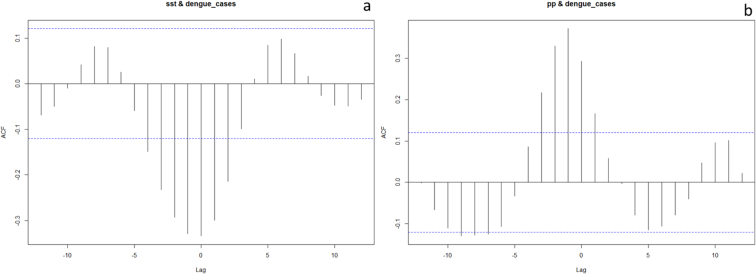
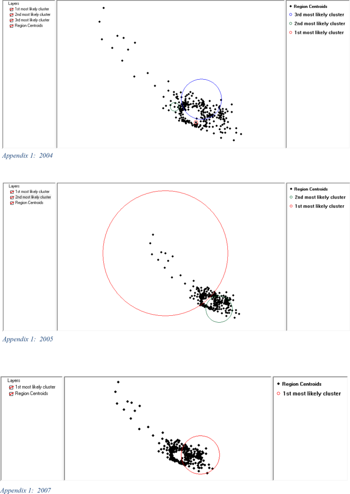
Dengue viruses are a significant global health concern, causing millions of infections annually and putting approximately half of the world's population at risk, as reported by the World Health Organization (WHO). Understanding the spatial and temporal patterns of dengue virus spread is crucial for effective prevention of future outbreaks. By investigating these patterns, targeted dengue surveillance and control measures can be improved, aiding in the management of outbreaks in dengue-affected regions. Curaçao, where dengue is endemic, has experienced frequent outbreaks over the past 25 years. To examine the spatial and temporal trends of dengue outbreaks in Curaçao, this study employs an interdisciplinary and multi-method approach. Data on >6500 cases of dengue infections in Curaçao between the years 1995 and 2016 were used. Temporal and spatial statistics were applied. The Moran's I index identified the presence of spatial autocorrelation for incident locations, allowing us to reject the null hypothesis of spatial randomness. The majority of cases were recorded in highly populated areas and a relationship was observed between population density and dengue cases. Temporal analysis demonstrated that cases mostly occurred from October to January, during the rainy season. Lower average temperatures, higher precipitation and a lower sea surface temperature appear to be related to an increase in dengue cases. This effect has a direct link to La Niña episodes, which is the cooling phase of El Niño Southern Oscillation. The spatial and temporal analyses conducted in this study are fundamental to understanding the timing and locations of outbreaks, and ultimately improving dengue outbreak management.
据世界卫生组织(WHO)报告,登革热病毒是全球重大的健康问题,每年导致数百万感染病例,使全球约一半人口面临风险。了解登革热病毒传播的时空模式对于有效预防未来疫情至关重要。通过调查这些模式,可以改进针对性的登革热监测和控制措施,有助于管理登革热流行地区的疫情。库拉索岛登革热流行,在过去25年中频繁爆发疫情。为了研究库拉索岛登革热疫情的时空趋势,本研究采用了跨学科和多方法的途径。使用了1995年至2016年间库拉索岛6500多例登革热感染病例的数据,并应用了时空统计方法。莫兰指数(Moran's I index)确定了发病地点存在空间自相关性,使我们能够拒绝空间随机性的零假设。大多数病例记录在人口密集地区,并且观察到人口密度与登革热病例之间存在关联。时间分析表明,病例大多发生在10月至1月的雨季。较低的平均气温、较高的降水量和较低的海面温度似乎与登革热病例增加有关。这种影响与拉尼娜事件直接相关,拉尼娜事件是厄尔尼诺-南方涛动的冷期。本研究进行的时空分析对于了解疫情发生的时间和地点至关重要,并最终改善登革热疫情管理。