Provost Floriane, Karabacak Volkan, Malet Jean-Philippe, Van der Woerd Jérôme, Meghraoui Mustapha, Masson Frédéric, Ferry Matthieu, Michéa David, Pointal Elisabeth
Ecole et Observatoire des Sciences de la Terre (EOST), CNRS UAR 830, Université de Strasbourg, 5 rue René Descartes, 67084, Strasbourg, France.
Institut Terre et Environnement de Strasbourg (ITES), CNRS UMR 7063, Université de Strasbourg, 5 rue René Descartes, 67084, Strasbourg, France.
Sci Rep. 2024 Mar 21;14(1):6834. doi: 10.1038/s41598-024-55009-5.
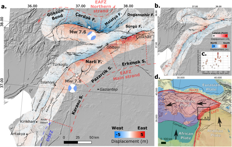
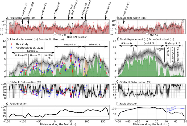
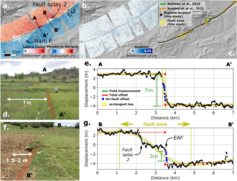
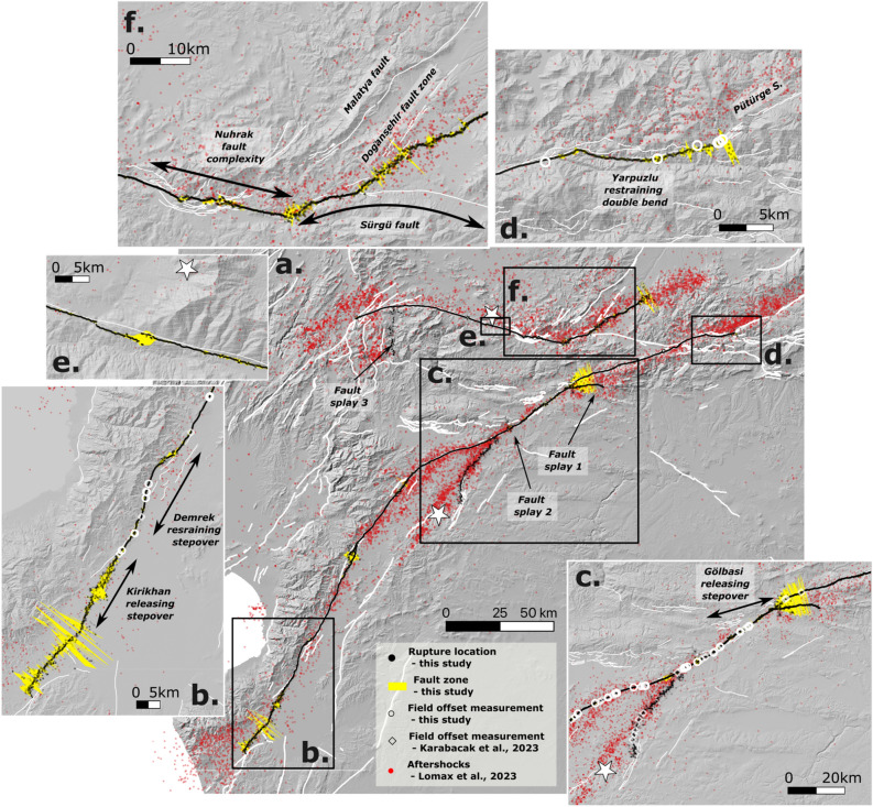
On February 6, 2023, southern Türkiye was struck by two large earthquakes at 01:17 UTC (Mw=7.8, Pazarcık, Kahramanmaraş) and 10:30 UTC (Mw = 7.6, Elbistan, Kahramanmaraş), causing severe damage at the complex junction of the Dead Sea Fault (DSF), the Cyprus Arc and the East Anatolian Fault Zone (EAFZ). The ruptures propagated along several known strands of the southwestern termination of the EAFZ, the main Pazarcık and Karasu valley faults, and the Çardak-Sürgü fault. Here we present the high-resolution mapping of the entire coseismic surface rupture and an estimate of the rupture width, total and on-fault offset, and diffuse deformation obtained a few days to three months after the two mainshocks. The mapping is derived from image correlation of Sentinel-2 optical satellite imagery and validated with offset measurements collected on the ground. We find that the ruptures extend over lengths of 310 km and 140 km for the Mw 7.8 and Mw 7.6 mainshocks, respectively. The maximum offsets reach 7.5 ± 0.8 m and 8.7 ± 0.8 m near the epicenters of the Mw 7.8 and Mw 7.6 events, respectively. We propose a segmentation of the two ruptures based on these observations, and further discuss the location of the potential supershear rupture. The use of optical image correlation, complemented by field investigations along earthquake faults, provides new insights into seismic hazard assessment.
2023年2月6日,土耳其南部于协调世界时01:17(Mw = 7.8,加济安泰普省巴扎尔吉克)和10:30(Mw = 7.6,埃尔比斯坦,加济安泰普省)遭受两次大地震袭击,在死海断层(DSF)、塞浦路斯弧和东安纳托利亚断层带(EAFZ)的复杂交汇处造成严重破坏。破裂沿着东安纳托利亚断层带西南端的几条已知断层、主要的巴扎尔吉克和卡拉苏河谷断层以及恰尔达克 - 叙尔居断层传播。在此,我们展示了整个同震地表破裂的高分辨率测绘图,并估算了破裂宽度、总偏移量和断层上的偏移量,以及在两次主震发生几天后至三个月内获得的弥散变形。该测绘图源自哨兵2号光学卫星图像的图像相关性,并通过实地采集的偏移测量数据进行了验证。我们发现,Mw 7.8和Mw 7.6主震的破裂长度分别延伸至310公里和140公里。在Mw 7.8和Mw 7.6地震震中附近,最大偏移量分别达到7.5±0.8米和8.7±0.8米。基于这些观测结果,我们对两次破裂进行了分段,并进一步讨论了潜在超剪切破裂的位置。光学图像相关性的应用,辅以沿地震断层的实地调查,为地震危险性评估提供了新的见解。